Meadowlands Nw Topo Map Minnesota
To zoom in, hover over the map of Meadowlands Nw
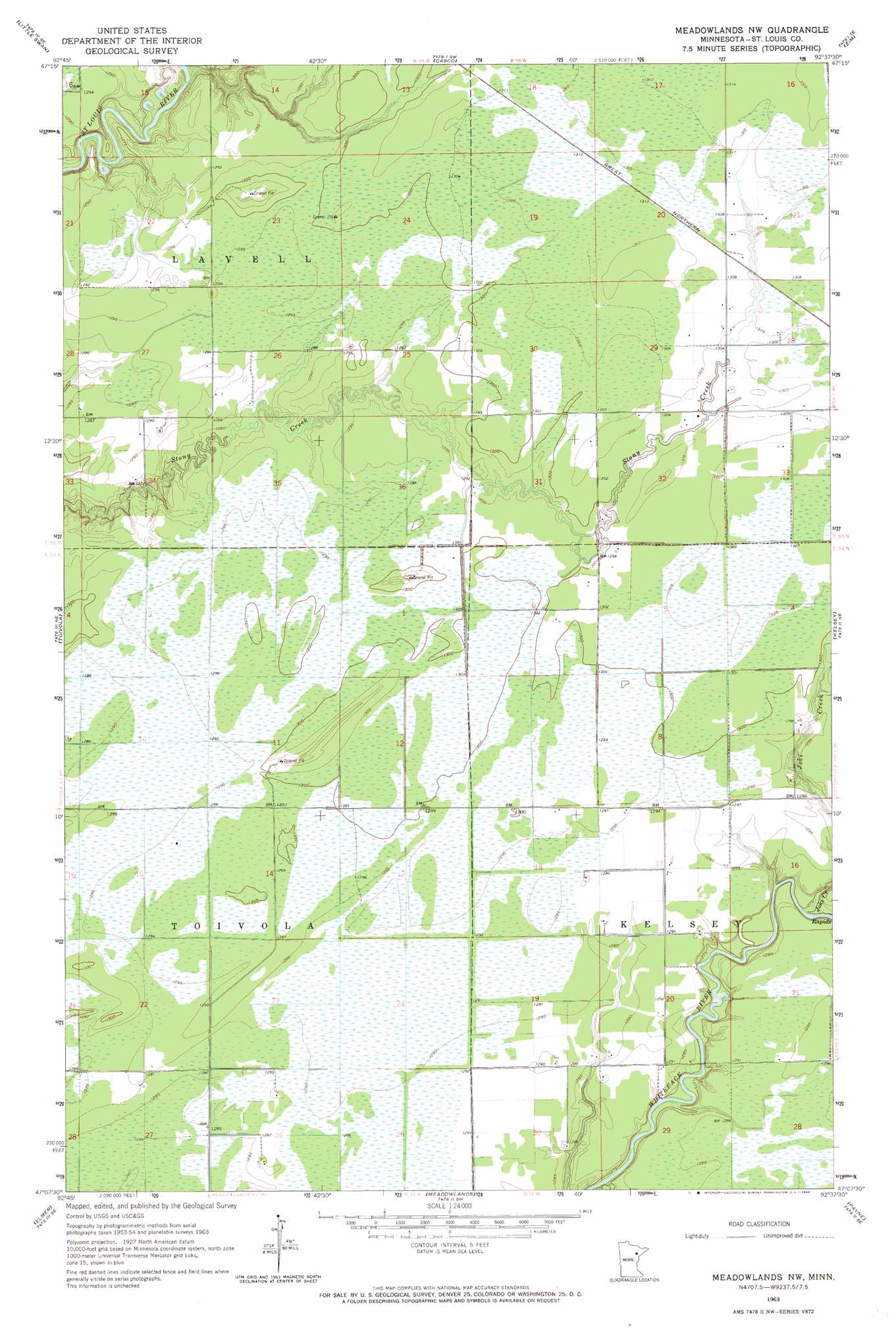
USGS Topo Quad 47092b6 - 1:24,000 scale
| Topo Map Name: | Meadowlands Nw |
| USGS Topo Quad ID: | 47092b6 |
| Print Size: | ca. 21 1/4" wide x 27" high |
| Southeast Coordinates: | 47.125° N latitude / 92.625° W longitude |
| Map Center Coordinates: | 47.1875° N latitude / 92.6875° W longitude |
| U.S. State: | MN |
| Filename: | o47092b6.jpg |
| Download Map JPG Image: | Meadowlands Nw topo map 1:24,000 scale |
| Map Type: | Topographic |
| Topo Series: | 7.5´ |
| Map Scale: | 1:24,000 |
| Source of Map Images: | United States Geological Survey (USGS) |
| Alternate Map Versions: |
Meadowlands NW MN 1963, updated 1964 Download PDF Buy paper map Meadowlands NW MN 2010 Download PDF Buy paper map Meadowlands NW MN 2013 Download PDF Buy paper map Meadowlands NW MN 2016 Download PDF Buy paper map |
1:24,000 Topo Quads surrounding Meadowlands Nw
Hibbing |
Buhl |
Kirk |
Eveleth |
Gilbert |
Riley |
Little Swan |
Casco |
Zim |
Central Lakes |
Upstead Lake |
Toivola |
Meadowlands Nw |
Kelsey |
Cotton |
Toivola Sw |
Elmer |
Meadowlands |
Payne |
Canyon |
Floodwood |
Mccarty River |
Brookston Nw |
Alborn |
Independence |
> Back to 47092a1 at 1:100,000 scale
> Back to 47092a1 at 1:250,000 scale
> Back to U.S. Topo Maps home
Meadowlands Nw digital topo map on disk
Buy this Meadowlands Nw topo map showing relief, roads, GPS coordinates and other geographical features, as a high-resolution digital map file on DVD: