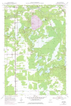
Zim Topo Map Minnesota
To zoom in, hover over the map of Zim
USGS Topo Quad 47092c5 - 1:24,000 scale
| Topo Map Name: | Zim |
| USGS Topo Quad ID: | 47092c5 |
| Print Size: | ca. 21 1/4" wide x 27" high |
| Southeast Coordinates: | 47.25° N latitude / 92.5° W longitude |
| Map Center Coordinates: | 47.3125° N latitude / 92.5625° W longitude |
| U.S. State: | MN |
| Filename: | o47092c5.jpg |
| Download Map JPG Image: | Zim topo map 1:24,000 scale |
| Map Type: | Topographic |
| Topo Series: | 7.5´ |
| Map Scale: | 1:24,000 |
| Source of Map Images: | United States Geological Survey (USGS) |
| Alternate Map Versions: |
Zim MN 1951, updated 1953 Download PDF Buy paper map Zim MN 1951, updated 1965 Download PDF Buy paper map Zim MN 1951, updated 1971 Download PDF Buy paper map Zim MN 1951, updated 1978 Download PDF Buy paper map Zim MN 2010 Download PDF Buy paper map Zim MN 2013 Download PDF Buy paper map Zim MN 2016 Download PDF Buy paper map |
1:24,000 Topo Quads surrounding Zim
> Back to 47092a1 at 1:100,000 scale
> Back to 47092a1 at 1:250,000 scale
> Back to U.S. Topo Maps home
Zim topo map: Gazetteer
Zim: Dams
Eveleth Taconite Tailings Dam elevation 413m 1354′Saint Louis River Dam elevation 403m 1322′
Zim: Lakes
Clover Lake elevation 411m 1348′Hammer Lake elevation 413m 1354′
Hiekkila Lake elevation 413m 1354′
Little Tony Lake elevation 411m 1348′
Perch Lake elevation 409m 1341′
Round Lake elevation 410m 1345′
Stone Lake elevation 408m 1338′
Twin Lakes elevation 413m 1354′
Zim: Parks
Lion Springs Wayside Park elevation 406m 1332′Zim: Populated Places
Forbes elevation 411m 1348′Peary elevation 407m 1335′
Zim elevation 408m 1338′
Zim: Post Offices
Forbes Post Office elevation 411m 1348′Zim Post Office (historical) elevation 408m 1338′
Zim: Reservoirs
Eveleth Taconite Tailings Basin elevation 413m 1354′Zim: Streams
Elbow Creek elevation 403m 1322′Long Lake Creek elevation 403m 1322′
Zim digital topo map on disk
Buy this Zim topo map showing relief, roads, GPS coordinates and other geographical features, as a high-resolution digital map file on DVD:


