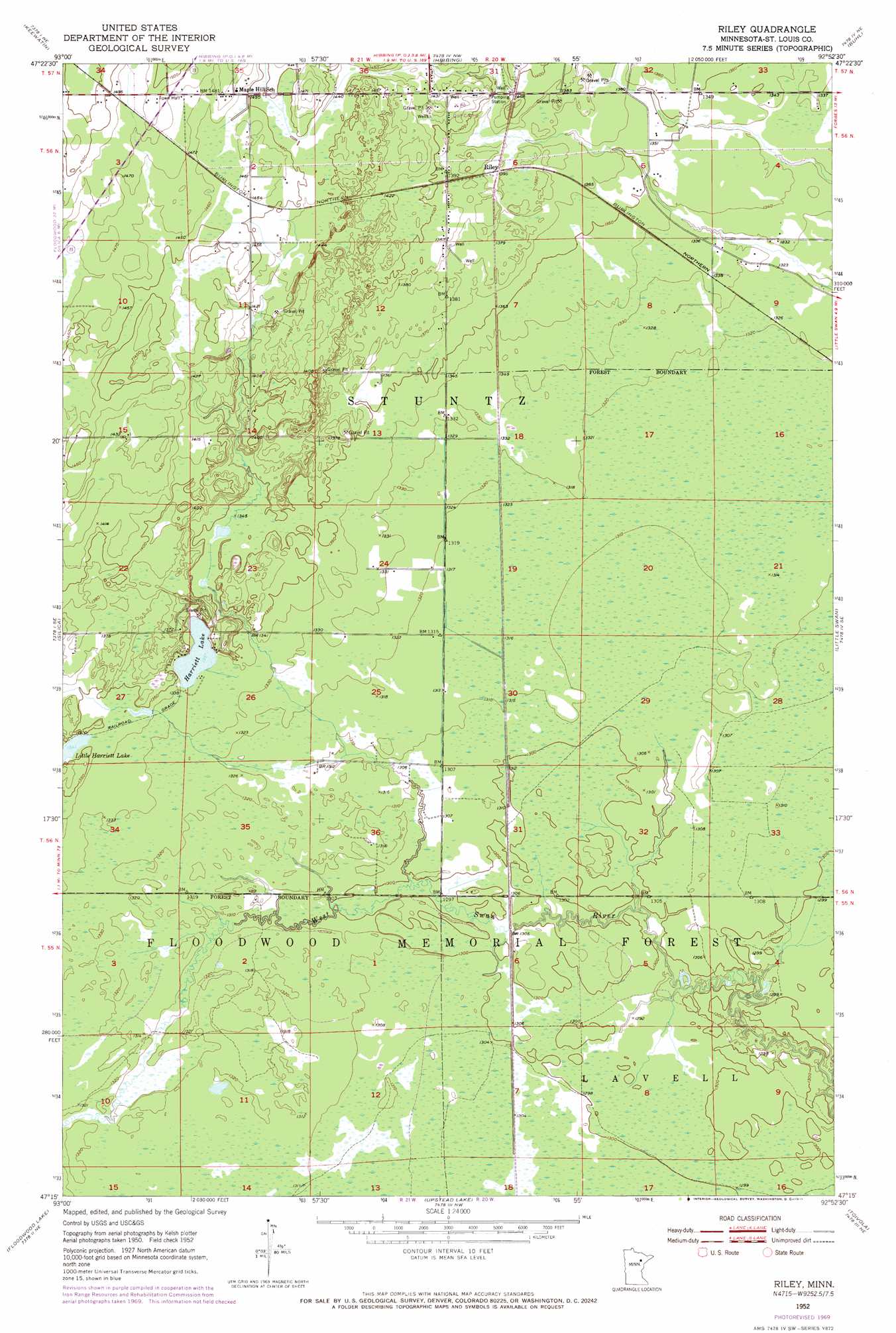
Riley Topo Map Minnesota
To zoom in, hover over the map of Riley
USGS Topo Quad 47092c8 - 1:24,000 scale
| Topo Map Name: | Riley |
| USGS Topo Quad ID: | 47092c8 |
| Print Size: | ca. 21 1/4" wide x 27" high |
| Southeast Coordinates: | 47.25° N latitude / 92.875° W longitude |
| Map Center Coordinates: | 47.3125° N latitude / 92.9375° W longitude |
| U.S. State: | MN |
| Filename: | o47092c8.jpg |
| Download Map JPG Image: | Riley topo map 1:24,000 scale |
| Map Type: | Topographic |
| Topo Series: | 7.5´ |
| Map Scale: | 1:24,000 |
| Source of Map Images: | United States Geological Survey (USGS) |
| Alternate Map Versions: |
Riley MN 1952, updated 1954 Download PDF Buy paper map Riley MN 1952, updated 1971 Download PDF Buy paper map Riley MN 2010 Download PDF Buy paper map Riley MN 2013 Download PDF Buy paper map Riley MN 2016 Download PDF Buy paper map |
1:24,000 Topo Quads surrounding Riley
O'Leary Lake |
Stingy Lake |
Dewey Lake |
Dewey Lake Se |
Kinney |
Nashwauk |
Keewatin |
Hibbing |
Buhl |
Kirk |
Pengilly |
Silica |
Riley |
Little Swan |
Casco |
Goodland |
Floodwood Lake |
Upstead Lake |
Toivola |
Meadowlands Nw |
Swan River |
Wawina |
Toivola Sw |
Elmer |
Meadowlands |
> Back to 47092a1 at 1:100,000 scale
> Back to 47092a1 at 1:250,000 scale
> Back to U.S. Topo Maps home
Riley topo map: Gazetteer
Riley: Forests
Floodwood Memorial Forest elevation 399m 1309′Riley: Lakes
Harriett Lake elevation 408m 1338′Little Harriett Lake elevation 409m 1341′
Riley: Populated Places
Riley elevation 421m 1381′Riley digital topo map on disk
Buy this Riley topo map showing relief, roads, GPS coordinates and other geographical features, as a high-resolution digital map file on DVD: