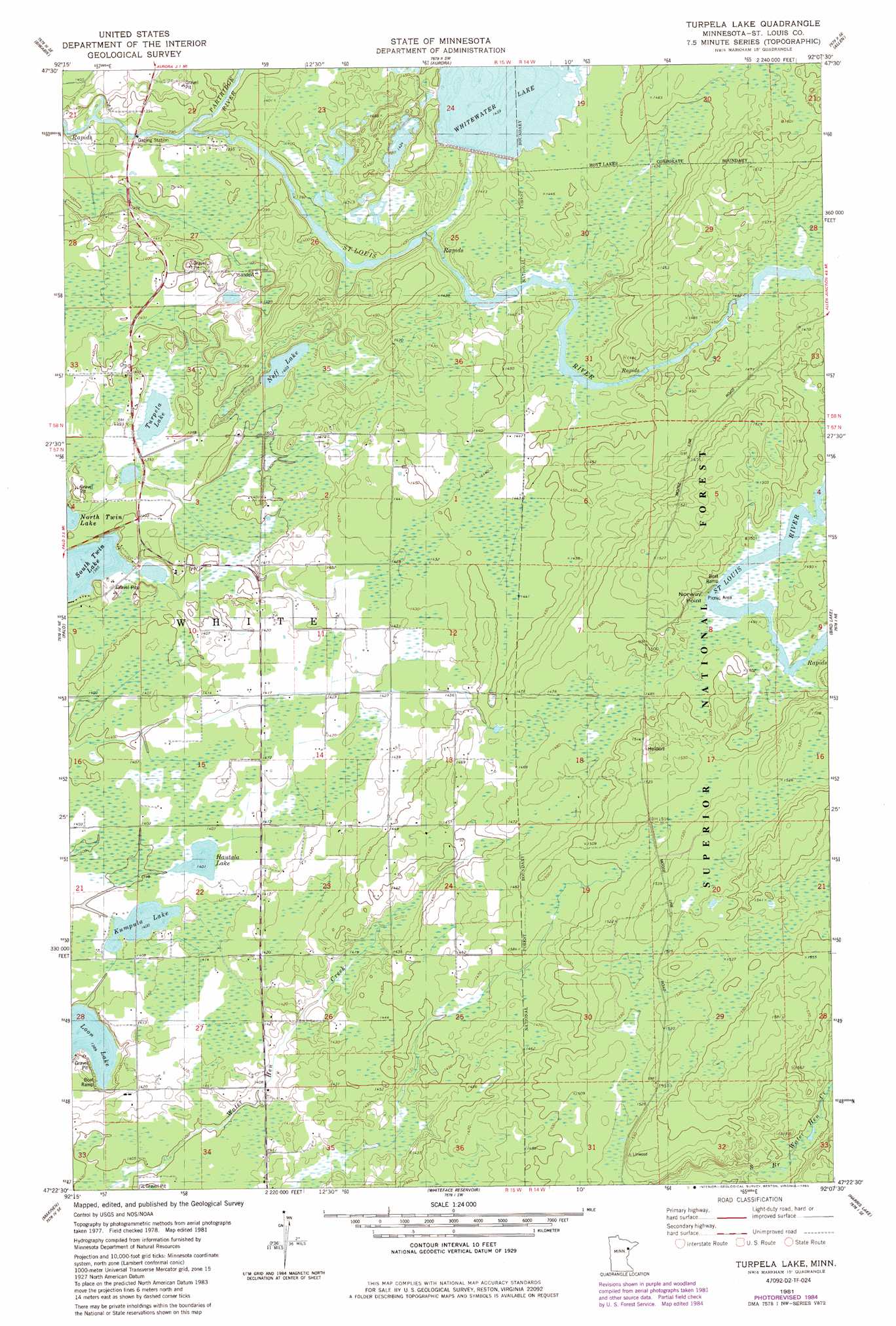
Turpela Lake Topo Map Minnesota
To zoom in, hover over the map of Turpela Lake
USGS Topo Quad 47092d2 - 1:24,000 scale
| Topo Map Name: | Turpela Lake |
| USGS Topo Quad ID: | 47092d2 |
| Print Size: | ca. 21 1/4" wide x 27" high |
| Southeast Coordinates: | 47.375° N latitude / 92.125° W longitude |
| Map Center Coordinates: | 47.4375° N latitude / 92.1875° W longitude |
| U.S. State: | MN |
| Filename: | o47092d2.jpg |
| Download Map JPG Image: | Turpela Lake topo map 1:24,000 scale |
| Map Type: | Topographic |
| Topo Series: | 7.5´ |
| Map Scale: | 1:24,000 |
| Source of Map Images: | United States Geological Survey (USGS) |
| Alternate Map Versions: |
Turpela Lake MN 1981, updated 1982 Download PDF Buy paper map Turpela Lake MN 1981, updated 1985 Download PDF Buy paper map Turpela Lake MN 2011 Download PDF Buy paper map Turpela Lake MN 2013 Download PDF Buy paper map Turpela Lake MN 2016 Download PDF Buy paper map |
| FStopo: | US Forest Service topo Turpela Lake is available: Download FStopo PDF Download FStopo TIF |
1:24,000 Topo Quads surrounding Turpela Lake
Biwabik Nw |
Biwabik Ne |
Embarrass |
Isaac Lake |
Babbitt |
Mckinley |
Biwabik |
Aurora |
Allen |
Babbitt Sw |
Gilbert |
Palo |
Turpela Lake |
Bird Lake |
Skibo |
Central Lakes |
Makinen |
Whiteface Reservoir |
Harris Lake |
Fairbanks |
Cotton |
Whiteface |
Comstock Lake |
Boulder Lake Reservoir Ne |
Pequaywan Lake |
> Back to 47092a1 at 1:100,000 scale
> Back to 47092a1 at 1:250,000 scale
> Back to U.S. Topo Maps home
Turpela Lake topo map: Gazetteer
Turpela Lake: Capes
Norway Point elevation 454m 1489′Turpela Lake: Dams
White Water Reservoir Dam elevation 429m 1407′Turpela Lake: Lakes
Hautala Lake elevation 427m 1400′Kumpula Lake elevation 427m 1400′
Neff Lake elevation 428m 1404′
South Twin Lake elevation 422m 1384′
Turpela Lake elevation 422m 1384′
Turpela Lake: Reservoirs
White Water Reservoir elevation 429m 1407′Whitewater Lake elevation 439m 1440′
Turpela Lake: Streams
Partridge River elevation 422m 1384′Turpela Lake digital topo map on disk
Buy this Turpela Lake topo map showing relief, roads, GPS coordinates and other geographical features, as a high-resolution digital map file on DVD: