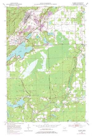
Gilbert Topo Map Minnesota
To zoom in, hover over the map of Gilbert
USGS Topo Quad 47092d4 - 1:24,000 scale
| Topo Map Name: | Gilbert |
| USGS Topo Quad ID: | 47092d4 |
| Print Size: | ca. 21 1/4" wide x 27" high |
| Southeast Coordinates: | 47.375° N latitude / 92.375° W longitude |
| Map Center Coordinates: | 47.4375° N latitude / 92.4375° W longitude |
| U.S. State: | MN |
| Filename: | o47092d4.jpg |
| Download Map JPG Image: | Gilbert topo map 1:24,000 scale |
| Map Type: | Topographic |
| Topo Series: | 7.5´ |
| Map Scale: | 1:24,000 |
| Source of Map Images: | United States Geological Survey (USGS) |
| Alternate Map Versions: |
Gilbert MN 1951, updated 1952 Download PDF Buy paper map Gilbert MN 1951, updated 1965 Download PDF Buy paper map Gilbert MN 1951, updated 1971 Download PDF Buy paper map Gilbert MN 1951, updated 1978 Download PDF Buy paper map Gilbert MN 2010 Download PDF Buy paper map Gilbert MN 2013 Download PDF Buy paper map Gilbert MN 2016 Download PDF Buy paper map |
1:24,000 Topo Quads surrounding Gilbert
> Back to 47092a1 at 1:100,000 scale
> Back to 47092a1 at 1:250,000 scale
> Back to U.S. Topo Maps home
Gilbert topo map: Gazetteer
Gilbert: Airports
Eveleth-Virginia Municipal Airport elevation 418m 1371′Sky Harbor Seaplane Base elevation 420m 1377′
Gilbert: Dams
Ely Lake Dam elevation 422m 1384′Esquagama Lake Dam elevation 412m 1351′
Gilbert: Lakes
Deep Lake elevation 421m 1381′Ely Lake elevation 420m 1377′
Gill Lake elevation 427m 1400′
Heikkala Lake elevation 410m 1345′
Leaf Lake elevation 424m 1391′
Lost Lake elevation 422m 1384′
Pleasant Lake elevation 409m 1341′
Gilbert: Mines
Genoa Mine elevation 463m 1519′Gilbert Mine elevation 445m 1459′
Schley Mine elevation 443m 1453′
Sparta-Matta Mine elevation 434m 1423′
Gilbert: Parks
Fayal Township State Game Refuge elevation 416m 1364′Gilbert: Populated Places
Gilbert elevation 467m 1532′Sparta elevation 446m 1463′
Gilbert: Post Offices
Gilbert Post Office elevation 467m 1532′Sparta Post Office (historical) elevation 446m 1463′
Gilbert: Reservoirs
Ely Lake elevation 422m 1384′Esquagama Lake elevation 412m 1351′
Gilbert: Streams
Ely Creek elevation 407m 1335′Embarrass River elevation 409m 1341′
Hay Creek elevation 409m 1341′
Gilbert digital topo map on disk
Buy this Gilbert topo map showing relief, roads, GPS coordinates and other geographical features, as a high-resolution digital map file on DVD:


