Kirk Topo Map Minnesota
To zoom in, hover over the map of Kirk
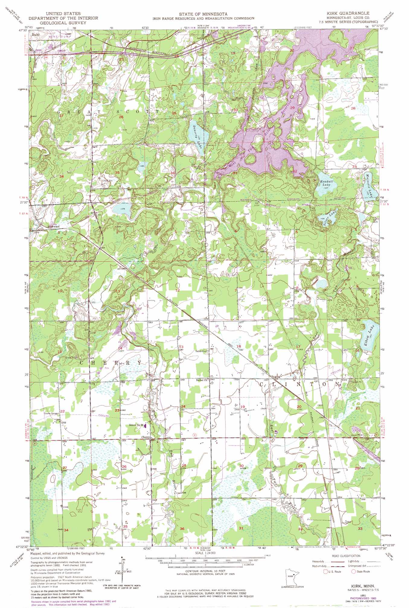
USGS Topo Quad 47092d6 - 1:24,000 scale
| Topo Map Name: | Kirk |
| USGS Topo Quad ID: | 47092d6 |
| Print Size: | ca. 21 1/4" wide x 27" high |
| Southeast Coordinates: | 47.375° N latitude / 92.625° W longitude |
| Map Center Coordinates: | 47.4375° N latitude / 92.6875° W longitude |
| U.S. State: | MN |
| Filename: | o47092d6.jpg |
| Download Map JPG Image: | Kirk topo map 1:24,000 scale |
| Map Type: | Topographic |
| Topo Series: | 7.5´ |
| Map Scale: | 1:24,000 |
| Source of Map Images: | United States Geological Survey (USGS) |
| Alternate Map Versions: |
Kirk MN 1951, updated 1952 Download PDF Buy paper map Kirk MN 1951, updated 1968 Download PDF Buy paper map Kirk MN 1951, updated 1971 Download PDF Buy paper map Kirk MN 1951, updated 1973 Download PDF Buy paper map Kirk MN 2010 Download PDF Buy paper map Kirk MN 2013 Download PDF Buy paper map Kirk MN 2016 Download PDF Buy paper map |
1:24,000 Topo Quads surrounding Kirk
Dewey Lake Nw |
Dark Lake |
Idington |
Britt |
Biwabik Nw |
Dewey Lake |
Dewey Lake Se |
Kinney |
Virginia |
Mckinley |
Hibbing |
Buhl |
Kirk |
Eveleth |
Gilbert |
Riley |
Little Swan |
Casco |
Zim |
Central Lakes |
Upstead Lake |
Toivola |
Meadowlands Nw |
Kelsey |
Cotton |
> Back to 47092a1 at 1:100,000 scale
> Back to 47092a1 at 1:250,000 scale
> Back to U.S. Topo Maps home
Kirk topo map: Gazetteer
Kirk: Airports
Stahlberg-Mohr Airport elevation 436m 1430′Kirk: Dams
West Two Rivers Dam elevation 434m 1423′Kirk: Lakes
Doherty Lake elevation 429m 1407′Kendall Lake elevation 428m 1404′
Majestic Lake elevation 427m 1400′
Silver Lake elevation 428m 1404′
Kirk: Populated Places
Cherry elevation 412m 1351′Kirk elevation 412m 1351′
Sherwood elevation 425m 1394′
Kirk: Post Offices
Cherry Post Office (historical) elevation 412m 1351′Kirk: Reservoirs
West Two River Reservoir elevation 432m 1417′Kirk digital topo map on disk
Buy this Kirk topo map showing relief, roads, GPS coordinates and other geographical features, as a high-resolution digital map file on DVD: