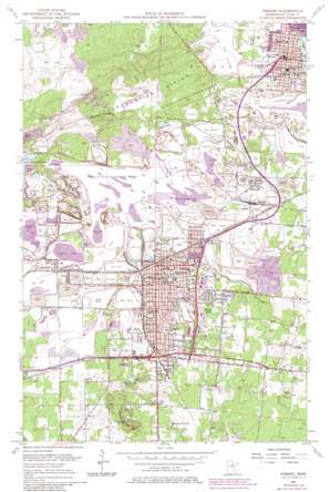
Hibbing Topo Map Minnesota
To zoom in, hover over the map of Hibbing
USGS Topo Quad 47092d8 - 1:24,000 scale
| Topo Map Name: | Hibbing |
| USGS Topo Quad ID: | 47092d8 |
| Print Size: | ca. 21 1/4" wide x 27" high |
| Southeast Coordinates: | 47.375° N latitude / 92.875° W longitude |
| Map Center Coordinates: | 47.4375° N latitude / 92.9375° W longitude |
| U.S. State: | MN |
| Filename: | o47092d8.jpg |
| Download Map JPG Image: | Hibbing topo map 1:24,000 scale |
| Map Type: | Topographic |
| Topo Series: | 7.5´ |
| Map Scale: | 1:24,000 |
| Source of Map Images: | United States Geological Survey (USGS) |
| Alternate Map Versions: |
Hibbing MN 1951, updated 1953 Download PDF Buy paper map Hibbing MN 1957, updated 1958 Download PDF Buy paper map Hibbing MN 1957, updated 1959 Download PDF Buy paper map Hibbing MN 1957, updated 1971 Download PDF Buy paper map Hibbing MN 2010 Download PDF Buy paper map Hibbing MN 2013 Download PDF Buy paper map Hibbing MN 2016 Download PDF Buy paper map |
1:24,000 Topo Quads surrounding Hibbing
> Back to 47092a1 at 1:100,000 scale
> Back to 47092a1 at 1:250,000 scale
> Back to U.S. Topo Maps home
Hibbing topo map: Gazetteer
Hibbing: Airports
Mesabi Regional Medical Center Heliport elevation 457m 1499′Hibbing: Dams
Mesabi Chief Clarification Dike elevation 457m 1499′Mesabi Chief Tailings Dike Three elevation 457m 1499′
Whitney Clearwater Dike elevation 442m 1450′
Whitney Tailings Dike elevation 441m 1446′
Hibbing: Lakes
Bryan Lake elevation 442m 1450′Rock Lake elevation 461m 1512′
Hibbing: Mines
Agnew Shaft elevation 471m 1545′Albany Mine elevation 453m 1486′
Bradford Mine elevation 481m 1578′
Burt-Sellers Mine elevation 471m 1545′
Carmi-Carson Lake Mine elevation 463m 1519′
Chataco Mine elevation 459m 1505′
Cyprus Mine elevation 489m 1604′
Glen Mine elevation 475m 1558′
Kerr Mine elevation 497m 1630′
Leonard-Burt Mine elevation 464m 1522′
Longyear Mine elevation 458m 1502′
Mahoning Mine elevation 465m 1525′
Mahoning Mine elevation 466m 1528′
Mahoning-Hull-Rust Mine elevation 480m 1574′
Morris Mine elevation 460m 1509′
Morton Mine elevation 462m 1515′
Pierce Mine elevation 466m 1528′
Pillsbury Mine elevation 481m 1578′
Scranton Mine elevation 462m 1515′
South Agnew Mine elevation 470m 1541′
Susquehanna Mine elevation 458m 1502′
Webb Mine elevation 461m 1512′
Weggum Mine elevation 457m 1499′
Hibbing: Parks
Bennett Park elevation 455m 1492′Bennett Park Geological Marker elevation 454m 1489′
Bryan Lake Park elevation 443m 1453′
Chisholm Memorial Park elevation 475m 1558′
Emergence of Man Through Steel Historical Marker elevation 475m 1558′
Geology of the Mesabi Region Geological Marker elevation 454m 1489′
Hibbing Park elevation 451m 1479′
Hull-Rust-Mahoning Mine Historical Marker elevation 454m 1489′
Pillsbury Mine Overlook elevation 478m 1568′
Sargent Park elevation 452m 1482′
Hibbing: Populated Places
Birch Lane Mobile Home Park elevation 449m 1473′Brooklyn elevation 453m 1486′
Chisholm elevation 468m 1535′
Country Estates Mobile Home Park elevation 427m 1400′
Hibbing elevation 455m 1492′
Kerr elevation 468m 1535′
Kitzville elevation 451m 1479′
Lavinia elevation 511m 1676′
Leetonia elevation 461m 1512′
Mahoning elevation 479m 1571′
Mitchell elevation 448m 1469′
Olson's Mobile Home Park elevation 447m 1466′
Redore elevation 449m 1473′
Ruby Junction elevation 447m 1466′
Scranton elevation 458m 1502′
Spruce Shadows Mobile Home Park elevation 479m 1571′
Hibbing: Post Offices
Chisholm Post Office elevation 464m 1522′Hibbing Post Office elevation 454m 1489′
Kitzville Post Office (historical) elevation 451m 1479′
Northland Post Office (historical) elevation 458m 1502′
Powers Post Office (historical) elevation 463m 1519′
Redore Post Office (historical) elevation 449m 1473′
Hibbing: Reservoirs
Mesabi Chief Clarification Basin elevation 457m 1499′Mesabi Chief Tailings Basin Three elevation 457m 1499′
Mesabi Chief Tailings Dike Two elevation 457m 1499′
Whitney Clearwater Basin elevation 442m 1450′
Whitney Tailings Basin elevation 441m 1446′
Hibbing: Summits
Maple Hill elevation 502m 1646′Hibbing digital topo map on disk
Buy this Hibbing topo map showing relief, roads, GPS coordinates and other geographical features, as a high-resolution digital map file on DVD:


