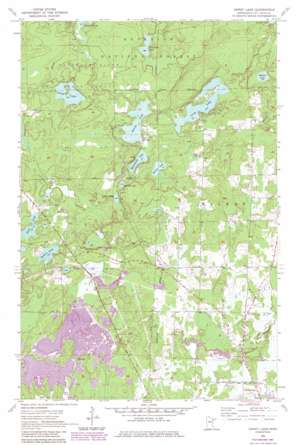
Dewey Lake Topo Map Minnesota
To zoom in, hover over the map of Dewey Lake
USGS Topo Quad 47092e8 - 1:24,000 scale
| Topo Map Name: | Dewey Lake |
| USGS Topo Quad ID: | 47092e8 |
| Print Size: | ca. 21 1/4" wide x 27" high |
| Southeast Coordinates: | 47.5° N latitude / 92.875° W longitude |
| Map Center Coordinates: | 47.5625° N latitude / 92.9375° W longitude |
| U.S. State: | MN |
| Filename: | o47092e8.jpg |
| Download Map JPG Image: | Dewey Lake topo map 1:24,000 scale |
| Map Type: | Topographic |
| Topo Series: | 7.5´ |
| Map Scale: | 1:24,000 |
| Source of Map Images: | United States Geological Survey (USGS) |
| Alternate Map Versions: |
Dewey Lake MN 1955, updated 1956 Download PDF Buy paper map Dewey Lake MN 1955, updated 1971 Download PDF Buy paper map Dewey Lake MN 1955, updated 1977 Download PDF Buy paper map Dewey Lake MN 1955, updated 1985 Download PDF Buy paper map Dewey Lake MN 2011 Download PDF Buy paper map Dewey Lake MN 2013 Download PDF Buy paper map Dewey Lake MN 2016 Download PDF Buy paper map |
| FStopo: | US Forest Service topo Dewey Lake is available: Download FStopo PDF Download FStopo TIF |
1:24,000 Topo Quads surrounding Dewey Lake
> Back to 47092e1 at 1:100,000 scale
> Back to 47092a1 at 1:250,000 scale
> Back to U.S. Topo Maps home
Dewey Lake topo map: Gazetteer
Dewey Lake: Dams
Hibbing Taconite Starter Dam Three elevation 453m 1486′Dewey Lake: Lakes
Balkan Lake elevation 433m 1420′Dewey Lake elevation 427m 1400′
Dollar Lake elevation 432m 1417′
Hobson Lake elevation 437m 1433′
Island Lake elevation 423m 1387′
Long Lake elevation 430m 1410′
Louise Lake elevation 430m 1410′
McCormack Lake elevation 428m 1404′
Rock Lake elevation 427m 1400′
Shoepack Lake elevation 425m 1394′
Spring Lake elevation 431m 1414′
Sunset Lake elevation 430m 1410′
Dewey Lake: Reservoirs
Hibbing Taconite Tailings Basin elevation 453m 1486′Dewey Lake digital topo map on disk
Buy this Dewey Lake topo map showing relief, roads, GPS coordinates and other geographical features, as a high-resolution digital map file on DVD:


