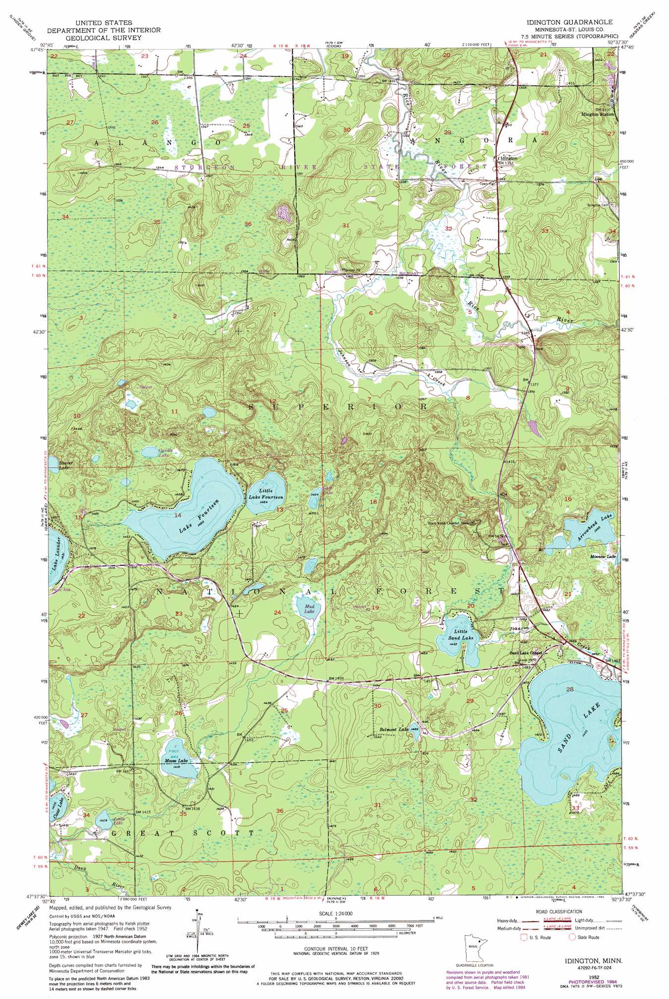
Idington Topo Map Minnesota
To zoom in, hover over the map of Idington
USGS Topo Quad 47092f6 - 1:24,000 scale
| Topo Map Name: | Idington |
| USGS Topo Quad ID: | 47092f6 |
| Print Size: | ca. 21 1/4" wide x 27" high |
| Southeast Coordinates: | 47.625° N latitude / 92.625° W longitude |
| Map Center Coordinates: | 47.6875° N latitude / 92.6875° W longitude |
| U.S. State: | MN |
| Filename: | o47092f6.jpg |
| Download Map JPG Image: | Idington topo map 1:24,000 scale |
| Map Type: | Topographic |
| Topo Series: | 7.5´ |
| Map Scale: | 1:24,000 |
| Source of Map Images: | United States Geological Survey (USGS) |
| Alternate Map Versions: |
Idington MN 1952, updated 1954 Download PDF Buy paper map Idington MN 1952, updated 1968 Download PDF Buy paper map Idington MN 1952, updated 1971 Download PDF Buy paper map Idington MN 1952, updated 1985 Download PDF Buy paper map Idington MN 2011 Download PDF Buy paper map Idington MN 2013 Download PDF Buy paper map Idington MN 2016 Download PDF Buy paper map |
| FStopo: | US Forest Service topo Idington is available: Download FStopo PDF Download FStopo TIF |
1:24,000 Topo Quads surrounding Idington
Gheen Nw |
Gheen |
Haley |
Norwegian Bay |
Vermilion Dam |
Meadow Brook |
Linden Grove |
Cook |
Sassas Creek |
Lost Lake |
Dewey Lake Nw |
Dark Lake |
Idington |
Britt |
Biwabik Nw |
Dewey Lake |
Dewey Lake Se |
Kinney |
Virginia |
Mckinley |
Hibbing |
Buhl |
Kirk |
Eveleth |
Gilbert |
> Back to 47092e1 at 1:100,000 scale
> Back to 47092a1 at 1:250,000 scale
> Back to U.S. Topo Maps home
Idington topo map: Gazetteer
Idington: Lakes
Arrowhead Lake elevation 447m 1466′Beaver Lake elevation 444m 1456′
Belmont Lake elevation 454m 1489′
Candle Lake elevation 447m 1466′
Goat Lake elevation 446m 1463′
Jutila Lake elevation 430m 1410′
Lake Fourteen elevation 445m 1459′
Lake Little Fourteen elevation 446m 1463′
Little Sand Lake elevation 437m 1433′
Moose Lake elevation 432m 1417′
Sand Lake elevation 447m 1466′
Watercress Lake elevation 438m 1437′
Idington: Parks
Arrowhead Lake State Game Refuge elevation 461m 1512′Superior State Game Refuge elevation 446m 1463′
Idington: Populated Places
Idington elevation 412m 1351′Idington: Streams
Johnson Creek elevation 407m 1335′Watercress Creek elevation 438m 1437′
Idington digital topo map on disk
Buy this Idington topo map showing relief, roads, GPS coordinates and other geographical features, as a high-resolution digital map file on DVD: