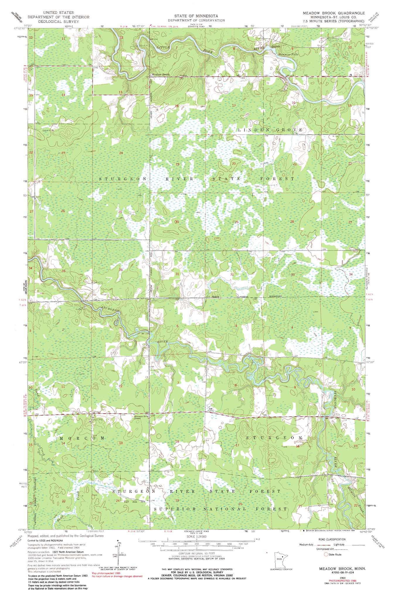
Meadow Brook Topo Map Minnesota
To zoom in, hover over the map of Meadow Brook
USGS Topo Quad 47092g8 - 1:24,000 scale
| Topo Map Name: | Meadow Brook |
| USGS Topo Quad ID: | 47092g8 |
| Print Size: | ca. 21 1/4" wide x 27" high |
| Southeast Coordinates: | 47.75° N latitude / 92.875° W longitude |
| Map Center Coordinates: | 47.8125° N latitude / 92.9375° W longitude |
| U.S. State: | MN |
| Filename: | o47092g8.jpg |
| Download Map JPG Image: | Meadow Brook topo map 1:24,000 scale |
| Map Type: | Topographic |
| Topo Series: | 7.5´ |
| Map Scale: | 1:24,000 |
| Source of Map Images: | United States Geological Survey (USGS) |
| Alternate Map Versions: |
Meadow Brook MN 1964, updated 1965 Download PDF Buy paper map Meadow Brook MN 1964, updated 1986 Download PDF Buy paper map Meadow Brook MN 2011 Download PDF Buy paper map Meadow Brook MN 2013 Download PDF Buy paper map Meadow Brook MN 2016 Download PDF Buy paper map |
| FStopo: | US Forest Service topo Meadow Brook is available: Download FStopo PDF Download FStopo TIF |
1:24,000 Topo Quads surrounding Meadow Brook
Nett Lake Sw |
Nett Lake |
Orr Sw |
Orr |
Myrtle Lake |
Rauch |
Silverdale |
Gheen Nw |
Gheen |
Haley |
Togo |
Bear River |
Meadow Brook |
Linden Grove |
Cook |
Sherry Lake |
Side Lake |
Dewey Lake Nw |
Dark Lake |
Idington |
O'Leary Lake |
Stingy Lake |
Dewey Lake |
Dewey Lake Se |
Kinney |
> Back to 47092e1 at 1:100,000 scale
> Back to 47092a1 at 1:250,000 scale
> Back to U.S. Topo Maps home
Meadow Brook topo map: Gazetteer
Meadow Brook: Falls
Hannine Falls elevation 384m 1259′Meadow Brook: Populated Places
Meadow Brook elevation 393m 1289′Meadow Brook: Post Offices
Meadow Brook Post Office (historical) elevation 393m 1289′Meadow Brook: Streams
Gilmore Creek elevation 389m 1276′Meadow Brook digital topo map on disk
Buy this Meadow Brook topo map showing relief, roads, GPS coordinates and other geographical features, as a high-resolution digital map file on DVD: