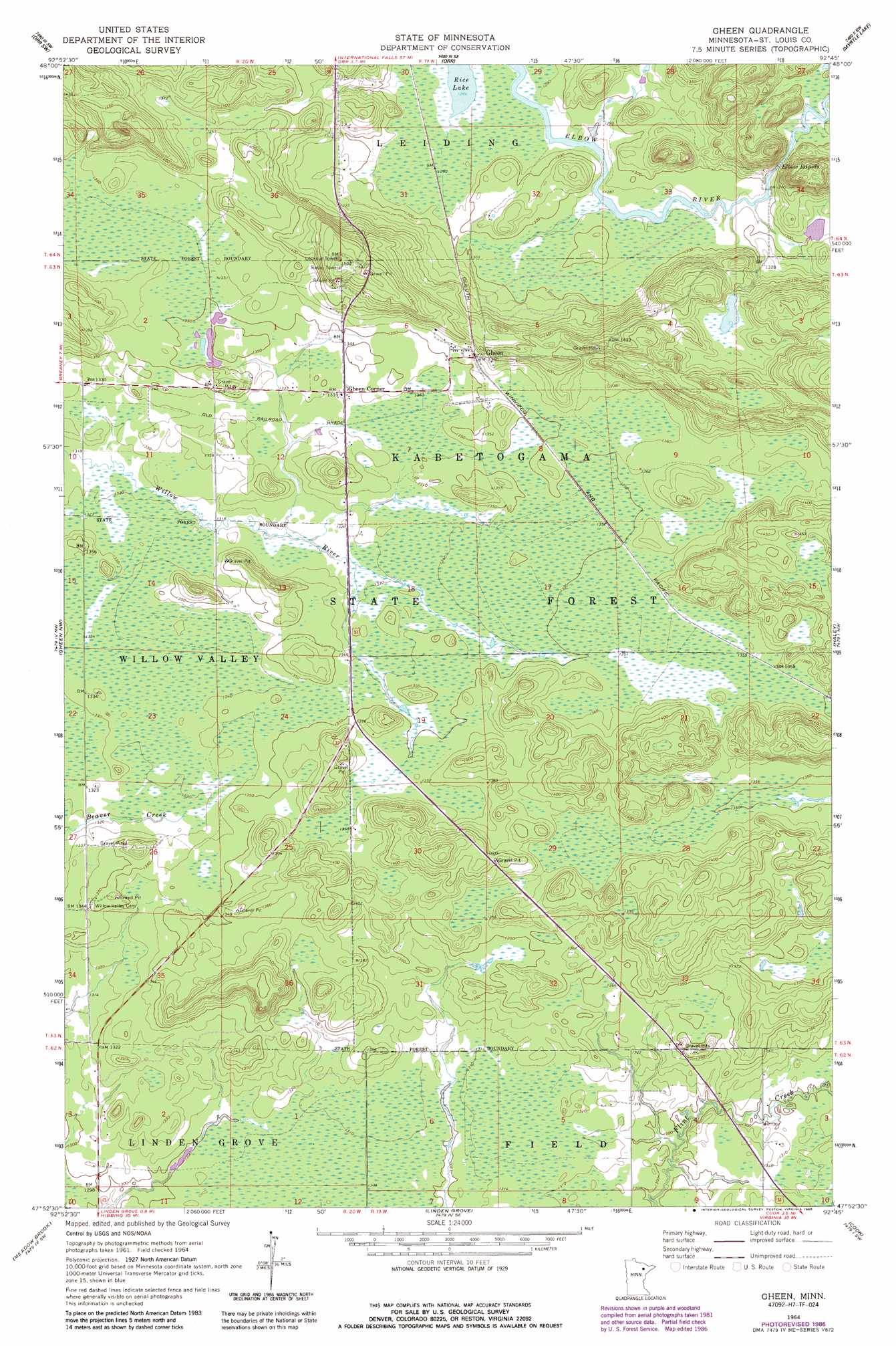
Gheen Topo Map Minnesota
To zoom in, hover over the map of Gheen
USGS Topo Quad 47092h7 - 1:24,000 scale
| Topo Map Name: | Gheen |
| USGS Topo Quad ID: | 47092h7 |
| Print Size: | ca. 21 1/4" wide x 27" high |
| Southeast Coordinates: | 47.875° N latitude / 92.75° W longitude |
| Map Center Coordinates: | 47.9375° N latitude / 92.8125° W longitude |
| U.S. State: | MN |
| Filename: | o47092h7.jpg |
| Download Map JPG Image: | Gheen topo map 1:24,000 scale |
| Map Type: | Topographic |
| Topo Series: | 7.5´ |
| Map Scale: | 1:24,000 |
| Source of Map Images: | United States Geological Survey (USGS) |
| Alternate Map Versions: |
Gheen MN 1964, updated 1965 Download PDF Buy paper map Gheen MN 1964, updated 1986 Download PDF Buy paper map Gheen MN 2011 Download PDF Buy paper map Gheen MN 2013 Download PDF Buy paper map Gheen MN 2016 Download PDF Buy paper map |
| FStopo: | US Forest Service topo Gheen is available: Download FStopo PDF Download FStopo TIF |
1:24,000 Topo Quads surrounding Gheen
Nett Lake Ne |
Ash Lake |
Orr Ne |
Elephant Lake |
Kabustasa Lake |
Nett Lake |
Orr Sw |
Orr |
Myrtle Lake |
Buyck |
Silverdale |
Gheen Nw |
Gheen |
Haley |
Norwegian Bay |
Bear River |
Meadow Brook |
Linden Grove |
Cook |
Sassas Creek |
Side Lake |
Dewey Lake Nw |
Dark Lake |
Idington |
Britt |
> Back to 47092e1 at 1:100,000 scale
> Back to 47092a1 at 1:250,000 scale
> Back to U.S. Topo Maps home
Gheen topo map: Gazetteer
Gheen: Populated Places
Gheen elevation 415m 1361′Gheen Corner elevation 409m 1341′
Gheen: Post Offices
Gheen Post Office elevation 415m 1361′Gheen: Rapids
Elbow Rapids elevation 398m 1305′Gheen digital topo map on disk
Buy this Gheen topo map showing relief, roads, GPS coordinates and other geographical features, as a high-resolution digital map file on DVD: