Swan River Topo Map Minnesota
To zoom in, hover over the map of Swan River
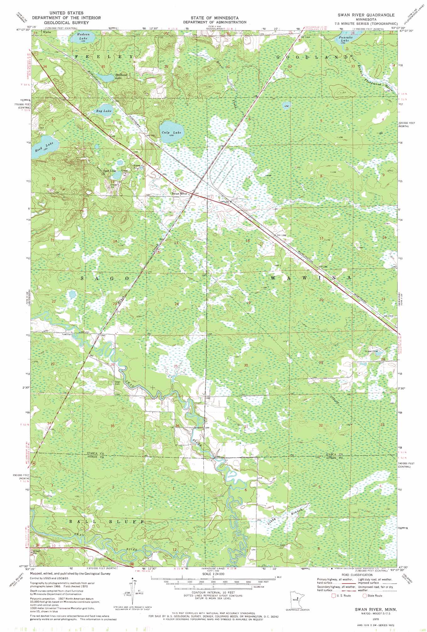
USGS Topo Quad 47093a2 - 1:24,000 scale
| Topo Map Name: | Swan River |
| USGS Topo Quad ID: | 47093a2 |
| Print Size: | ca. 21 1/4" wide x 27" high |
| Southeast Coordinates: | 47° N latitude / 93.125° W longitude |
| Map Center Coordinates: | 47.0625° N latitude / 93.1875° W longitude |
| U.S. State: | MN |
| Filename: | o47093a2.jpg |
| Download Map JPG Image: | Swan River topo map 1:24,000 scale |
| Map Type: | Topographic |
| Topo Series: | 7.5´ |
| Map Scale: | 1:24,000 |
| Source of Map Images: | United States Geological Survey (USGS) |
| Alternate Map Versions: |
Swan River MN 1970, updated 1972 Download PDF Buy paper map Swan River MN 2010 Download PDF Buy paper map Swan River MN 2013 Download PDF Buy paper map Swan River MN 2016 Download PDF Buy paper map |
1:24,000 Topo Quads surrounding Swan River
Bovey |
Calumet |
Pengilly |
Silica |
Riley |
La Prairie |
Warba |
Goodland |
Floodwood Lake |
Upstead Lake |
Split Hand Lake |
Jacobson |
Swan River |
Wawina |
Toivola Sw |
Rabey |
Ball Bluff |
Vanduse Lake |
Island |
Floodwood |
Sanders Lake |
Libby |
Balsam |
Little Prairie Lake |
Prairie Lake |
> Back to 47093a1 at 1:100,000 scale
> Back to 47092a1 at 1:250,000 scale
> Back to U.S. Topo Maps home
Swan River topo map: Gazetteer
Swan River: Lakes
Bog Lake elevation 393m 1289′Bullhead Lake elevation 393m 1289′
Culp Lake elevation 393m 1289′
Hudson Lake elevation 395m 1295′
Reed Lake elevation 386m 1266′
Spot Lake elevation 396m 1299′
Swan River: Populated Places
Swan River elevation 393m 1289′Swan River: Post Offices
Leopold Post Office (historical) elevation 387m 1269′Swan River Post Office elevation 393m 1289′
Swan River: Streams
Bruce Creek elevation 384m 1259′Libby Branch elevation 378m 1240′
Swan River digital topo map on disk
Buy this Swan River topo map showing relief, roads, GPS coordinates and other geographical features, as a high-resolution digital map file on DVD: