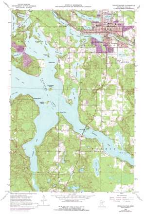
Grand Rapids Topo Map Minnesota
To zoom in, hover over the map of Grand Rapids
USGS Topo Quad 47093b5 - 1:24,000 scale
| Topo Map Name: | Grand Rapids |
| USGS Topo Quad ID: | 47093b5 |
| Print Size: | ca. 21 1/4" wide x 27" high |
| Southeast Coordinates: | 47.125° N latitude / 93.5° W longitude |
| Map Center Coordinates: | 47.1875° N latitude / 93.5625° W longitude |
| U.S. State: | MN |
| Filename: | o47093b5.jpg |
| Download Map JPG Image: | Grand Rapids topo map 1:24,000 scale |
| Map Type: | Topographic |
| Topo Series: | 7.5´ |
| Map Scale: | 1:24,000 |
| Source of Map Images: | United States Geological Survey (USGS) |
| Alternate Map Versions: |
Grand Rapids MN 1953, updated 1955 Download PDF Buy paper map Grand Rapids MN 1953, updated 1968 Download PDF Buy paper map Grand Rapids MN 1953, updated 1971 Download PDF Buy paper map Grand Rapids MN 1953, updated 1975 Download PDF Buy paper map Grand Rapids MN 2010 Download PDF Buy paper map Grand Rapids MN 2013 Download PDF Buy paper map Grand Rapids MN 2016 Download PDF Buy paper map |
1:24,000 Topo Quads surrounding Grand Rapids
> Back to 47093a1 at 1:100,000 scale
> Back to 47092a1 at 1:250,000 scale
> Back to U.S. Topo Maps home
Grand Rapids topo map: Gazetteer
Grand Rapids: Airports
Grand Rapids-Itasca County/Gordon Newstrom Field elevation 400m 1312′Grand Rapids: Bays
King Bay elevation 388m 1272′Meyers Bay elevation 388m 1272′
Poole Bay elevation 388m 1272′
Sherry Arm Bay elevation 388m 1272′
Sugar Bay elevation 388m 1272′
Turtle Bay elevation 388m 1272′
Wendigo Arm Bay elevation 388m 1272′
Grand Rapids: Capes
Chisholm Point elevation 395m 1295′Moose Point elevation 395m 1295′
Stony Point elevation 393m 1289′
Grand Rapids: Dams
Blandin Dam elevation 382m 1253′Pokegama Lake Dam elevation 388m 1272′
Grand Rapids: Harbors
New Spirit Woman's Clinic elevation 397m 1302′Grand Rapids: Islands
Drumbeater Island elevation 390m 1279′Nesbitt Island elevation 390m 1279′
Wendigo Island elevation 390m 1279′
Wilder Island elevation 389m 1276′
Grand Rapids: Lakes
Cavanaugh Lake elevation 389m 1276′Crystal Lake elevation 391m 1282′
Forest Lake elevation 390m 1279′
Hale Lake elevation 390m 1279′
Horseshoe Lake elevation 392m 1286′
Lake Sylvan elevation 387m 1269′
Lily Lake elevation 391m 1282′
Little Jay Gould Lake elevation 390m 1279′
Little Pokegama Lake elevation 388m 1272′
Munzer Lake elevation 391m 1282′
Pokegama Lake elevation 388m 1272′
Stokey Lake elevation 404m 1325′
Grand Rapids: Levees
Lake Pokegama Rest Area elevation 395m 1295′Grand Rapids: Mines
Tioga Mine elevation 405m 1328′Grand Rapids: Parks
American Legion Memorial Park elevation 404m 1325′Blandin Mississippi River Park elevation 389m 1276′
Blandin Park elevation 390m 1279′
D A Grossendorf Park elevation 391m 1282′
Grand Rapids Wayside Park elevation 392m 1286′
Murhunt Park elevation 394m 1292′
Oakland Park elevation 382m 1253′
Riverside Park elevation 389m 1276′
Willow Park elevation 393m 1289′
Grand Rapids: Populated Places
Acheson Mobile Home Village elevation 393m 1289′Best Mobile Home Park elevation 396m 1299′
Grand Rapids elevation 392m 1286′
Huhn Addition Mobile Home Court elevation 398m 1305′
Lakeview Terrace elevation 398m 1305′
North Star Moblie Home Park elevation 397m 1302′
Oakland Estates Mobile Home Park elevation 392m 1286′
Wagon Wheel Mobile Home Park elevation 411m 1348′
Grand Rapids: Post Offices
Grand Rapids Post Office elevation 392m 1286′Grand Rapids: Reservoirs
Paper Mill Reservoir elevation 382m 1253′Pokegama Reservoir elevation 388m 1272′
Sylvan Lake elevation 382m 1253′
Grand Rapids: Streams
Sugar Brook elevation 388m 1272′Grand Rapids digital topo map on disk
Buy this Grand Rapids topo map showing relief, roads, GPS coordinates and other geographical features, as a high-resolution digital map file on DVD:


