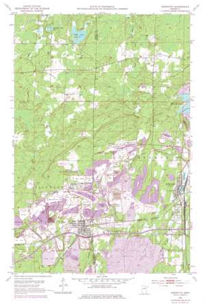
Keewatin Topo Map Minnesota
To zoom in, hover over the map of Keewatin
USGS Topo Quad 47093d1 - 1:24,000 scale
| Topo Map Name: | Keewatin |
| USGS Topo Quad ID: | 47093d1 |
| Print Size: | ca. 21 1/4" wide x 27" high |
| Southeast Coordinates: | 47.375° N latitude / 93° W longitude |
| Map Center Coordinates: | 47.4375° N latitude / 93.0625° W longitude |
| U.S. State: | MN |
| Filename: | o47093d1.jpg |
| Download Map JPG Image: | Keewatin topo map 1:24,000 scale |
| Map Type: | Topographic |
| Topo Series: | 7.5´ |
| Map Scale: | 1:24,000 |
| Source of Map Images: | United States Geological Survey (USGS) |
| Alternate Map Versions: |
Keewatin MN 1952, updated 1954 Download PDF Buy paper map Keewatin MN 1952, updated 1971 Download PDF Buy paper map Keewatin MN 1952, updated 1977 Download PDF Buy paper map Keewatin MN 2010 Download PDF Buy paper map Keewatin MN 2013 Download PDF Buy paper map Keewatin MN 2016 Download PDF Buy paper map |
1:24,000 Topo Quads surrounding Keewatin
> Back to 47093a1 at 1:100,000 scale
> Back to 47092a1 at 1:250,000 scale
> Back to U.S. Topo Maps home
Keewatin topo map: Gazetteer
Keewatin: Lakes
Horsehead Lake elevation 431m 1414′Kelly Lake elevation 458m 1502′
Libby Lake elevation 434m 1423′
Mahoning Lakes elevation 479m 1571′
Snowshoe Lake elevation 459m 1505′
Welcome Lake elevation 443m 1453′
Keewatin: Mines
Alexander Mine elevation 482m 1581′Bennett Mine elevation 461m 1512′
Bray Mine elevation 457m 1499′
Carlz Mine elevation 447m 1466′
Forest Mine elevation 486m 1594′
Lamberton Mine elevation 484m 1587′
Mace Number One Mine elevation 489m 1604′
Mesabi Chief Mine elevation 456m 1496′
Mississippi Number One Mine elevation 467m 1532′
North Russell Mine elevation 473m 1551′
Perry Mine elevation 449m 1473′
Saint Paul Mine elevation 458m 1502′
Sargent Mine elevation 452m 1482′
Section Eighteen Mine elevation 474m 1555′
South Russell Mine elevation 467m 1532′
Stein Mine elevation 460m 1509′
Stevenson Mine elevation 481m 1578′
Keewatin: Populated Places
Bennett elevation 477m 1564′Keewatin elevation 444m 1456′
Kelly Lake elevation 459m 1505′
Olson's Mobile Home Park elevation 448m 1469′
Stevenson elevation 496m 1627′
Keewatin: Post Offices
Keewating Post Offce elevation 448m 1469′Kelly Lake Post Office elevation 459m 1505′
Stevenson Post Office (historical) elevation 496m 1627′
Keewatin digital topo map on disk
Buy this Keewatin topo map showing relief, roads, GPS coordinates and other geographical features, as a high-resolution digital map file on DVD:


