Rauch Topo Map Minnesota
To zoom in, hover over the map of Rauch
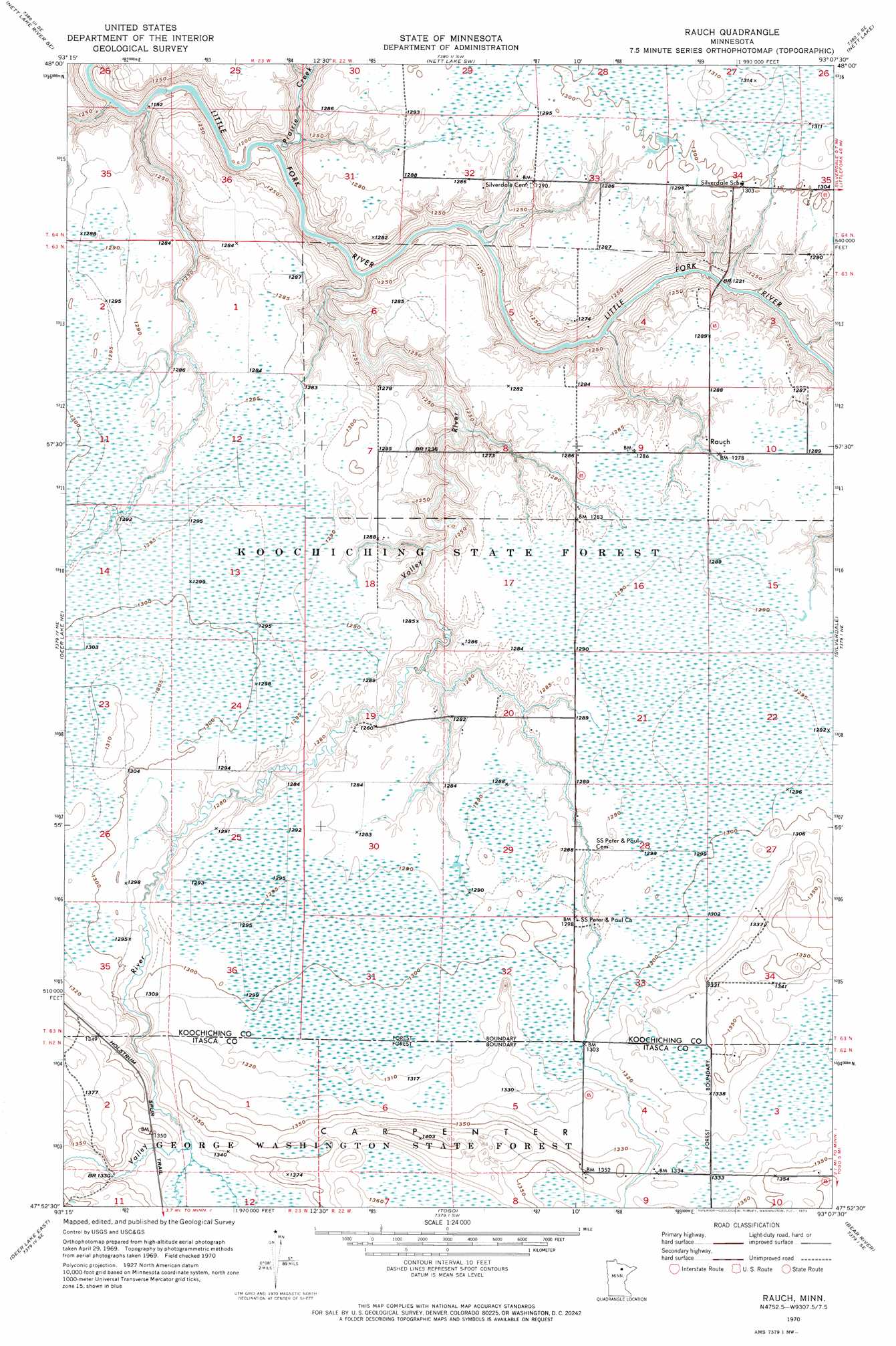
USGS Topo Quad 47093h2 - 1:24,000 scale
| Topo Map Name: | Rauch |
| USGS Topo Quad ID: | 47093h2 |
| Print Size: | ca. 21 1/4" wide x 27" high |
| Southeast Coordinates: | 47.875° N latitude / 93.125° W longitude |
| Map Center Coordinates: | 47.9375° N latitude / 93.1875° W longitude |
| U.S. State: | MN |
| Filename: | o47093h2.jpg |
| Download Map JPG Image: | Rauch topo map 1:24,000 scale |
| Map Type: | Topographic |
| Topo Series: | 7.5´ |
| Map Scale: | 1:24,000 |
| Source of Map Images: | United States Geological Survey (USGS) |
| Alternate Map Versions: |
Rauch MN 1970, updated 1973 Download PDF Buy paper map Rauch MN 2010 Download PDF Buy paper map Rauch MN 2013 Download PDF Buy paper map Rauch MN 2016 Download PDF Buy paper map |
1:24,000 Topo Quads surrounding Rauch
Nett Lake River West |
Nett Lake River East |
Nett Lake Nw |
Nett Lake Ne |
Ash Lake |
Nett Lake River Sw |
Nett Lake River Se |
Nett Lake Sw |
Nett Lake |
Orr Sw |
Deer Lake Nw |
Deer Lake Ne |
Rauch |
Silverdale |
Gheen Nw |
Deer Lake West |
Deer Lake East |
Togo |
Bear River |
Meadow Brook |
Anderson Lake |
Horsehead Lake |
Sherry Lake |
Side Lake |
Dewey Lake Nw |
> Back to 47093e1 at 1:100,000 scale
> Back to 47092a1 at 1:250,000 scale
> Back to U.S. Topo Maps home
Rauch topo map: Gazetteer
Rauch: Populated Places
Rauch elevation 391m 1282′Rauch: Post Offices
Rauch Post Office (historical) elevation 391m 1282′Rauch: Streams
Prairie Creek elevation 362m 1187′Valley River elevation 363m 1190′
Rauch digital topo map on disk
Buy this Rauch topo map showing relief, roads, GPS coordinates and other geographical features, as a high-resolution digital map file on DVD: