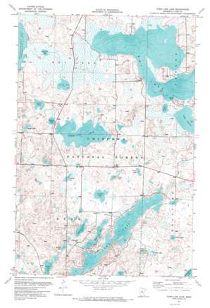
Town Line Lake Topo Map Minnesota
To zoom in, hover over the map of Town Line Lake
USGS Topo Quad 47094a2 - 1:24,000 scale
| Topo Map Name: | Town Line Lake |
| USGS Topo Quad ID: | 47094a2 |
| Print Size: | ca. 21 1/4" wide x 27" high |
| Southeast Coordinates: | 47° N latitude / 94.125° W longitude |
| Map Center Coordinates: | 47.0625° N latitude / 94.1875° W longitude |
| U.S. State: | MN |
| Filename: | p47094a2.jpg |
| Download Map JPG Image: | Town Line Lake topo map 1:24,000 scale |
| Map Type: | Orthophoto |
| Topo Series: | 7.5´ |
| Map Scale: | 1:24,000 |
| Source of Map Images: | United States Geological Survey (USGS) |
| Alternate Map Versions: |
Town Line Lake MN 1971, updated 1974 Download PDF Buy paper map Town Line Lake MN 1996, updated 1998 Download PDF Buy paper map Town Line Lake MN 2011 Download PDF Buy paper map Town Line Lake MN 2013 Download PDF Buy paper map Town Line Lake MN 2016 Download PDF Buy paper map |
| FStopo: | US Forest Service topo Town Line Lake is available: Download FStopo PDF Download FStopo TIF |
1:24,000 Topo Quads surrounding Town Line Lake
> Back to 47094a1 at 1:100,000 scale
> Back to 47094a1 at 1:250,000 scale
> Back to U.S. Topo Maps home
Town Line Lake topo map: Gazetteer
Town Line Lake: Lakes
Aultman Lake elevation 403m 1322′Boxell Lake elevation 407m 1335′
Boy Lake elevation 396m 1299′
Camp Lake elevation 403m 1322′
Cedar Lake elevation 408m 1338′
County Lake elevation 412m 1351′
Crown Lake elevation 412m 1351′
Football Lake elevation 415m 1361′
Ford Lake elevation 407m 1335′
Haugen Lake elevation 406m 1332′
Iverson Lake elevation 396m 1299′
Johnson Lake elevation 407m 1335′
Kego Lake elevation 411m 1348′
Long Lake elevation 405m 1328′
Lundeen Lake elevation 414m 1358′
Mad Dog Lake elevation 395m 1295′
Maple Lake elevation 411m 1348′
Rabbit Lake elevation 396m 1299′
Tadpole Lake elevation 415m 1361′
Town Line Lake elevation 405m 1328′
Town Line Lake: Trails
North Country Trail elevation 421m 1381′Town Line Lake digital topo map on disk
Buy this Town Line Lake topo map showing relief, roads, GPS coordinates and other geographical features, as a high-resolution digital map file on DVD:


