Laporte Topo Map Minnesota
To zoom in, hover over the map of Laporte
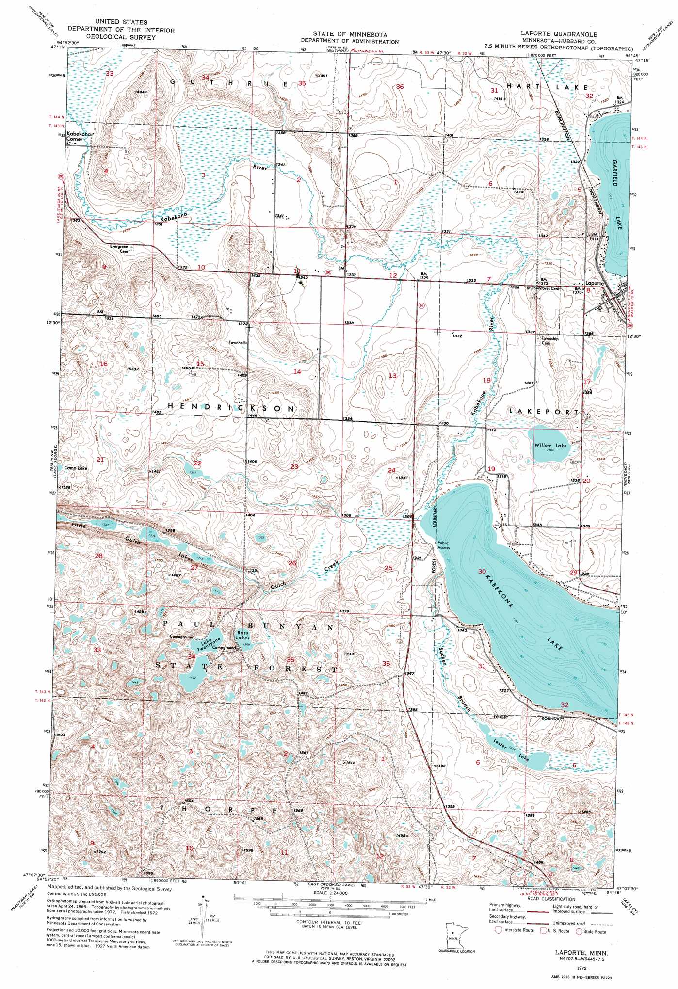
USGS Topo Quad 47094b7 - 1:24,000 scale
| Topo Map Name: | Laporte |
| USGS Topo Quad ID: | 47094b7 |
| Print Size: | ca. 21 1/4" wide x 27" high |
| Southeast Coordinates: | 47.125° N latitude / 94.75° W longitude |
| Map Center Coordinates: | 47.1875° N latitude / 94.8125° W longitude |
| U.S. State: | MN |
| Filename: | p47094b7.jpg |
| Download Map JPG Image: | Laporte topo map 1:24,000 scale |
| Map Type: | Orthophoto |
| Topo Series: | 7.5´ |
| Map Scale: | 1:24,000 |
| Source of Map Images: | United States Geological Survey (USGS) |
| Alternate Map Versions: |
Laporte MN 1972, updated 1974 Download PDF Buy paper map Laporte MN 1972, updated 1986 Download PDF Buy paper map Laporte MN 2010 Download PDF Buy paper map Laporte MN 2013 Download PDF Buy paper map Laporte MN 2016 Download PDF Buy paper map |
1:24,000 Topo Quads surrounding Laporte
Grant Lake |
Bemidji West |
Bemidji East |
Andrusia Lake |
Cass Lake |
Lake Hattie |
Frontenac Lake |
Guthrie |
Steamboat Lake |
Pike Bay |
Schoolcraft Lake |
Lake George |
Laporte |
Benedict |
Steamboat Bay |
Skunk Lake |
Mantrap Lake |
East Crooked Lake |
Akeley |
Walker |
Park Rapids |
Dorset |
Nevis |
Crystal Lake |
Hackensack |
> Back to 47094a1 at 1:100,000 scale
> Back to 47094a1 at 1:250,000 scale
> Back to U.S. Topo Maps home
Laporte topo map: Gazetteer
Laporte: Airports
Robco Airport elevation 420m 1377′Laporte: Lakes
Bass Lakes elevation 418m 1371′Kabekona Lake elevation 395m 1295′
Lake Twentyone elevation 434m 1423′
Lester Lake elevation 402m 1318′
Little Gulch Lakes elevation 421m 1381′
Willow Lake elevation 398m 1305′
Laporte: Populated Places
Laporte elevation 411m 1348′Laporte: Post Offices
Laporte Post Office elevation 410m 1345′Laporte: Streams
Gulch Creek elevation 395m 1295′Kabekona River elevation 396m 1299′
Sucker Branch elevation 402m 1318′
Laporte digital topo map on disk
Buy this Laporte topo map showing relief, roads, GPS coordinates and other geographical features, as a high-resolution digital map file on DVD: