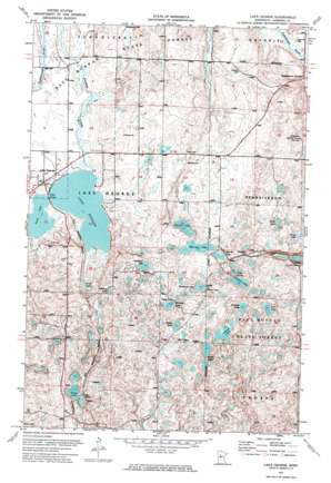
Lake George Topo Map Minnesota
To zoom in, hover over the map of Lake George
USGS Topo Quad 47094b8 - 1:24,000 scale
| Topo Map Name: | Lake George |
| USGS Topo Quad ID: | 47094b8 |
| Print Size: | ca. 21 1/4" wide x 27" high |
| Southeast Coordinates: | 47.125° N latitude / 94.875° W longitude |
| Map Center Coordinates: | 47.1875° N latitude / 94.9375° W longitude |
| U.S. State: | MN |
| Filename: | p47094b8.jpg |
| Download Map JPG Image: | Lake George topo map 1:24,000 scale |
| Map Type: | Orthophoto |
| Topo Series: | 7.5´ |
| Map Scale: | 1:24,000 |
| Source of Map Images: | United States Geological Survey (USGS) |
| Alternate Map Versions: |
Lake George MN 1972, updated 1974 Download PDF Buy paper map Lake George MN 2010 Download PDF Buy paper map Lake George MN 2013 Download PDF Buy paper map Lake George MN 2016 Download PDF Buy paper map |
1:24,000 Topo Quads surrounding Lake George
> Back to 47094a1 at 1:100,000 scale
> Back to 47094a1 at 1:250,000 scale
> Back to U.S. Topo Maps home
Lake George topo map: Gazetteer
Lake George: Lakes
Beaver Lake elevation 443m 1453′Bend Lake elevation 471m 1545′
Camp Lake elevation 470m 1541′
Camp Lake elevation 469m 1538′
Coon Lake elevation 452m 1482′
Crappie Lake elevation 447m 1466′
Deep Lake elevation 440m 1443′
Gillett Lake elevation 448m 1469′
Halverson Lake elevation 452m 1482′
Island Lake elevation 443m 1453′
Kahlstorf Lake elevation 469m 1538′
Lake George elevation 432m 1417′
Long Lake elevation 443m 1453′
McCarty Lake elevation 461m 1512′
Paine Lake elevation 432m 1417′
Shanty Lake elevation 440m 1443′
Sheridan Lake elevation 443m 1453′
Spur Lakes elevation 467m 1532′
Tepee Lakes elevation 441m 1446′
Whiting Lake elevation 471m 1545′
Lake George: Populated Places
Kabekona Corner elevation 418m 1371′Ken and Debi Lathrop Mobile Home Park elevation 434m 1423′
Lake George elevation 434m 1423′
Lake George Pines Mobile Home Park elevation 434m 1423′
Lake George: Post Offices
Kabekona Post Office (historical) elevation 418m 1371′Lake George Post Office elevation 434m 1423′
Niawa Post Office (historical) elevation 460m 1509′
Lake George digital topo map on disk
Buy this Lake George topo map showing relief, roads, GPS coordinates and other geographical features, as a high-resolution digital map file on DVD:


