Sucker Lakes Topo Map Minnesota
To zoom in, hover over the map of Sucker Lakes
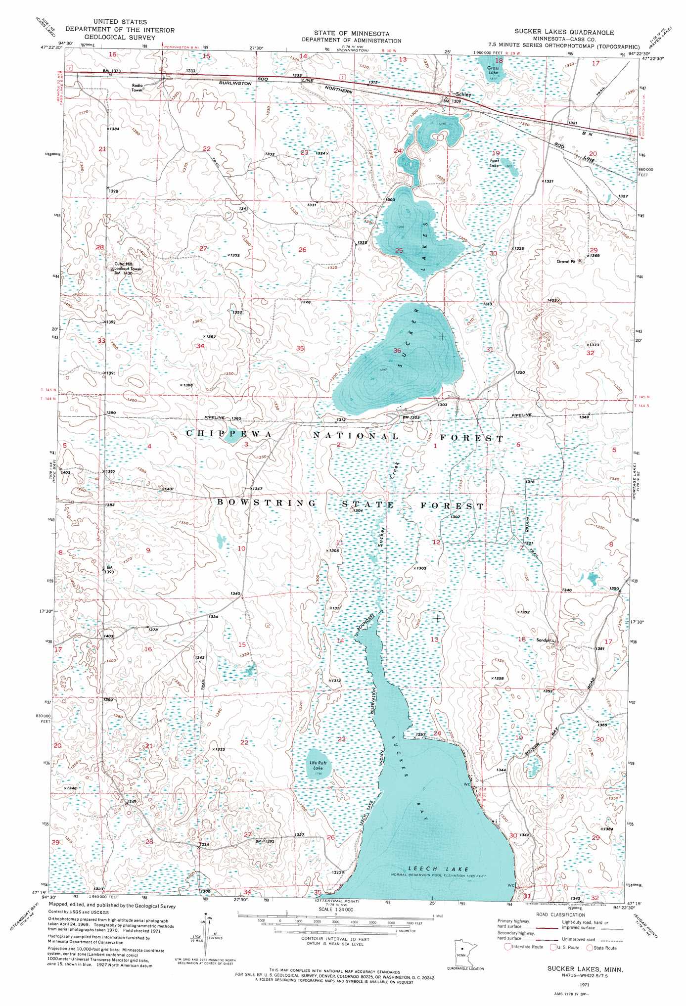
USGS Topo Quad 47094c4 - 1:24,000 scale
| Topo Map Name: | Sucker Lakes |
| USGS Topo Quad ID: | 47094c4 |
| Print Size: | ca. 21 1/4" wide x 27" high |
| Southeast Coordinates: | 47.25° N latitude / 94.375° W longitude |
| Map Center Coordinates: | 47.3125° N latitude / 94.4375° W longitude |
| U.S. State: | MN |
| Filename: | p47094c4.jpg |
| Download Map JPG Image: | Sucker Lakes topo map 1:24,000 scale |
| Map Type: | Orthophoto |
| Topo Series: | 7.5´ |
| Map Scale: | 1:24,000 |
| Source of Map Images: | United States Geological Survey (USGS) |
| Alternate Map Versions: |
Sucker Lakes MN 1971, updated 1974 Download PDF Buy paper map Sucker Lakes MN 1996, updated 1998 Download PDF Buy paper map Sucker Lakes MN 2011 Download PDF Buy paper map Sucker Lakes MN 2013 Download PDF Buy paper map Sucker Lakes MN 2016 Download PDF Buy paper map |
| FStopo: | US Forest Service topo Sucker Lakes is available: Download FStopo PDF Download FStopo TIF |
1:24,000 Topo Quads surrounding Sucker Lakes
Turtle River Lake |
Pimushe Lake |
Gimmer Lake |
Dixon Lake |
Pigeon Dam Lake |
Andrusia Lake |
Cass Lake |
Pennington |
Raven Lake |
Bena Nw |
Steamboat Lake |
Pike Bay |
Sucker Lakes |
Portage Lake |
Bena |
Benedict |
Steamboat Bay |
Ottertail Point |
Sugar Point |
Federal Dam |
Akeley |
Walker |
Jack Lake |
Whipholt |
Town Line Lake |
> Back to 47094a1 at 1:100,000 scale
> Back to 47094a1 at 1:250,000 scale
> Back to U.S. Topo Maps home
Sucker Lakes topo map: Gazetteer
Sucker Lakes: Dams
Sucker Bay Impoundment Dam elevation 401m 1315′Sucker Lakes: Lakes
Foot Lake elevation 398m 1305′Life Raft Lake elevation 395m 1295′
Sucker Lakes elevation 396m 1299′
Sucker Lakes: Populated Places
Schley elevation 400m 1312′Sucker Lakes: Post Offices
Schley Post Office (historical) elevation 400m 1312′Sucker Lakes: Reservoirs
Brush Lake Wildlife Impoundment elevation 409m 1341′Cuba Wildlife Impoundment elevation 420m 1377′
Ketchum Wildlife Impoundment elevation 398m 1305′
Middle Sucker Wildlife Impoundment elevation 400m 1312′
Sucker Bay Impoundment elevation 401m 1315′
Sucker Bay Wildlife Impoundment elevation 403m 1322′
Sucker Lakes: Streams
Sucker Creek elevation 396m 1299′Sucker Lakes digital topo map on disk
Buy this Sucker Lakes topo map showing relief, roads, GPS coordinates and other geographical features, as a high-resolution digital map file on DVD: