Dora Lake Topo Map Minnesota
To zoom in, hover over the map of Dora Lake
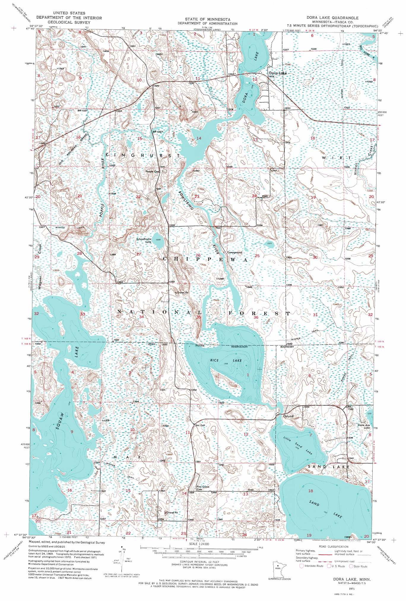
USGS Topo Quad 47094f1 - 1:24,000 scale
| Topo Map Name: | Dora Lake |
| USGS Topo Quad ID: | 47094f1 |
| Print Size: | ca. 21 1/4" wide x 27" high |
| Southeast Coordinates: | 47.625° N latitude / 94° W longitude |
| Map Center Coordinates: | 47.6875° N latitude / 94.0625° W longitude |
| U.S. State: | MN |
| Filename: | p47094f1.jpg |
| Download Map JPG Image: | Dora Lake topo map 1:24,000 scale |
| Map Type: | Orthophoto |
| Topo Series: | 7.5´ |
| Map Scale: | 1:24,000 |
| Source of Map Images: | United States Geological Survey (USGS) |
| Alternate Map Versions: |
Dora Lake MN 1971, updated 1974 Download PDF Buy paper map Dora Lake MN 1971, updated 1988 Download PDF Buy paper map Dora Lake MN 1996, updated 1998 Download PDF Buy paper map Dora Lake MN 2011 Download PDF Buy paper map Dora Lake MN 2013 Download PDF Buy paper map Dora Lake MN 2016 Download PDF Buy paper map |
| FStopo: | US Forest Service topo Dora Lake is available: Download FStopo PDF Download FStopo TIF |
1:24,000 Topo Quads surrounding Dora Lake
Northome North |
Mizpah |
Mizpah Ne |
Wildwood |
Wildwood Ne |
Northome South |
Elmwood Island |
Coddington Lake |
Pomroy |
Wildwood Se |
Alvwood |
Squaw Lake |
Dora Lake |
Wirt |
Spring Lake |
Dixon Lake |
Pigeon Dam Lake |
Max |
Bowstring Lake |
Jessie Lake |
Raven Lake |
Bena Nw |
Little Winnibigoshish Lake |
Little Ball Club Lake |
Deer River Ne |
> Back to 47094e1 at 1:100,000 scale
> Back to 47094a1 at 1:250,000 scale
> Back to U.S. Topo Maps home
Dora Lake topo map: Gazetteer
Dora Lake: Lakes
Dora Lake elevation 402m 1318′Little Sand Lake elevation 402m 1318′
Natures Lake elevation 402m 1318′
Rice Lake elevation 402m 1318′
Schoolhouse Lake elevation 408m 1338′
Dora Lake: Populated Places
Dora Lake elevation 404m 1325′Oslund elevation 404m 1325′
Dora Lake: Post Offices
Dora Lake Post Office (historical) elevation 404m 1325′Oslund Post Office (historical) elevation 404m 1325′
Dora Lake: Reservoirs
Shogrean Dam Impoundment elevation 413m 1354′Dora Lake: Streams
Bowstring River elevation 402m 1318′Popple River elevation 402m 1318′
Wagner Creek elevation 402m 1318′
Dora Lake digital topo map on disk
Buy this Dora Lake topo map showing relief, roads, GPS coordinates and other geographical features, as a high-resolution digital map file on DVD: