Funkley Topo Map Minnesota
To zoom in, hover over the map of Funkley
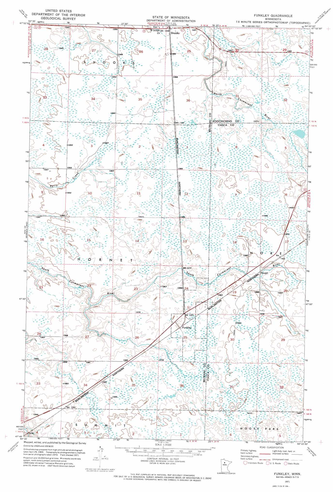
USGS Topo Quad 47094g4 - 1:24,000 scale
| Topo Map Name: | Funkley |
| USGS Topo Quad ID: | 47094g4 |
| Print Size: | ca. 21 1/4" wide x 27" high |
| Southeast Coordinates: | 47.75° N latitude / 94.375° W longitude |
| Map Center Coordinates: | 47.8125° N latitude / 94.4375° W longitude |
| U.S. State: | MN |
| Filename: | p47094g4.jpg |
| Download Map JPG Image: | Funkley topo map 1:24,000 scale |
| Map Type: | Orthophoto |
| Topo Series: | 7.5´ |
| Map Scale: | 1:24,000 |
| Source of Map Images: | United States Geological Survey (USGS) |
| Alternate Map Versions: |
Funkley MN 1971, updated 1974 Download PDF Buy paper map Funkley MN 2010 Download PDF Buy paper map Funkley MN 2013 Download PDF Buy paper map Funkley MN 2016 Download PDF Buy paper map |
1:24,000 Topo Quads surrounding Funkley
Shotley |
Shotley Brook |
Norman Lake Sw |
Norman Lake Se |
Ridge Sw |
Saum |
Saum Ne |
Kelliher |
Northome North |
Mizpah |
O'Brien Lookout Tower |
Borden Lake |
Funkley |
Northome South |
Elmwood Island |
Tenstrike |
Blackduck |
Decker Lake |
Alvwood |
Squaw Lake |
Turtle River Lake |
Pimushe Lake |
Gimmer Lake |
Dixon Lake |
Pigeon Dam Lake |
> Back to 47094e1 at 1:100,000 scale
> Back to 47094a1 at 1:250,000 scale
> Back to U.S. Topo Maps home
Funkley topo map: Gazetteer
Funkley: Populated Places
Funkley elevation 424m 1391′Houpt elevation 425m 1394′
Shooks elevation 414m 1358′
Funkley: Post Offices
Funkley Post Office (historical) elevation 424m 1391′Houpt Post Office (historical) elevation 425m 1394′
Shooks Post Office (historical) elevation 414m 1358′
Funkley digital topo map on disk
Buy this Funkley topo map showing relief, roads, GPS coordinates and other geographical features, as a high-resolution digital map file on DVD: