Borden Lake Topo Map Minnesota
To zoom in, hover over the map of Borden Lake
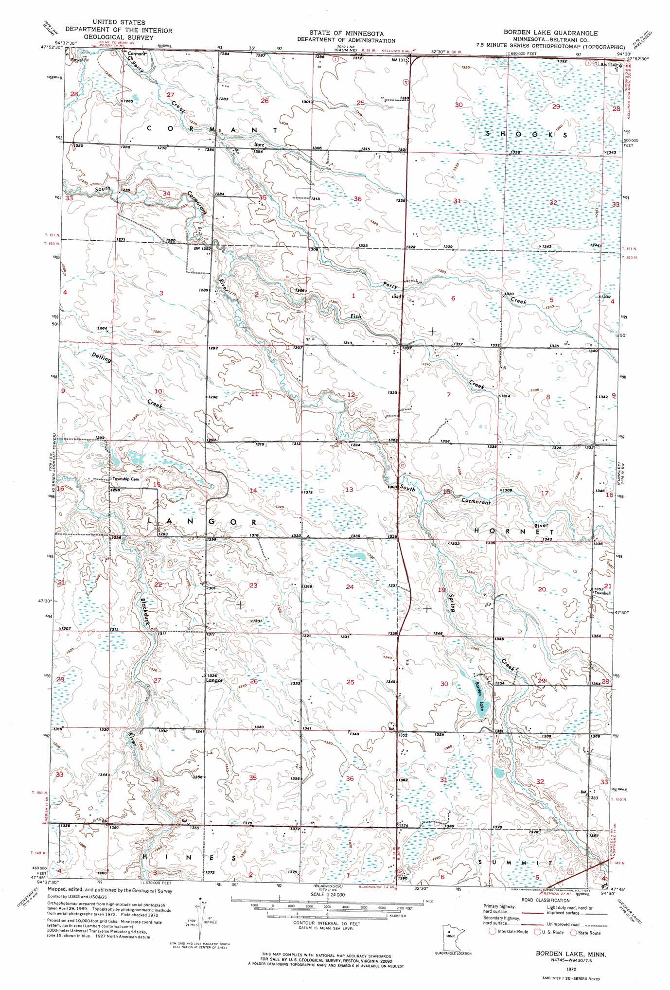
USGS Topo Quad 47094g5 - 1:24,000 scale
| Topo Map Name: | Borden Lake |
| USGS Topo Quad ID: | 47094g5 |
| Print Size: | ca. 21 1/4" wide x 27" high |
| Southeast Coordinates: | 47.75° N latitude / 94.5° W longitude |
| Map Center Coordinates: | 47.8125° N latitude / 94.5625° W longitude |
| U.S. State: | MN |
| Filename: | p47094g5.jpg |
| Download Map JPG Image: | Borden Lake topo map 1:24,000 scale |
| Map Type: | Orthophoto |
| Topo Series: | 7.5´ |
| Map Scale: | 1:24,000 |
| Source of Map Images: | United States Geological Survey (USGS) |
| Alternate Map Versions: |
Borden Lake MN 1972, updated 1974 Download PDF Buy paper map Borden Lake MN 2010 Download PDF Buy paper map Borden Lake MN 2013 Download PDF Buy paper map Borden Lake MN 2016 Download PDF Buy paper map |
1:24,000 Topo Quads surrounding Borden Lake
Sucker Creek |
Shotley |
Shotley Brook |
Norman Lake Sw |
Norman Lake Se |
Redby Ne |
Saum |
Saum Ne |
Kelliher |
Northome North |
Nebish |
O'Brien Lookout Tower |
Borden Lake |
Funkley |
Northome South |
White Fish Lake |
Tenstrike |
Blackduck |
Decker Lake |
Alvwood |
Turtle River |
Turtle River Lake |
Pimushe Lake |
Gimmer Lake |
Dixon Lake |
> Back to 47094e1 at 1:100,000 scale
> Back to 47094a1 at 1:250,000 scale
> Back to U.S. Topo Maps home
Borden Lake topo map: Gazetteer
Borden Lake: Lakes
Borden Lake elevation 407m 1335′Borden Lake: Populated Places
Inez elevation 394m 1292′Langor elevation 404m 1325′
Borden Lake: Post Offices
Inez Post Office (historical) elevation 394m 1292′Langor Post Office (historical) elevation 404m 1325′
Borden Lake: Streams
Fish Creek elevation 383m 1256′Spring Creek elevation 397m 1302′
Borden Lake digital topo map on disk
Buy this Borden Lake topo map showing relief, roads, GPS coordinates and other geographical features, as a high-resolution digital map file on DVD: