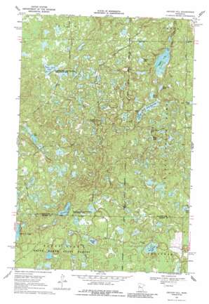
Anchor Hill Topo Map Minnesota
To zoom in, hover over the map of Anchor Hill
USGS Topo Quad 47095b3 - 1:24,000 scale
| Topo Map Name: | Anchor Hill |
| USGS Topo Quad ID: | 47095b3 |
| Print Size: | ca. 21 1/4" wide x 27" high |
| Southeast Coordinates: | 47.125° N latitude / 95.25° W longitude |
| Map Center Coordinates: | 47.1875° N latitude / 95.3125° W longitude |
| U.S. State: | MN |
| Filename: | o47095b3.jpg |
| Download Map JPG Image: | Anchor Hill topo map 1:24,000 scale |
| Map Type: | Topographic |
| Topo Series: | 7.5´ |
| Map Scale: | 1:24,000 |
| Source of Map Images: | United States Geological Survey (USGS) |
| Alternate Map Versions: |
Anchor Hill MN 1969, updated 1971 Download PDF Buy paper map Anchor Hill MN 2011 Download PDF Buy paper map Anchor Hill MN 2013 Download PDF Buy paper map Anchor Hill MN 2016 Download PDF Buy paper map |
1:24,000 Topo Quads surrounding Anchor Hill
> Back to 47095a1 at 1:100,000 scale
> Back to 47094a1 at 1:250,000 scale
> Back to U.S. Topo Maps home
Anchor Hill topo map: Gazetteer
Anchor Hill: Lakes
Cox Lake elevation 493m 1617′Dead Beaver Lake elevation 518m 1699′
Gardner Lake elevation 489m 1604′
Kirk Lake elevation 491m 1610′
Mink Lake elevation 505m 1656′
Missouri Lake elevation 487m 1597′
Myrtle Lake elevation 494m 1620′
North Twin Lake elevation 501m 1643′
Ozawindib Lake elevation 474m 1555′
South Twin Lake elevation 501m 1643′
Sugar Bush Lake elevation 532m 1745′
Tamarack Lake elevation 486m 1594′
Twin Island Lake elevation 485m 1591′
Ways Lake elevation 513m 1683′
Anchor Hill: Parks
Bad Medicine Lake Historical Marker elevation 491m 1610′Geology of Bad Medicine Lake Geological Marker elevation 491m 1610′
Anchor Hill: Summits
Anchor Hill elevation 574m 1883′Anchor Hill: Trails
East Bad Medicine Trail elevation 511m 1676′Anchor Hill digital topo map on disk
Buy this Anchor Hill topo map showing relief, roads, GPS coordinates and other geographical features, as a high-resolution digital map file on DVD:


