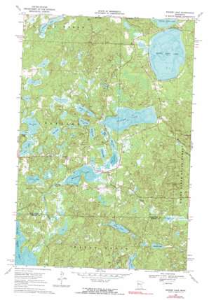
Snider Lake Topo Map Minnesota
To zoom in, hover over the map of Snider Lake
USGS Topo Quad 47095b6 - 1:24,000 scale
| Topo Map Name: | Snider Lake |
| USGS Topo Quad ID: | 47095b6 |
| Print Size: | ca. 21 1/4" wide x 27" high |
| Southeast Coordinates: | 47.125° N latitude / 95.625° W longitude |
| Map Center Coordinates: | 47.1875° N latitude / 95.6875° W longitude |
| U.S. State: | MN |
| Filename: | o47095b6.jpg |
| Download Map JPG Image: | Snider Lake topo map 1:24,000 scale |
| Map Type: | Topographic |
| Topo Series: | 7.5´ |
| Map Scale: | 1:24,000 |
| Source of Map Images: | United States Geological Survey (USGS) |
| Alternate Map Versions: |
Snider Lake MN 1969, updated 1971 Download PDF Buy paper map Snider Lake MN 1969, updated 1991 Download PDF Buy paper map Snider Lake MN 2010 Download PDF Buy paper map Snider Lake MN 2013 Download PDF Buy paper map Snider Lake MN 2016 Download PDF Buy paper map |
1:24,000 Topo Quads surrounding Snider Lake
> Back to 47095a1 at 1:100,000 scale
> Back to 47094a1 at 1:250,000 scale
> Back to U.S. Topo Maps home
Snider Lake topo map: Gazetteer
Snider Lake: Dams
McCraney Lake Dam elevation 448m 1469′Snider Lake: Lakes
Big Lake elevation 454m 1489′Crooked Lake elevation 454m 1489′
Egg Lake elevation 446m 1463′
Gable Lake elevation 460m 1509′
Gull Lake elevation 446m 1463′
Jay Lake elevation 456m 1496′
Jessie Lake elevation 447m 1466′
Johnson Lake elevation 464m 1522′
Long Lake elevation 456m 1496′
McCraney Lake elevation 445m 1459′
Mike Lake elevation 447m 1466′
Nest Lake elevation 451m 1479′
Pine Lake elevation 453m 1486′
Rooster Lake elevation 448m 1469′
Sawmill Lake elevation 439m 1440′
Snider Lake elevation 446m 1463′
South Twin Lake elevation 440m 1443′
Sucker Lake elevation 448m 1469′
Wadena Lake elevation 447m 1466′
Snider Lake: Parks
Wayside Park elevation 449m 1473′Snider Lake: Reservoirs
McCraney Lake elevation 448m 1469′Snider Lake: Streams
Gull Creek elevation 443m 1453′Little Elbow Creek elevation 446m 1463′
Tulaby Creek elevation 445m 1459′
Snider Lake digital topo map on disk
Buy this Snider Lake topo map showing relief, roads, GPS coordinates and other geographical features, as a high-resolution digital map file on DVD:


