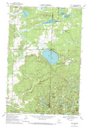
Roy Lake Topo Map Minnesota
To zoom in, hover over the map of Roy Lake
USGS Topo Quad 47095c5 - 1:24,000 scale
| Topo Map Name: | Roy Lake |
| USGS Topo Quad ID: | 47095c5 |
| Print Size: | ca. 21 1/4" wide x 27" high |
| Southeast Coordinates: | 47.25° N latitude / 95.5° W longitude |
| Map Center Coordinates: | 47.3125° N latitude / 95.5625° W longitude |
| U.S. State: | MN |
| Filename: | o47095c5.jpg |
| Download Map JPG Image: | Roy Lake topo map 1:24,000 scale |
| Map Type: | Topographic |
| Topo Series: | 7.5´ |
| Map Scale: | 1:24,000 |
| Source of Map Images: | United States Geological Survey (USGS) |
| Alternate Map Versions: |
Roy Lake MN 1969, updated 1971 Download PDF Buy paper map Roy Lake MN 2011 Download PDF Buy paper map Roy Lake MN 2013 Download PDF Buy paper map Roy Lake MN 2016 Download PDF Buy paper map |
1:24,000 Topo Quads surrounding Roy Lake
> Back to 47095a1 at 1:100,000 scale
> Back to 47094a1 at 1:250,000 scale
> Back to U.S. Topo Maps home
Roy Lake topo map: Gazetteer
Roy Lake: Lakes
Franta Lake elevation 557m 1827′Horseshoe Lake elevation 507m 1663′
Jackson Lake elevation 449m 1473′
Long Lake elevation 445m 1459′
Main Lake elevation 448m 1469′
Norris Lake elevation 502m 1646′
Perch Lake elevation 448m 1469′
Sargeant Lake elevation 547m 1794′
Skinaway Lake elevation 531m 1742′
Tamarack Lake elevation 443m 1453′
Terway Lake elevation 548m 1797′
Roy Lake: Parks
Jackson Lake State Wildlife Management Area elevation 452m 1482′Roy Lake: Populated Places
Mahkonce elevation 462m 1515′Roy Lake elevation 460m 1509′
Roy Lake: Post Offices
Mahkonce Post Office (historical) elevation 461m 1512′Roy Lake: Reservoirs
Roy Lake elevation 454m 1489′Roy Lake: Summits
Hogback Hill elevation 571m 1873′Jack Pine Hill elevation 593m 1945′
Norris Hill elevation 586m 1922′
Roy Lake digital topo map on disk
Buy this Roy Lake topo map showing relief, roads, GPS coordinates and other geographical features, as a high-resolution digital map file on DVD:


