Mahnomen Topo Map Minnesota
To zoom in, hover over the map of Mahnomen
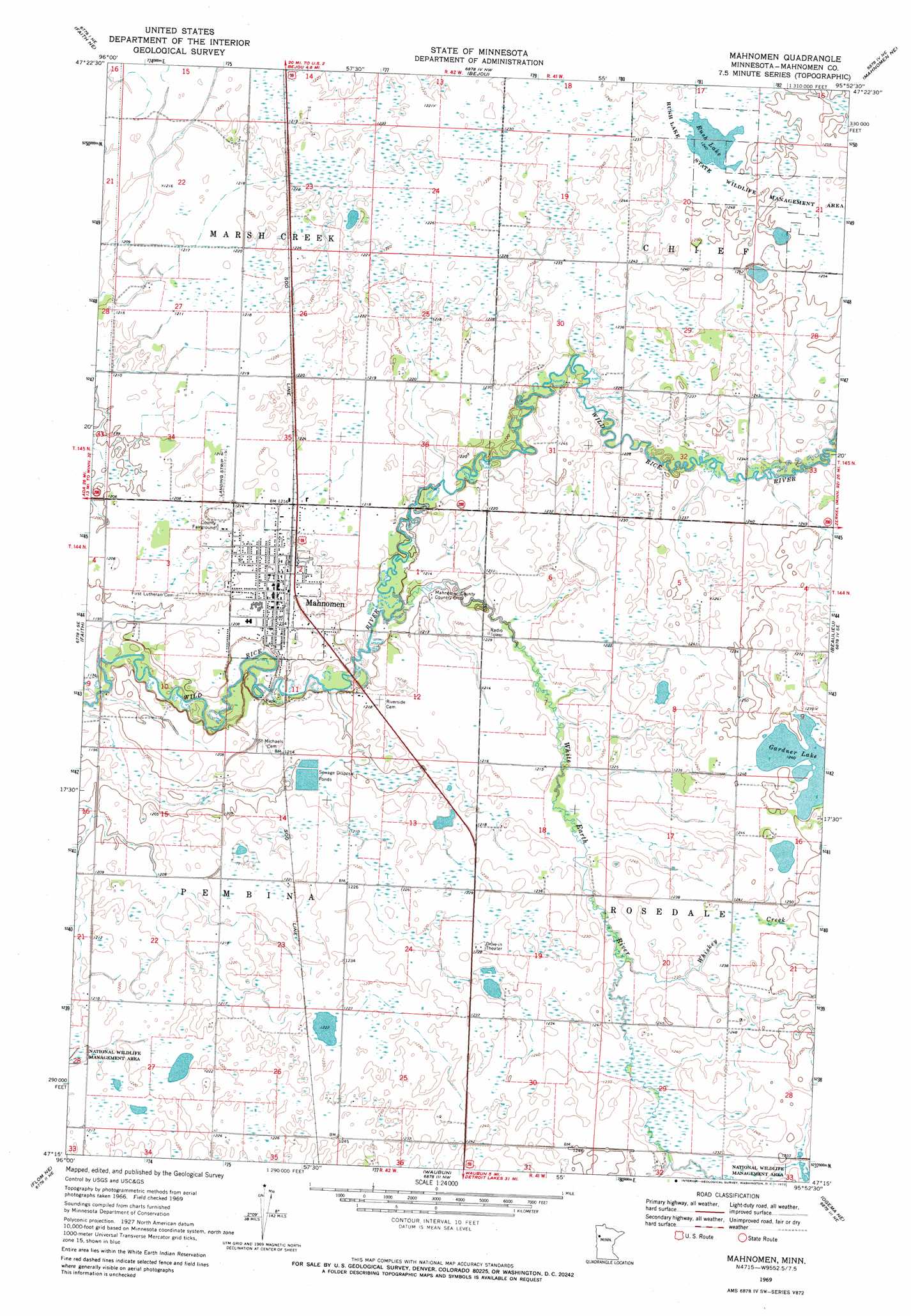
USGS Topo Quad 47095c8 - 1:24,000 scale
| Topo Map Name: | Mahnomen |
| USGS Topo Quad ID: | 47095c8 |
| Print Size: | ca. 21 1/4" wide x 27" high |
| Southeast Coordinates: | 47.25° N latitude / 95.875° W longitude |
| Map Center Coordinates: | 47.3125° N latitude / 95.9375° W longitude |
| U.S. State: | MN |
| Filename: | o47095c8.jpg |
| Download Map JPG Image: | Mahnomen topo map 1:24,000 scale |
| Map Type: | Topographic |
| Topo Series: | 7.5´ |
| Map Scale: | 1:24,000 |
| Source of Map Images: | United States Geological Survey (USGS) |
| Alternate Map Versions: |
Mahnomen MN 1969, updated 1972 Download PDF Buy paper map Mahnomen MN 2011 Download PDF Buy paper map Mahnomen MN 2013 Download PDF Buy paper map Mahnomen MN 2016 Download PDF Buy paper map |
1:24,000 Topo Quads surrounding Mahnomen
Halverson Lake |
Union Lake |
Winger |
Fosston West |
Fosston East |
Ranum |
Faith Ne |
Bejou |
Mahnomen Ne |
Ebro Nw |
Waukon |
Faith |
Mahnomen |
Beaulieu |
North Twin Lake |
Flom |
Flom Ne |
Waubun |
Ogema Ne |
Snider Lake |
Tilde Lake |
Flom Se |
Ogema |
White Earth |
Strawberry Lake |
> Back to 47095a1 at 1:100,000 scale
> Back to 47094a1 at 1:250,000 scale
> Back to U.S. Topo Maps home
Mahnomen topo map: Gazetteer
Mahnomen: Airports
Mahnomen County Airport elevation 378m 1240′Mahnomen County and Village Hospital Heliport elevation 368m 1207′
Mahnomen: Lakes
Gardner Lake elevation 379m 1243′Rush Lake elevation 378m 1240′
Mahnomen: Parks
Rush Lake State Wildlife Management Area elevation 380m 1246′Mahnomen: Populated Places
Mahnomen elevation 369m 1210′Mahnomen Mobile Home Park elevation 369m 1210′
Mahnomen: Post Offices
Mahnomen Post Office elevation 369m 1210′Mahnomen: Streams
Whiskey Creek elevation 372m 1220′White Earth River elevation 365m 1197′
Mahnomen digital topo map on disk
Buy this Mahnomen topo map showing relief, roads, GPS coordinates and other geographical features, as a high-resolution digital map file on DVD: