Bejou Topo Map Minnesota
To zoom in, hover over the map of Bejou
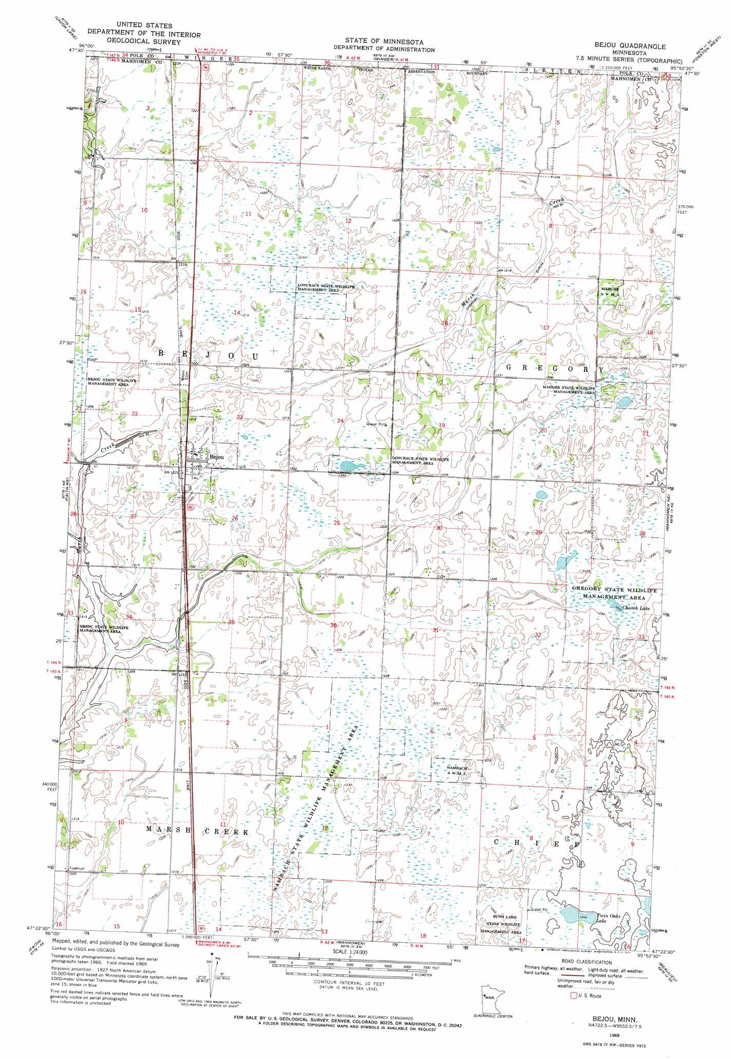
USGS Topo Quad 47095d8 - 1:24,000 scale
| Topo Map Name: | Bejou |
| USGS Topo Quad ID: | 47095d8 |
| Print Size: | ca. 21 1/4" wide x 27" high |
| Southeast Coordinates: | 47.375° N latitude / 95.875° W longitude |
| Map Center Coordinates: | 47.4375° N latitude / 95.9375° W longitude |
| U.S. State: | MN |
| Filename: | o47095d8.jpg |
| Download Map JPG Image: | Bejou topo map 1:24,000 scale |
| Map Type: | Topographic |
| Topo Series: | 7.5´ |
| Map Scale: | 1:24,000 |
| Source of Map Images: | United States Geological Survey (USGS) |
| Alternate Map Versions: |
Bejou MN 1969, updated 1972 Download PDF Buy paper map Bejou MN 2011 Download PDF Buy paper map Bejou MN 2013 Download PDF Buy paper map Bejou MN 2016 Download PDF Buy paper map |
1:24,000 Topo Quads surrounding Bejou
Mentor |
Erskine |
Mcintosh |
Mcintosh Ne |
Olga |
Halverson Lake |
Union Lake |
Winger |
Fosston West |
Fosston East |
Ranum |
Faith Ne |
Bejou |
Mahnomen Ne |
Ebro Nw |
Waukon |
Faith |
Mahnomen |
Beaulieu |
North Twin Lake |
Flom |
Flom Ne |
Waubun |
Ogema Ne |
Snider Lake |
> Back to 47095a1 at 1:100,000 scale
> Back to 47094a1 at 1:250,000 scale
> Back to U.S. Topo Maps home
Bejou topo map: Gazetteer
Bejou: Canals
Judicial Ditch Number Ninetyone elevation 368m 1207′Bejou: Lakes
Church Lake elevation 373m 1223′Twin Oaks Lake elevation 379m 1243′
Bejou: Parks
Gregory State Wildlife Management Area elevation 373m 1223′Loncrace State Wildlife Management Area elevation 373m 1223′
Mahgre State Wildlife Management Area elevation 373m 1223′
Wambach State Wildlife Management Area elevation 373m 1223′
Bejou: Populated Places
Bejou elevation 373m 1223′Bejou: Post Offices
Bejou Post Office elevation 373m 1223′Bejou digital topo map on disk
Buy this Bejou topo map showing relief, roads, GPS coordinates and other geographical features, as a high-resolution digital map file on DVD: