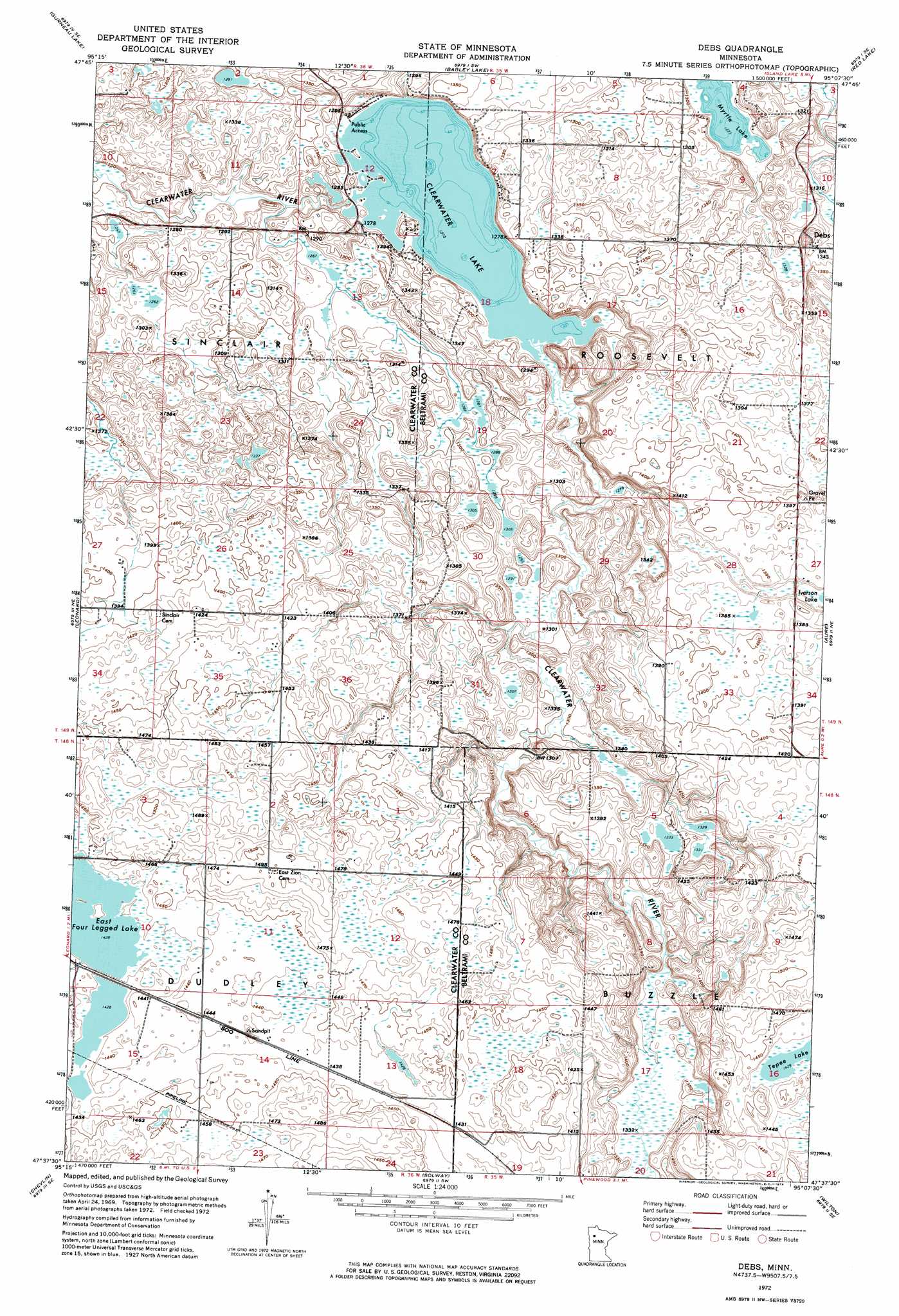
Debs Topo Map Minnesota
To zoom in, hover over the map of Debs
USGS Topo Quad 47095f2 - 1:24,000 scale
| Topo Map Name: | Debs |
| USGS Topo Quad ID: | 47095f2 |
| Print Size: | ca. 21 1/4" wide x 27" high |
| Southeast Coordinates: | 47.625° N latitude / 95.125° W longitude |
| Map Center Coordinates: | 47.6875° N latitude / 95.1875° W longitude |
| U.S. State: | MN |
| Filename: | p47095f2.jpg |
| Download Map JPG Image: | Debs topo map 1:24,000 scale |
| Map Type: | Orthophoto |
| Topo Series: | 7.5´ |
| Map Scale: | 1:24,000 |
| Source of Map Images: | United States Geological Survey (USGS) |
| Alternate Map Versions: |
Debs MN 1972, updated 1974 Download PDF Buy paper map Debs MN 2010 Download PDF Buy paper map Debs MN 2013 Download PDF Buy paper map Debs MN 2016 Download PDF Buy paper map |
1:24,000 Topo Quads surrounding Debs
Bailey Lake |
Berner Ne |
|||
Berner |
Gurneau Lake |
Bagley Lake |
Red Lake |
Redby |
Clearbrook |
Leonard |
Debs |
Aure |
Puposky Lake |
Bagley |
Shevlin |
Solway |
Wilton |
Peterson Lake |
Zerkel Nw |
Upper Rice Lake |
Alida |
Grant Lake |
Bemidji West |
> Back to 47095e1 at 1:100,000 scale
> Back to 47094a1 at 1:250,000 scale
> Back to U.S. Topo Maps home
Debs topo map: Gazetteer
Debs: Dams
Clearwater Dam elevation 388m 1272′Debs: Lakes
Clearwater Lake elevation 388m 1272′East Four Legged Lake elevation 436m 1430′
Myrtle Lake elevation 388m 1272′
Tepee Lake elevation 436m 1430′
Debs: Populated Places
Debs elevation 409m 1341′Debs: Post Offices
Debs Post Office (historical) elevation 408m 1338′Neving Post Office (historical) elevation 392m 1286′
Debs: Reservoirs
Clearwater Lake elevation 388m 1272′Debs digital topo map on disk
Buy this Debs topo map showing relief, roads, GPS coordinates and other geographical features, as a high-resolution digital map file on DVD: