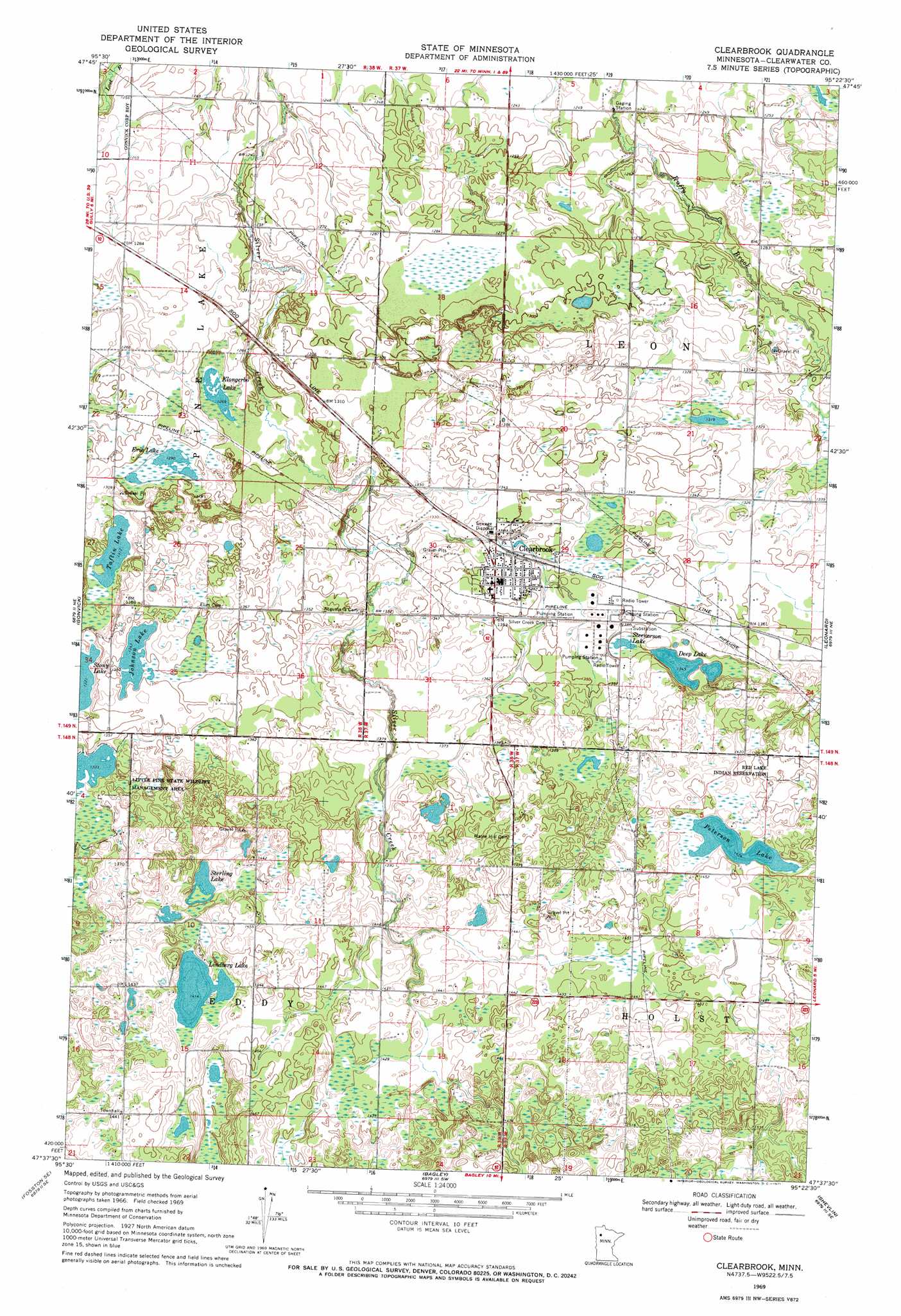
Clearbrook Topo Map Minnesota
To zoom in, hover over the map of Clearbrook
USGS Topo Quad 47095f4 - 1:24,000 scale
| Topo Map Name: | Clearbrook |
| USGS Topo Quad ID: | 47095f4 |
| Print Size: | ca. 21 1/4" wide x 27" high |
| Southeast Coordinates: | 47.625° N latitude / 95.375° W longitude |
| Map Center Coordinates: | 47.6875° N latitude / 95.4375° W longitude |
| U.S. State: | MN |
| Filename: | o47095f4.jpg |
| Download Map JPG Image: | Clearbrook topo map 1:24,000 scale |
| Map Type: | Topographic |
| Topo Series: | 7.5´ |
| Map Scale: | 1:24,000 |
| Source of Map Images: | United States Geological Survey (USGS) |
| Alternate Map Versions: |
Clearbrook MN 1969, updated 1971 Download PDF Buy paper map Clearbrook MN 2010 Download PDF Buy paper map Clearbrook MN 2013 Download PDF Buy paper map Clearbrook MN 2016 Download PDF Buy paper map |
1:24,000 Topo Quads surrounding Clearbrook
Gully Nw |
Gully Ne |
Bailey Lake |
Berner Ne |
|
Trail |
Gully |
Berner |
Gurneau Lake |
Bagley Lake |
Olga |
Gonvick |
Clearbrook |
Leonard |
Debs |
Fosston East |
Fosston Se |
Bagley |
Shevlin |
Solway |
Ebro Nw |
Ebro |
Zerkel Nw |
Upper Rice Lake |
Alida |
> Back to 47095e1 at 1:100,000 scale
> Back to 47094a1 at 1:250,000 scale
> Back to U.S. Topo Maps home
Clearbrook topo map: Gazetteer
Clearbrook: Lakes
Deep Lake elevation 411m 1348′Erie Lake elevation 391m 1282′
Johnson Lake elevation 411m 1348′
Klongerbo Lake elevation 385m 1263′
Lindberg Lake elevation 431m 1414′
Peterson Lake elevation 434m 1423′
Steenerson Lake elevation 412m 1351′
Sterling Lake elevation 432m 1417′
Taflin Lake elevation 400m 1312′
Clearbrook: Populated Places
Clearbrook elevation 411m 1348′Clearbrook: Post Offices
Clearbrook Post Office elevation 410m 1345′Leon Post Office (historical) elevation 379m 1243′
Clearbrook digital topo map on disk
Buy this Clearbrook topo map showing relief, roads, GPS coordinates and other geographical features, as a high-resolution digital map file on DVD: