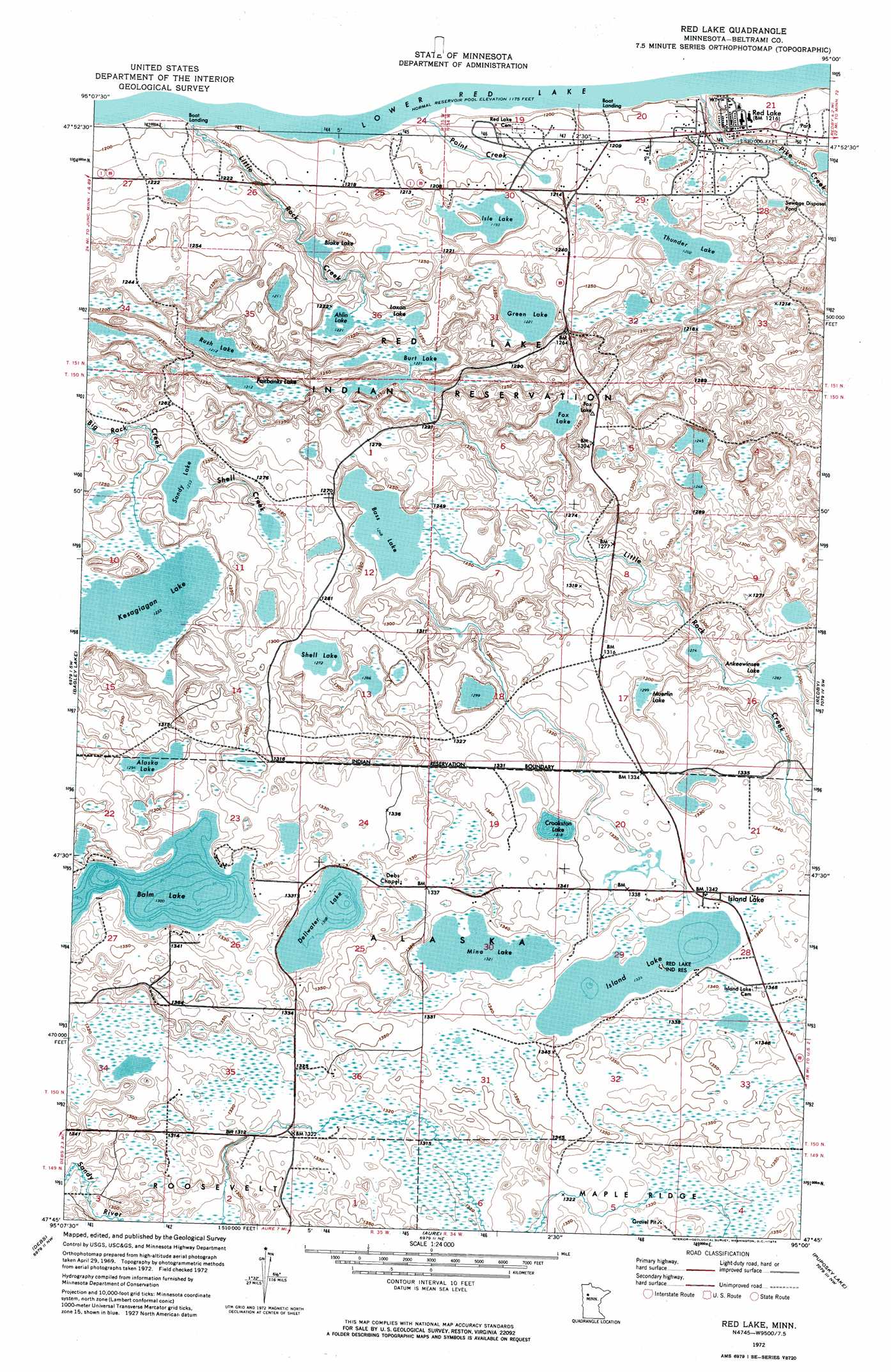
Red Lake Topo Map Minnesota
To zoom in, hover over the map of Red Lake
USGS Topo Quad 47095g1 - 1:24,000 scale
| Topo Map Name: | Red Lake |
| USGS Topo Quad ID: | 47095g1 |
| Print Size: | ca. 21 1/4" wide x 27" high |
| Southeast Coordinates: | 47.75° N latitude / 95° W longitude |
| Map Center Coordinates: | 47.8125° N latitude / 95.0625° W longitude |
| U.S. State: | MN |
| Filename: | p47095g1.jpg |
| Download Map JPG Image: | Red Lake topo map 1:24,000 scale |
| Map Type: | Orthophoto |
| Topo Series: | 7.5´ |
| Map Scale: | 1:24,000 |
| Source of Map Images: | United States Geological Survey (USGS) |
| Alternate Map Versions: |
Red Lake MN 1972, updated 1974 Download PDF Buy paper map Red Lake MN 2010 Download PDF Buy paper map Red Lake MN 2013 Download PDF Buy paper map Red Lake MN 2016 Download PDF Buy paper map |
1:24,000 Topo Quads surrounding Red Lake
Gimiwan Lake |
Mosquito Creek |
Manomin Creek Se |
Ponemah |
Sucker Creek |
Berner Ne |
Redby Ne |
|||
Gurneau Lake |
Bagley Lake |
Red Lake |
Redby |
Nebish |
Leonard |
Debs |
Aure |
Puposky Lake |
White Fish Lake |
Shevlin |
Solway |
Wilton |
Peterson Lake |
Turtle River |
> Back to 47095e1 at 1:100,000 scale
> Back to 47094a1 at 1:250,000 scale
> Back to U.S. Topo Maps home
Red Lake topo map: Gazetteer
Red Lake: Lakes
Ahlin Lake elevation 374m 1227′Alaska Lake elevation 395m 1295′
Ankeewinsee Lake elevation 391m 1282′
Balm Lake elevation 397m 1302′
Bass Lake elevation 381m 1250′
Blake Lake elevation 364m 1194′
Burt Lake elevation 373m 1223′
Crookston Lake elevation 402m 1318′
Dellwater Lake elevation 399m 1309′
Fairbanks Lake elevation 370m 1213′
Fox Lake elevation 376m 1233′
Green Lake elevation 373m 1223′
Island Lake elevation 407m 1335′
Isle Lake elevation 364m 1194′
Kesagiagan Lake elevation 376m 1233′
Laxon Lake elevation 373m 1223′
Mina Lake elevation 403m 1322′
Muerlin Lake elevation 396m 1299′
Rush Lake elevation 370m 1213′
Sandy Lake elevation 376m 1233′
Shell Lake elevation 388m 1272′
Thunder Lake elevation 367m 1204′
Red Lake: Populated Places
Island Lake elevation 409m 1341′Little Rock elevation 367m 1204′
Red Lake: Post Offices
Island Lake Post Office (historical) elevation 409m 1341′Red Lake: Streams
Shell Creek elevation 379m 1243′Red Lake digital topo map on disk
Buy this Red Lake topo map showing relief, roads, GPS coordinates and other geographical features, as a high-resolution digital map file on DVD: