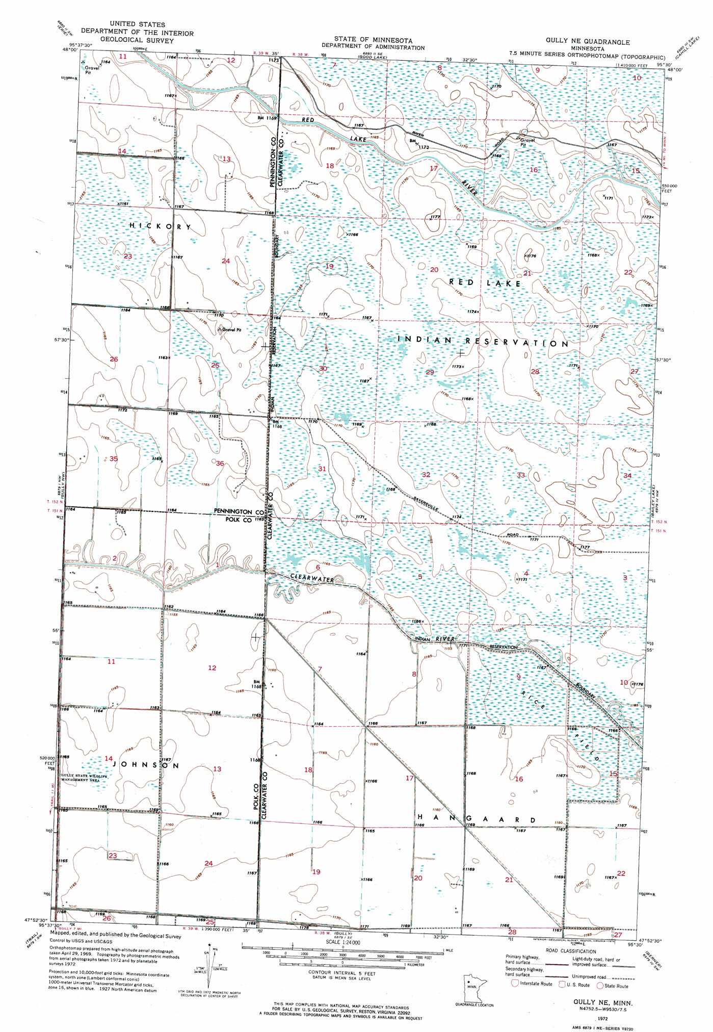
Gully Ne Topo Map Minnesota
To zoom in, hover over the map of Gully Ne
USGS Topo Quad 47095h5 - 1:24,000 scale
| Topo Map Name: | Gully Ne |
| USGS Topo Quad ID: | 47095h5 |
| Print Size: | ca. 21 1/4" wide x 27" high |
| Southeast Coordinates: | 47.875° N latitude / 95.5° W longitude |
| Map Center Coordinates: | 47.9375° N latitude / 95.5625° W longitude |
| U.S. State: | MN |
| Filename: | p47095h5.jpg |
| Download Map JPG Image: | Gully Ne topo map 1:24,000 scale |
| Map Type: | Orthophoto |
| Topo Series: | 7.5´ |
| Map Scale: | 1:24,000 |
| Source of Map Images: | United States Geological Survey (USGS) |
| Alternate Map Versions: |
Gully NE MN 1972, updated 1976 Download PDF Buy paper map Gully NE MN 2010 Download PDF Buy paper map Gully NE MN 2013 Download PDF Buy paper map Gully NE MN 2016 Download PDF Buy paper map |
1:24,000 Topo Quads surrounding Gully Ne
Goodridge |
Erie Nw |
Erie Ne |
Jelle |
Jelle Ne |
High Landing |
Erie |
Good Lake |
Cahill Lake |
Gimiwan Lake |
Roland |
Gully Nw |
Gully Ne |
Bailey Lake |
Berner Ne |
Oklee |
Trail |
Gully |
Berner |
Gurneau Lake |
Mcintosh Ne |
Olga |
Gonvick |
Clearbrook |
Leonard |
> Back to 47095e1 at 1:100,000 scale
> Back to 47094a1 at 1:250,000 scale
> Back to U.S. Topo Maps home
Gully Ne topo map: Gazetteer
Gully Ne: Parks
Gully State Wildlife Management Area elevation 355m 1164′Gully Ne: Post Offices
Gunder Post Office (historical) elevation 357m 1171′Neptune Post Office (historical) elevation 356m 1167′
Gully Ne digital topo map on disk
Buy this Gully Ne topo map showing relief, roads, GPS coordinates and other geographical features, as a high-resolution digital map file on DVD: