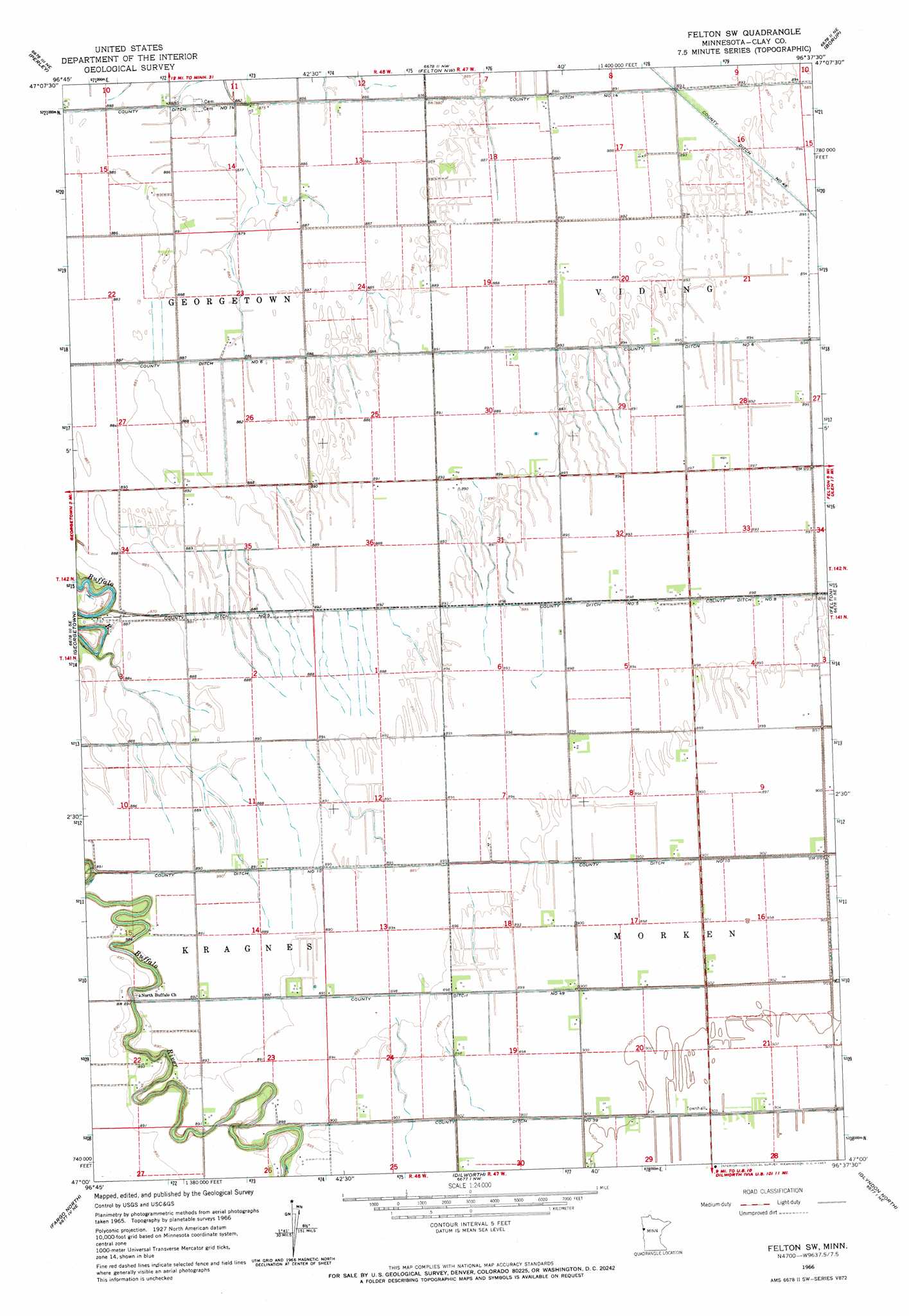
Felton Sw Topo Map Minnesota
To zoom in, hover over the map of Felton Sw
USGS Topo Quad 47096a6 - 1:24,000 scale
| Topo Map Name: | Felton Sw |
| USGS Topo Quad ID: | 47096a6 |
| Print Size: | ca. 21 1/4" wide x 27" high |
| Southeast Coordinates: | 47° N latitude / 96.625° W longitude |
| Map Center Coordinates: | 47.0625° N latitude / 96.6875° W longitude |
| U.S. State: | MN |
| Filename: | o47096a6.jpg |
| Download Map JPG Image: | Felton Sw topo map 1:24,000 scale |
| Map Type: | Topographic |
| Topo Series: | 7.5´ |
| Map Scale: | 1:24,000 |
| Source of Map Images: | United States Geological Survey (USGS) |
| Alternate Map Versions: |
Felton SW MN 1966, updated 1967 Download PDF Buy paper map Felton SW MN 2010 Download PDF Buy paper map Felton SW MN 2013 Download PDF Buy paper map Felton SW MN 2016 Download PDF Buy paper map |
1:24,000 Topo Quads surrounding Felton Sw
Halstad Sw |
Halstad |
Anthony |
Ada |
Twin Valley Sw |
Gardner |
Perley |
Felton Nw |
Borup |
Ulen Nw |
Argusville |
Georgetown |
Felton Sw |
Felton |
Ulen Sw |
West Fargo North |
Fargo North |
Dilworth |
Glyndon North |
Hawley Nw |
West Fargo South |
Fargo South |
Sabin |
Glyndon South |
Downer |
> Back to 47096a1 at 1:100,000 scale
> Back to 47096a1 at 1:250,000 scale
> Back to U.S. Topo Maps home
Felton Sw topo map: Gazetteer
Felton Sw: Airports
Pake Airport elevation 273m 895′Felton Sw: Canals
County Ditch Number Fiftynine elevation 275m 902′County Ditch Number Five elevation 270m 885′
County Ditch Number Fortynine elevation 273m 895′
County Ditch Number Fourteen elevation 268m 879′
County Ditch Number Six elevation 270m 885′
County Ditch Number Ten elevation 275m 902′
Felton Sw: Post Offices
Real Post Office (historical) elevation 273m 895′Felton Sw digital topo map on disk
Buy this Felton Sw topo map showing relief, roads, GPS coordinates and other geographical features, as a high-resolution digital map file on DVD:
Eastern North Dakota & Eastern South Dakota
Buy digital topo maps: Eastern North Dakota & Eastern South Dakota