Ulen Nw Topo Map Minnesota
To zoom in, hover over the map of Ulen Nw
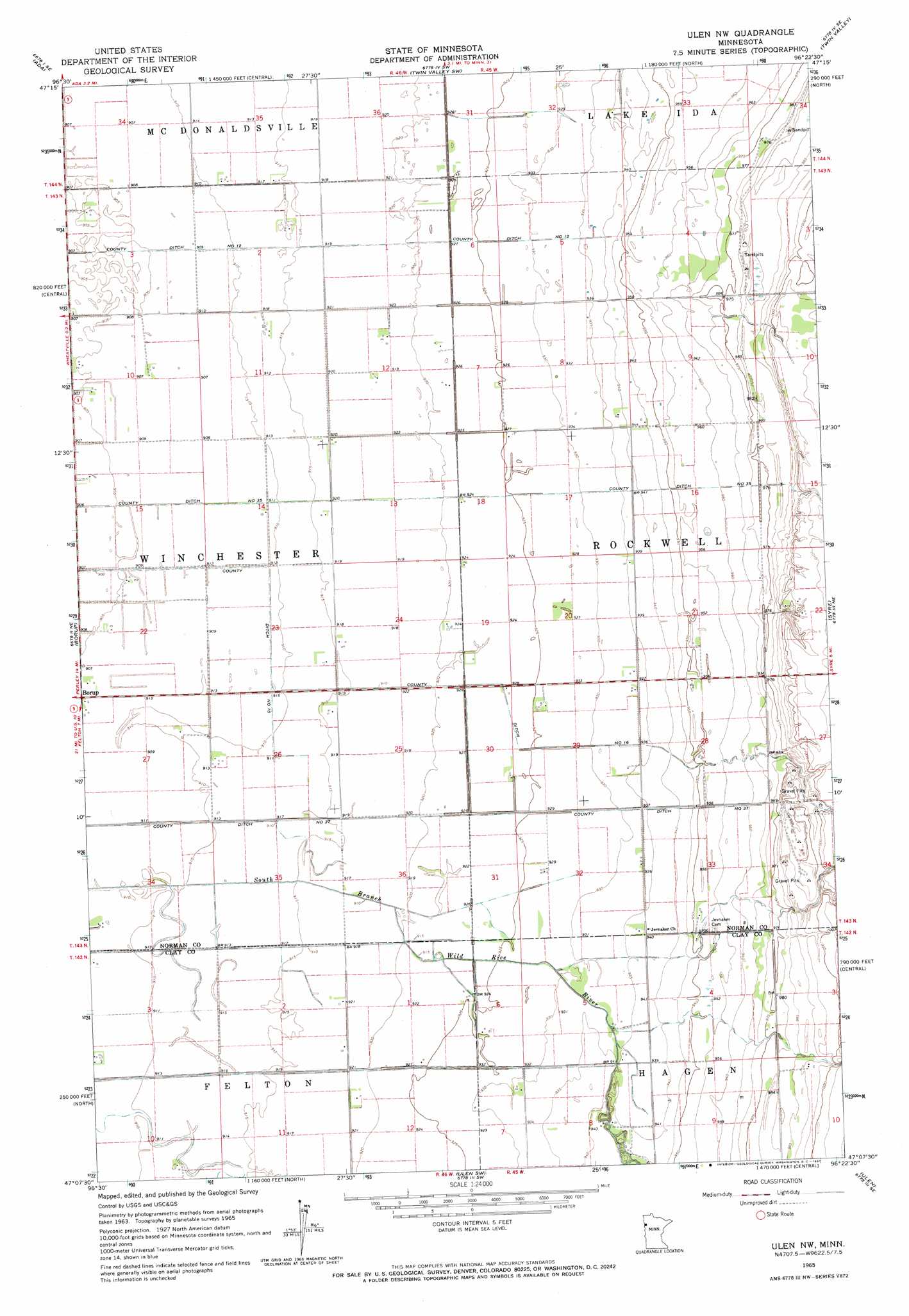
USGS Topo Quad 47096b4 - 1:24,000 scale
| Topo Map Name: | Ulen Nw |
| USGS Topo Quad ID: | 47096b4 |
| Print Size: | ca. 21 1/4" wide x 27" high |
| Southeast Coordinates: | 47.125° N latitude / 96.375° W longitude |
| Map Center Coordinates: | 47.1875° N latitude / 96.4375° W longitude |
| U.S. State: | MN |
| Filename: | o47096b4.jpg |
| Download Map JPG Image: | Ulen Nw topo map 1:24,000 scale |
| Map Type: | Topographic |
| Topo Series: | 7.5´ |
| Map Scale: | 1:24,000 |
| Source of Map Images: | United States Geological Survey (USGS) |
| Alternate Map Versions: |
Ulen NW MN 1965, updated 1967 Download PDF Buy paper map Elkton MN 1967, updated 1968 Download PDF Buy paper map Ulen NW MN 2010 Download PDF Buy paper map Ulen NW MN 2013 Download PDF Buy paper map Ulen NW MN 2016 Download PDF Buy paper map |
1:24,000 Topo Quads surrounding Ulen Nw
Ada Nw |
Lockhart |
Twin Valley Nw |
Flaming |
Ranum |
Anthony |
Ada |
Twin Valley Sw |
Twin Valley |
Waukon |
Felton Nw |
Borup |
Ulen Nw |
Syre |
Flom |
Felton Sw |
Felton |
Ulen Sw |
Ulen |
Tilde Lake |
Dilworth |
Glyndon North |
Hawley Nw |
Hawley |
Dale |
> Back to 47096a1 at 1:100,000 scale
> Back to 47096a1 at 1:250,000 scale
> Back to U.S. Topo Maps home
Ulen Nw topo map: Gazetteer
Ulen Nw: Canals
County Ditch Number Sixteen elevation 282m 925′County Ditch Number Ten elevation 275m 902′
County Ditch Number Thirtyfive elevation 278m 912′
County Ditch Number Thirtyseven elevation 280m 918′
County Ditch Number Twelve elevation 280m 918′
Ulen Nw digital topo map on disk
Buy this Ulen Nw topo map showing relief, roads, GPS coordinates and other geographical features, as a high-resolution digital map file on DVD:
Eastern North Dakota & Eastern South Dakota
Buy digital topo maps: Eastern North Dakota & Eastern South Dakota