Faith Topo Map Minnesota
To zoom in, hover over the map of Faith
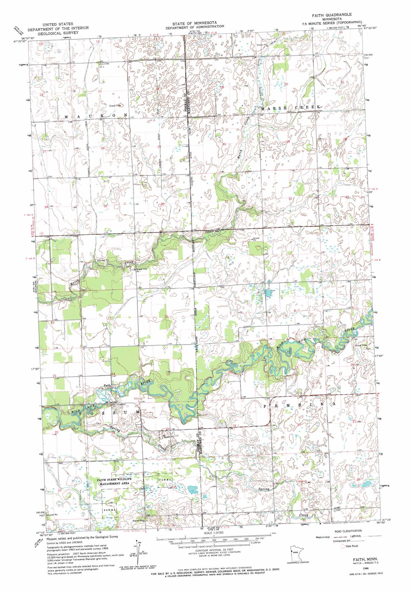
USGS Topo Quad 47096c1 - 1:24,000 scale
| Topo Map Name: | Faith |
| USGS Topo Quad ID: | 47096c1 |
| Print Size: | ca. 21 1/4" wide x 27" high |
| Southeast Coordinates: | 47.25° N latitude / 96° W longitude |
| Map Center Coordinates: | 47.3125° N latitude / 96.0625° W longitude |
| U.S. State: | MN |
| Filename: | o47096c1.jpg |
| Download Map JPG Image: | Faith topo map 1:24,000 scale |
| Map Type: | Topographic |
| Topo Series: | 7.5´ |
| Map Scale: | 1:24,000 |
| Source of Map Images: | United States Geological Survey (USGS) |
| Alternate Map Versions: |
Faith MN 1966, updated 1967 Download PDF Buy paper map Faith MN 2011 Download PDF Buy paper map Faith MN 2013 Download PDF Buy paper map Faith MN 2016 Download PDF Buy paper map |
1:24,000 Topo Quads surrounding Faith
Fertile |
Halverson Lake |
Union Lake |
Winger |
Fosston West |
Flaming |
Ranum |
Faith Ne |
Bejou |
Mahnomen Ne |
Twin Valley |
Waukon |
Faith |
Mahnomen |
Beaulieu |
Syre |
Flom |
Flom Ne |
Waubun |
Ogema Ne |
Ulen |
Tilde Lake |
Flom Se |
Ogema |
White Earth |
> Back to 47096a1 at 1:100,000 scale
> Back to 47096a1 at 1:250,000 scale
> Back to U.S. Topo Maps home
Faith topo map: Gazetteer
Faith: Canals
County Ditch Number Eight elevation 366m 1200′County Ditch Number Nine elevation 364m 1194′
Faith: Dams
Faith Dam elevation 338m 1108′Faith: Parks
Faith State Wildlife Management Area elevation 351m 1151′Faith: Populated Places
Faith elevation 349m 1145′Faith: Post Offices
Faith Post Office (historical) elevation 349m 1145′Qual Post Office (historical) elevation 352m 1154′
Faith: Streams
Spring Creek elevation 336m 1102′Faith digital topo map on disk
Buy this Faith topo map showing relief, roads, GPS coordinates and other geographical features, as a high-resolution digital map file on DVD:
Eastern North Dakota & Eastern South Dakota
Buy digital topo maps: Eastern North Dakota & Eastern South Dakota