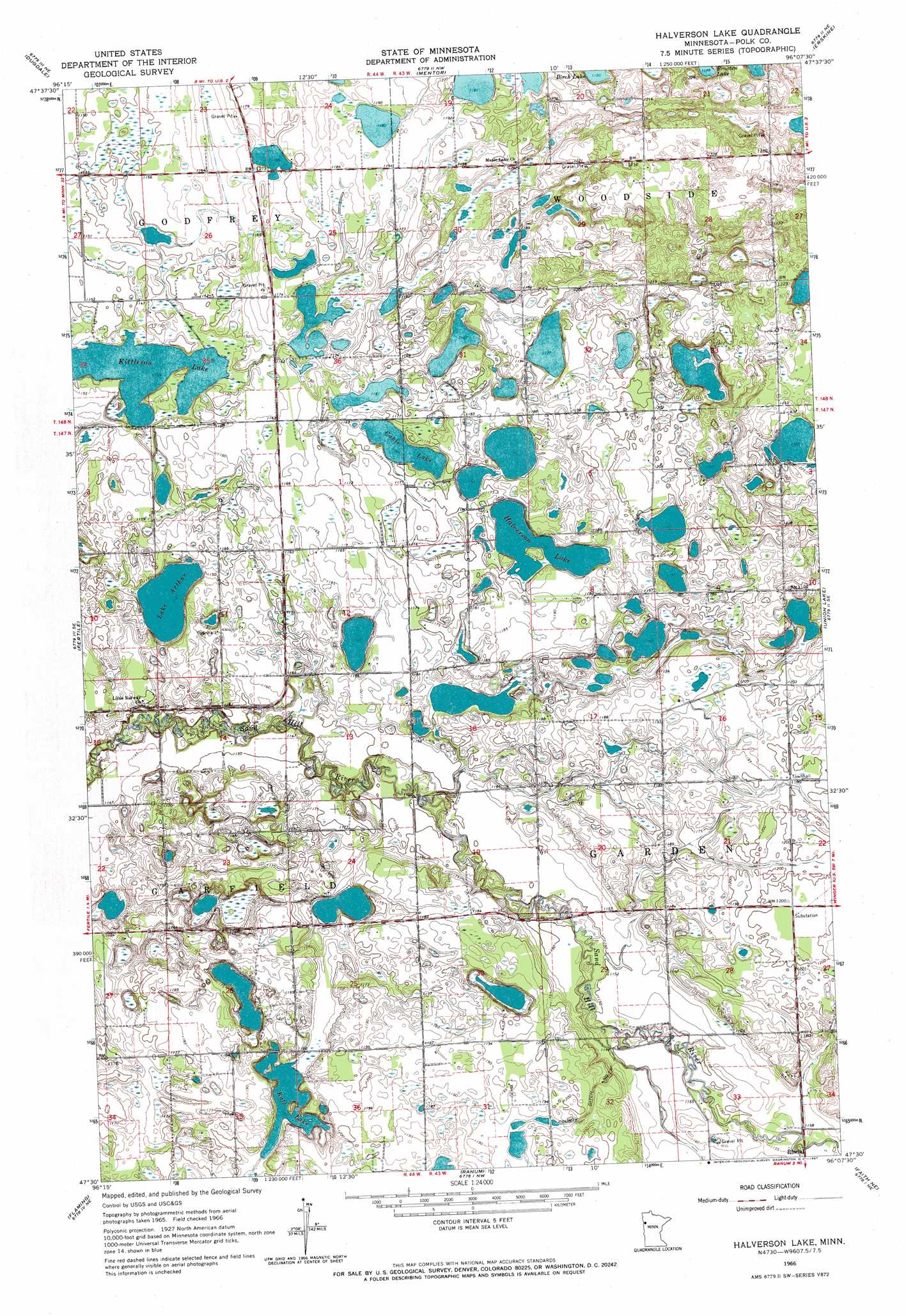
Halverson Lake Topo Map Minnesota
To zoom in, hover over the map of Halverson Lake
USGS Topo Quad 47096e2 - 1:24,000 scale
| Topo Map Name: | Halverson Lake |
| USGS Topo Quad ID: | 47096e2 |
| Print Size: | ca. 21 1/4" wide x 27" high |
| Southeast Coordinates: | 47.5° N latitude / 96.125° W longitude |
| Map Center Coordinates: | 47.5625° N latitude / 96.1875° W longitude |
| U.S. State: | MN |
| Filename: | o47096e2.jpg |
| Download Map JPG Image: | Halverson Lake topo map 1:24,000 scale |
| Map Type: | Topographic |
| Topo Series: | 7.5´ |
| Map Scale: | 1:24,000 |
| Source of Map Images: | United States Geological Survey (USGS) |
| Alternate Map Versions: |
Halverson Lake MN 1966, updated 1967 Download PDF Buy paper map Halverson Lake MN 2010 Download PDF Buy paper map Halverson Lake MN 2013 Download PDF Buy paper map Halverson Lake MN 2016 Download PDF Buy paper map |
1:24,000 Topo Quads surrounding Halverson Lake
Gentilly |
Marcoux Corners |
Terrebonne |
Brooks |
Oklee Sw |
Harold |
Dugdale |
Mentor |
Erskine |
Mcintosh |
Melvin |
Fertile |
Halverson Lake |
Union Lake |
Winger |
Twin Valley Nw |
Flaming |
Ranum |
Faith Ne |
Bejou |
Twin Valley Sw |
Twin Valley |
Waukon |
Faith |
Mahnomen |
> Back to 47096e1 at 1:100,000 scale
> Back to 47096a1 at 1:250,000 scale
> Back to U.S. Topo Maps home
Halverson Lake topo map: Gazetteer
Halverson Lake: Canals
County Ditch Number Seventeen elevation 361m 1184′Halverson Lake: Lakes
Cable Lake elevation 355m 1164′Halverson Lake elevation 358m 1174′
Kittleson Lake elevation 347m 1138′
Lake Arthur elevation 347m 1138′
Raff Lake elevation 356m 1167′
Halverson Lake: Post Offices
Valley Post Office (historical) elevation 353m 1158′Halverson Lake: Streams
Garden Slough elevation 349m 1145′Halverson Lake digital topo map on disk
Buy this Halverson Lake topo map showing relief, roads, GPS coordinates and other geographical features, as a high-resolution digital map file on DVD:
Eastern North Dakota & Eastern South Dakota
Buy digital topo maps: Eastern North Dakota & Eastern South Dakota