Climax Nw Topo Map North Dakota
To zoom in, hover over the map of Climax Nw
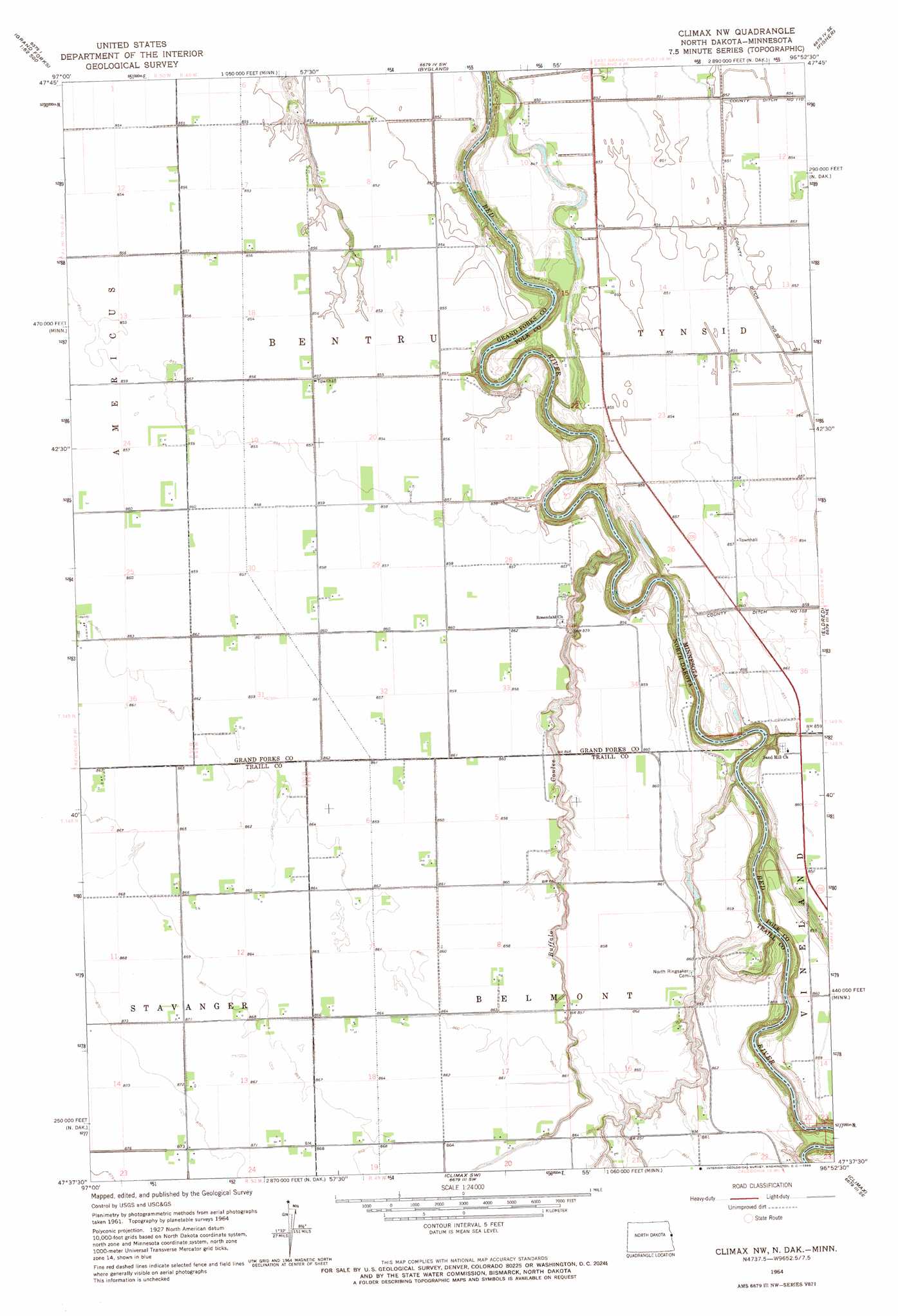
USGS Topo Quad 47096f8 - 1:24,000 scale
| Topo Map Name: | Climax Nw |
| USGS Topo Quad ID: | 47096f8 |
| Print Size: | ca. 21 1/4" wide x 27" high |
| Southeast Coordinates: | 47.625° N latitude / 96.875° W longitude |
| Map Center Coordinates: | 47.6875° N latitude / 96.9375° W longitude |
| U.S. States: | ND, MN |
| Filename: | O47096F8.jpg |
| Download Map JPG Image: | Climax Nw topo map 1:24,000 scale |
| Map Type: | Topographic |
| Topo Series: | 7.5´ |
| Map Scale: | 1:24,000 |
| Source of Map Images: | United States Geological Survey (USGS) |
| Alternate Map Versions: |
Climax NW ND 1964, updated 1966 Download PDF Buy paper map Climax NW ND 2011 Download PDF Buy paper map Climax NW ND 2014 Download PDF Buy paper map |
1:24,000 Topo Quads surrounding Climax Nw
Kelly |
Grand Forks |
Mallory |
Key West |
Euclid |
Grand Forks Sw |
Thompson |
Bygland |
Fisher |
Crookston Sw |
Buxton Nw |
Reynolds |
Climax Nw |
Eldred |
Girard |
Buxton Sw |
Buxton |
Climax Sw |
Climax |
Beltrami Sw |
Hillsboro Nw |
Hillsboro |
Caledonia |
Shelly |
Ada Nw |
> Back to 47096e1 at 1:100,000 scale
> Back to 47096a1 at 1:250,000 scale
> Back to U.S. Topo Maps home
Climax Nw topo map: Gazetteer
Climax Nw: Canals
County Ditch Number Fiftythree elevation 259m 849′Climax Nw: Post Offices
Neby Post Office (historical) elevation 262m 859′Climax Nw: Streams
Buffalo Coulee elevation 243m 797′Climax Nw digital topo map on disk
Buy this Climax Nw topo map showing relief, roads, GPS coordinates and other geographical features, as a high-resolution digital map file on DVD:
Eastern North Dakota & Eastern South Dakota
Buy digital topo maps: Eastern North Dakota & Eastern South Dakota