Arthur Topo Map North Dakota
To zoom in, hover over the map of Arthur
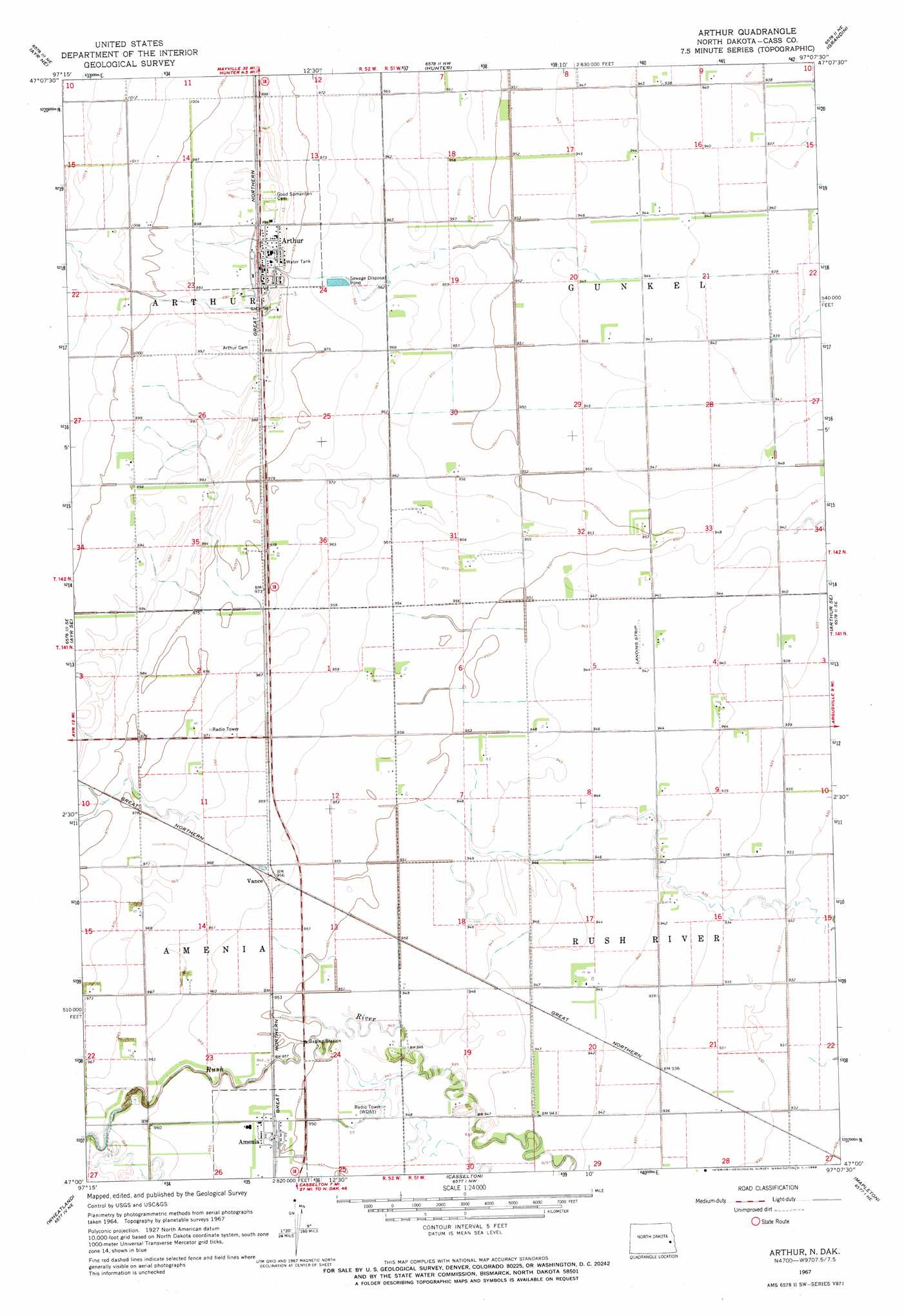
USGS Topo Quad 47097a2 - 1:24,000 scale
| Topo Map Name: | Arthur |
| USGS Topo Quad ID: | 47097a2 |
| Print Size: | ca. 21 1/4" wide x 27" high |
| Southeast Coordinates: | 47° N latitude / 97.125° W longitude |
| Map Center Coordinates: | 47.0625° N latitude / 97.1875° W longitude |
| U.S. State: | ND |
| Filename: | O47097A2.jpg |
| Download Map JPG Image: | Arthur topo map 1:24,000 scale |
| Map Type: | Topographic |
| Topo Series: | 7.5´ |
| Map Scale: | 1:24,000 |
| Source of Map Images: | United States Geological Survey (USGS) |
| Alternate Map Versions: |
Arthur ND 1967, updated 1969 Download PDF Buy paper map Arthur ND 2011 Download PDF Buy paper map Arthur ND 2014 Download PDF Buy paper map |
1:24,000 Topo Quads surrounding Arthur
Galesburg |
Galesburg Se |
Blanchard |
Kelso |
Halstad Sw |
Ayr Nw |
Ayr Ne |
Hunter |
Grandin |
Gardner |
Ayr |
Ayr Se |
Arthur |
Arthur Se |
Argusville |
Absaraka |
Wheatland |
Casselton |
Mapleton |
West Fargo North |
Embden |
Chaffee |
Durbin |
Casselton Se |
West Fargo South |
> Back to 47097a1 at 1:100,000 scale
> Back to 47096a1 at 1:250,000 scale
> Back to U.S. Topo Maps home
Arthur topo map: Gazetteer
Arthur: Airports
Arthur Field elevation 296m 971′Nelson Field elevation 290m 951′
Smith Private Strip elevation 287m 941′
Turner Field elevation 288m 944′
Arthur: Populated Places
Amenia elevation 290m 951′Arthur elevation 302m 990′
Vance elevation 293m 961′
Arthur digital topo map on disk
Buy this Arthur topo map showing relief, roads, GPS coordinates and other geographical features, as a high-resolution digital map file on DVD:
Eastern North Dakota & Eastern South Dakota
Buy digital topo maps: Eastern North Dakota & Eastern South Dakota