Pillsbury Se Topo Map North Dakota
To zoom in, hover over the map of Pillsbury Se
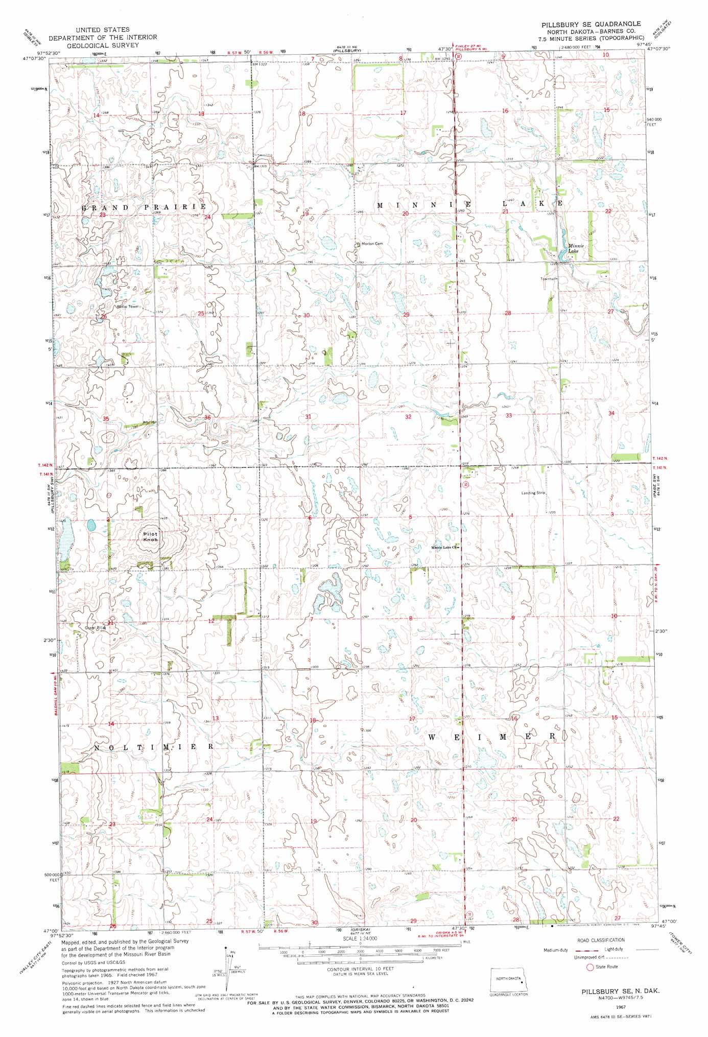
USGS Topo Quad 47097a7 - 1:24,000 scale
| Topo Map Name: | Pillsbury Se |
| USGS Topo Quad ID: | 47097a7 |
| Print Size: | ca. 21 1/4" wide x 27" high |
| Southeast Coordinates: | 47° N latitude / 97.75° W longitude |
| Map Center Coordinates: | 47.0625° N latitude / 97.8125° W longitude |
| U.S. State: | ND |
| Filename: | O47097A7.jpg |
| Download Map JPG Image: | Pillsbury Se topo map 1:24,000 scale |
| Map Type: | Topographic |
| Topo Series: | 7.5´ |
| Map Scale: | 1:24,000 |
| Source of Map Images: | United States Geological Survey (USGS) |
| Alternate Map Versions: |
Pillsbury SE ND 1967, updated 1969 Download PDF Buy paper map Pillsbury SE ND 2011 Download PDF Buy paper map Pillsbury SE ND 2014 Download PDF Buy paper map |
1:24,000 Topo Quads surrounding Pillsbury Se
Karnak |
Luverne |
Luverne Se |
Hope |
Hope Se |
Dazey Ne |
Sibley |
Pillsbury |
Colgate |
Page |
Baldhill Dam |
Pillsbury Sw |
Pillsbury Se |
Page Sw |
Page Se |
Valley City West |
Valley City East |
Oriska |
Tower City |
Buffalo |
Sanborn Se |
Fingal Sw |
Fingal |
Tower City Sw |
Alice |
> Back to 47097a1 at 1:100,000 scale
> Back to 47096a1 at 1:250,000 scale
> Back to U.S. Topo Maps home
Pillsbury Se topo map: Gazetteer
Pillsbury Se: Airports
Gage Flying Farmer Landing Strip elevation 375m 1230′Pillsbury Se: Lakes
Minnie Lake elevation 370m 1213′Pillsbury Se: Summits
Pilot Knob elevation 450m 1476′Pillsbury Se digital topo map on disk
Buy this Pillsbury Se topo map showing relief, roads, GPS coordinates and other geographical features, as a high-resolution digital map file on DVD:
Eastern North Dakota & Eastern South Dakota
Buy digital topo maps: Eastern North Dakota & Eastern South Dakota