Finley Ne Topo Map North Dakota
To zoom in, hover over the map of Finley Ne
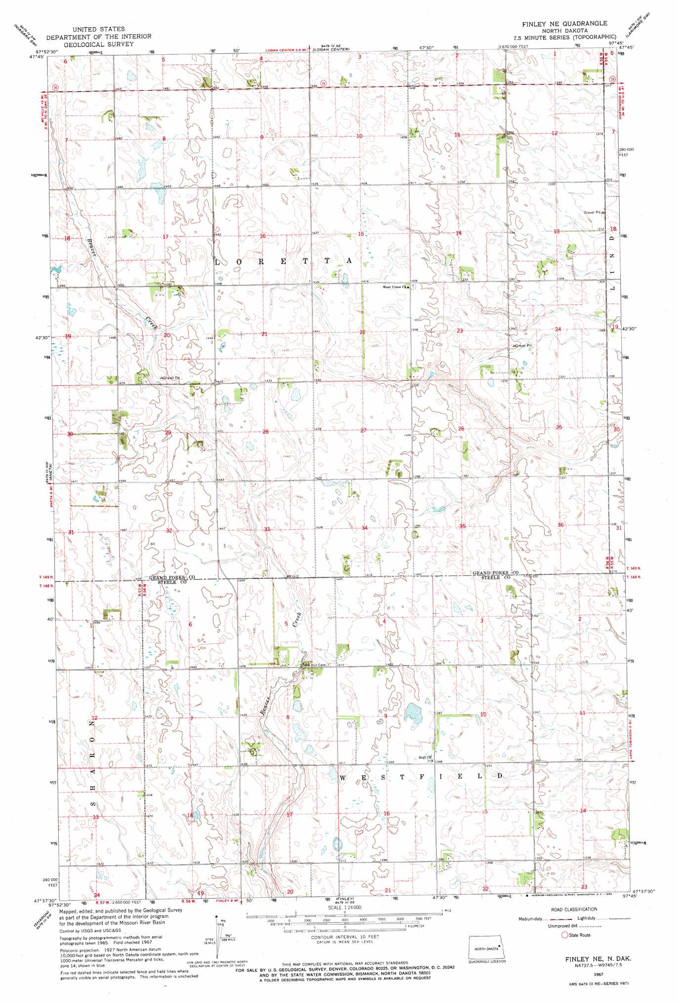
USGS Topo Quad 47097f7 - 1:24,000 scale
| Topo Map Name: | Finley Ne |
| USGS Topo Quad ID: | 47097f7 |
| Print Size: | ca. 21 1/4" wide x 27" high |
| Southeast Coordinates: | 47.625° N latitude / 97.75° W longitude |
| Map Center Coordinates: | 47.6875° N latitude / 97.8125° W longitude |
| U.S. State: | ND |
| Filename: | O47097F7.jpg |
| Download Map JPG Image: | Finley Ne topo map 1:24,000 scale |
| Map Type: | Topographic |
| Topo Series: | 7.5´ |
| Map Scale: | 1:24,000 |
| Source of Map Images: | United States Geological Survey (USGS) |
| Alternate Map Versions: |
Finley NE ND 1967, updated 1969 Download PDF Buy paper map Finley NE ND 2011 Download PDF Buy paper map Finley NE ND 2014 Download PDF Buy paper map |
1:24,000 Topo Quads surrounding Finley Ne
Lambs Lake |
Lake Pickard |
Niagara |
Larimore West |
Larimore East |
Mcville Se |
Niagara Sw |
Logan Center |
Larimore Sw |
Kempton |
Kloten |
Aneta |
Finley Ne |
Northwood Nw |
Northwood |
Kloten Se |
Sharon |
Finley |
Golden Lake |
Northwood Se |
Cooperstown East |
Luverne Nw |
Blabon |
Sherbrooke |
Hope Ne |
> Back to 47097e1 at 1:100,000 scale
> Back to 47096a1 at 1:250,000 scale
> Back to U.S. Topo Maps home
No gazetteer data is available for the Finley Ne topo map sheet.
Finley Ne digital topo map on disk
Buy this Finley Ne topo map showing relief, roads, GPS coordinates and other geographical features, as a high-resolution digital map file on DVD:
Eastern North Dakota & Eastern South Dakota
Buy digital topo maps: Eastern North Dakota & Eastern South Dakota