Pingree Topo Map North Dakota
To zoom in, hover over the map of Pingree
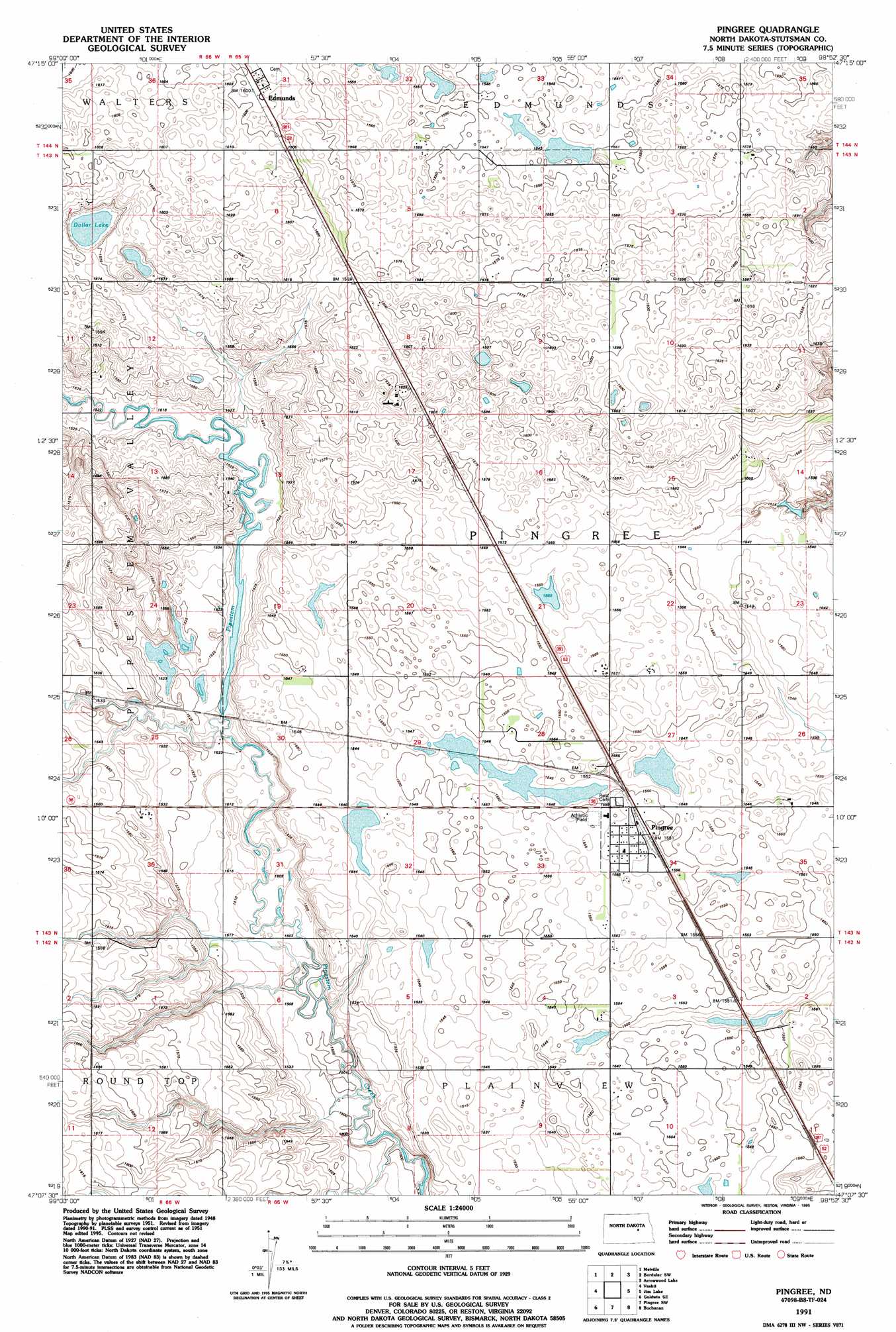
USGS Topo Quad 47098b8 - 1:24,000 scale
| Topo Map Name: | Pingree |
| USGS Topo Quad ID: | 47098b8 |
| Print Size: | ca. 21 1/4" wide x 27" high |
| Southeast Coordinates: | 47.125° N latitude / 98.875° W longitude |
| Map Center Coordinates: | 47.1875° N latitude / 98.9375° W longitude |
| U.S. State: | ND |
| Filename: | O47098B8.jpg |
| Download Map JPG Image: | Pingree topo map 1:24,000 scale |
| Map Type: | Topographic |
| Topo Series: | 7.5´ |
| Map Scale: | 1:24,000 |
| Source of Map Images: | United States Geological Survey (USGS) |
| Alternate Map Versions: |
Pingree ND 1951, updated 1953 Download PDF Buy paper map Pingree ND 1991, updated 1995 Download PDF Buy paper map Pingree ND 2011 Download PDF Buy paper map Pingree ND 2014 Download PDF Buy paper map |
1:24,000 Topo Quads surrounding Pingree
Carrington West |
Carrington East |
Bordulac |
Bordulac Ne |
Kensal Nw |
Carrington Sw |
Melville |
Bordulac Sw |
Arrowwood Lake |
Kensal |
Goldwin |
Vashti |
Pingree |
Jim Lake |
Courtenay Nw |
Goldwin Sw |
Goldwin Se |
Pingree Sw |
Buchanan |
Fried |
Cleveland Nw |
Cleveland |
Eldridge Nw |
Eldridge |
Jamestown |
> Back to 47098a1 at 1:100,000 scale
> Back to 47098a1 at 1:250,000 scale
> Back to U.S. Topo Maps home
Pingree topo map: Gazetteer
Pingree: Lakes
Dollar Lake elevation 476m 1561′Pingree: Populated Places
Edmunds elevation 487m 1597′Pingree elevation 475m 1558′
Pingree digital topo map on disk
Buy this Pingree topo map showing relief, roads, GPS coordinates and other geographical features, as a high-resolution digital map file on DVD:
Eastern North Dakota & Eastern South Dakota
Buy digital topo maps: Eastern North Dakota & Eastern South Dakota