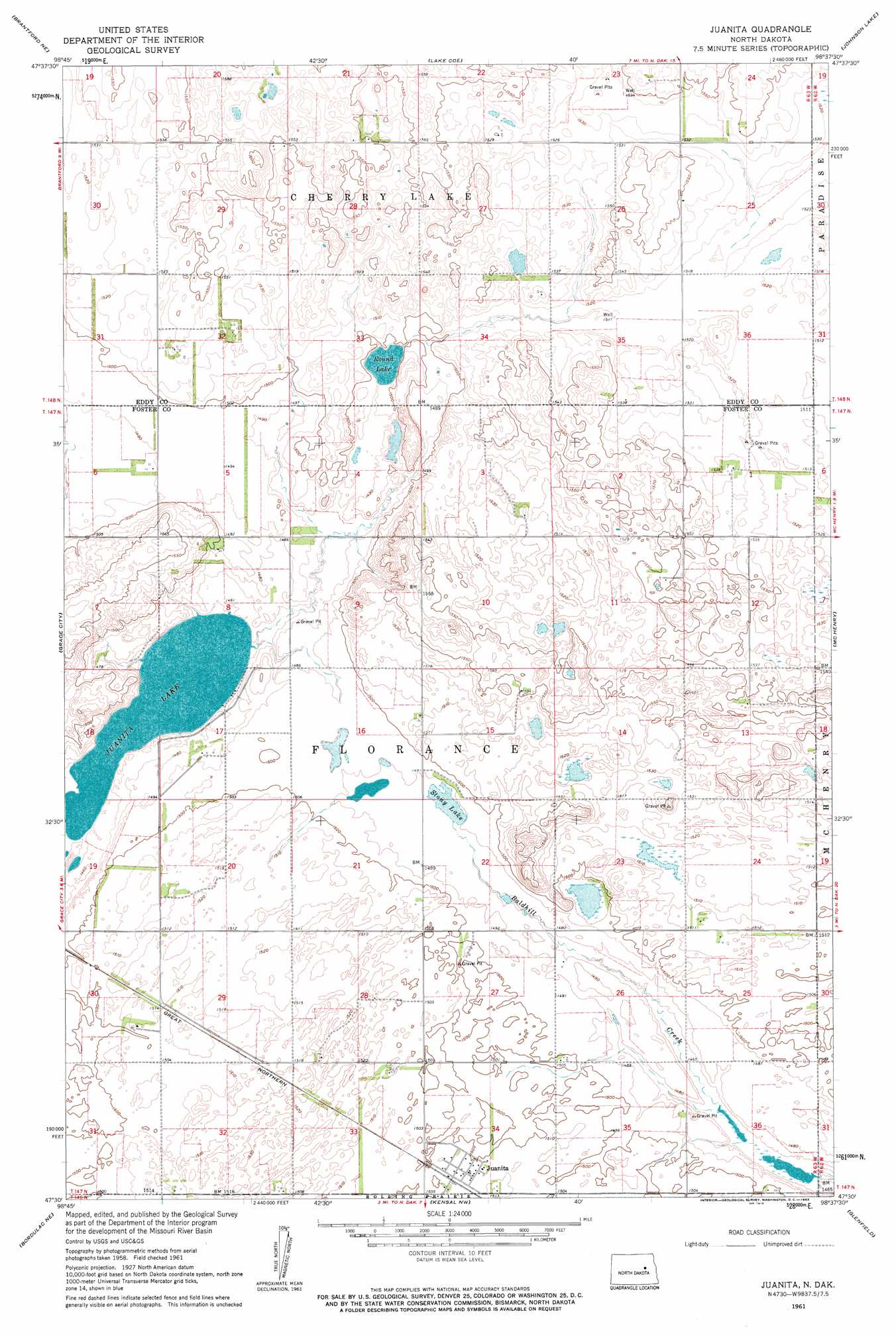
Juanita Topo Map North Dakota
To zoom in, hover over the map of Juanita
USGS Topo Quad 47098e6 - 1:24,000 scale
| Topo Map Name: | Juanita |
| USGS Topo Quad ID: | 47098e6 |
| Print Size: | ca. 21 1/4" wide x 27" high |
| Southeast Coordinates: | 47.5° N latitude / 98.625° W longitude |
| Map Center Coordinates: | 47.5625° N latitude / 98.6875° W longitude |
| U.S. State: | ND |
| Filename: | O47098E6.jpg |
| Download Map JPG Image: | Juanita topo map 1:24,000 scale |
| Map Type: | Topographic |
| Topo Series: | 7.5´ |
| Map Scale: | 1:24,000 |
| Source of Map Images: | United States Geological Survey (USGS) |
| Alternate Map Versions: |
Juanita ND 1961, updated 1963 Download PDF Buy paper map Juanita ND 2011 Download PDF Buy paper map Juanita ND 2014 Download PDF Buy paper map |
1:24,000 Topo Quads surrounding Juanita
Tokio Sw |
Horseshoe Lake |
Warwick |
Hamar |
Tolna |
Brantford Nw |
Brantford Ne |
Lake Coe |
Johnson Lake |
Binford Nw |
Brantford |
Grace City |
Juanita |
Mchenry |
Mose |
Bordulac |
Bordulac Ne |
Kensal Nw |
Glenfield |
Sutton |
Bordulac Sw |
Arrowwood Lake |
Kensal |
Kensal Se |
Sutton Sw |
> Back to 47098e1 at 1:100,000 scale
> Back to 47098a1 at 1:250,000 scale
> Back to U.S. Topo Maps home
Juanita topo map: Gazetteer
Juanita: Dams
Lake Juanita Outlet Control Dam elevation 444m 1456′Juanita: Lakes
Juanita Lake elevation 444m 1456′Round Lake elevation 454m 1489′
Stony Lake elevation 453m 1486′
Juanita: Populated Places
Juanita elevation 460m 1509′Juanita digital topo map on disk
Buy this Juanita topo map showing relief, roads, GPS coordinates and other geographical features, as a high-resolution digital map file on DVD:
Eastern North Dakota & Eastern South Dakota
Buy digital topo maps: Eastern North Dakota & Eastern South Dakota