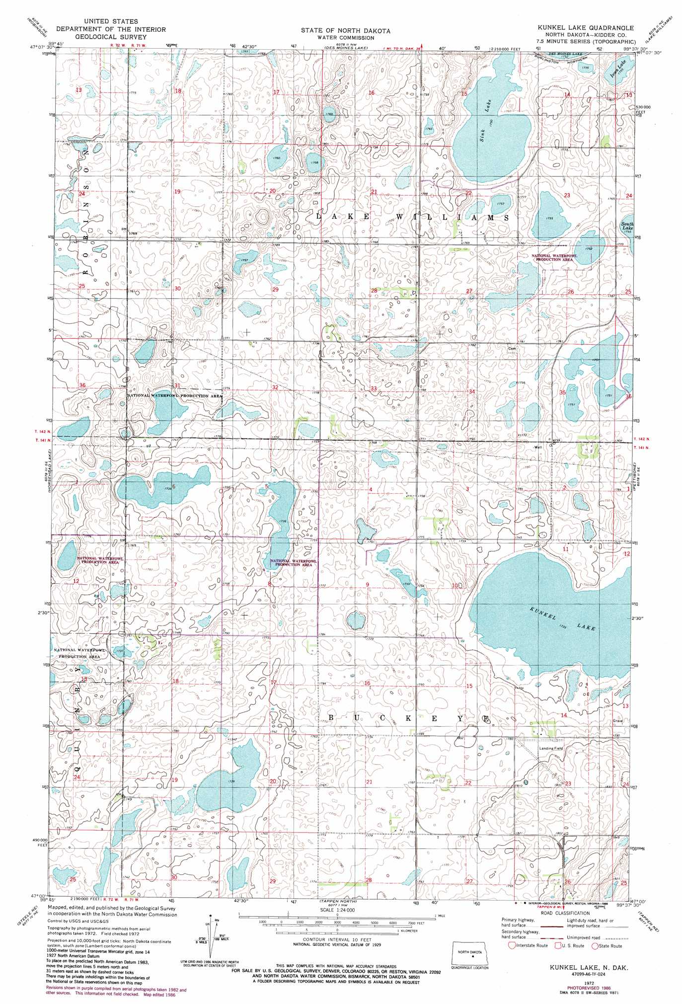
Kunkel Lake Topo Map North Dakota
To zoom in, hover over the map of Kunkel Lake
USGS Topo Quad 47099a6 - 1:24,000 scale
| Topo Map Name: | Kunkel Lake |
| USGS Topo Quad ID: | 47099a6 |
| Print Size: | ca. 21 1/4" wide x 27" high |
| Southeast Coordinates: | 47° N latitude / 99.625° W longitude |
| Map Center Coordinates: | 47.0625° N latitude / 99.6875° W longitude |
| U.S. State: | ND |
| Filename: | O47099A6.jpg |
| Download Map JPG Image: | Kunkel Lake topo map 1:24,000 scale |
| Map Type: | Topographic |
| Topo Series: | 7.5´ |
| Map Scale: | 1:24,000 |
| Source of Map Images: | United States Geological Survey (USGS) |
| Alternate Map Versions: |
Kunkel Lake ND 1972, updated 1974 Download PDF Buy paper map Kunkel Lake ND 1972, updated 1986 Download PDF Buy paper map Kunkel Lake ND 2011 Download PDF Buy paper map Kunkel Lake ND 2014 Download PDF Buy paper map |
1:24,000 Topo Quads surrounding Kunkel Lake
Senior Lake |
Willow Lake |
Wagon Wheel Hill |
Bowden Se |
Sykeston Sw |
Tuttle |
Robinson |
Des Moines Lake |
Lake Williams |
Woodworth Nw |
Tuttle Sw |
Horsehead Lake |
Kunkel Lake |
Pettibone |
Lake Louise |
Steele Nw |
Steele Ne |
Tappen North |
Tappen Ne |
Crystal Springs |
Steele |
Dawson |
Tappen South |
Tappen Se |
Medina Sw |
> Back to 47099a1 at 1:100,000 scale
> Back to 47098a1 at 1:250,000 scale
> Back to U.S. Topo Maps home
Kunkel Lake topo map: Gazetteer
Kunkel Lake: Lakes
Iowa Lake elevation 535m 1755′Kunkel Lake elevation 529m 1735′
Sink Lake elevation 534m 1751′
Kunkel Lake digital topo map on disk
Buy this Kunkel Lake topo map showing relief, roads, GPS coordinates and other geographical features, as a high-resolution digital map file on DVD:
Eastern North Dakota & Eastern South Dakota
Buy digital topo maps: Eastern North Dakota & Eastern South Dakota