Manfred Sw Topo Map North Dakota
To zoom in, hover over the map of Manfred Sw
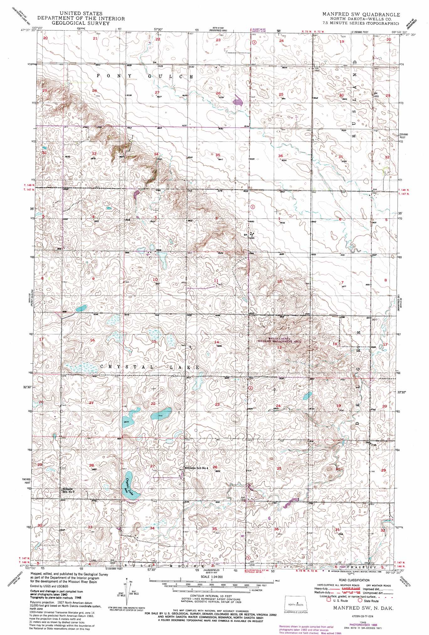
USGS Topo Quad 47099e8 - 1:24,000 scale
| Topo Map Name: | Manfred Sw |
| USGS Topo Quad ID: | 47099e8 |
| Print Size: | ca. 21 1/4" wide x 27" high |
| Southeast Coordinates: | 47.5° N latitude / 99.875° W longitude |
| Map Center Coordinates: | 47.5625° N latitude / 99.9375° W longitude |
| U.S. State: | ND |
| Filename: | O47099E8.jpg |
| Download Map JPG Image: | Manfred Sw topo map 1:24,000 scale |
| Map Type: | Topographic |
| Topo Series: | 7.5´ |
| Map Scale: | 1:24,000 |
| Source of Map Images: | United States Geological Survey (USGS) |
| Alternate Map Versions: |
Manfred SW ND 1949, updated 1949 Download PDF Buy paper map Manfred SW ND 1950, updated 1986 Download PDF Buy paper map Manfred SW ND 2011 Download PDF Buy paper map Manfred SW ND 2014 Download PDF Buy paper map |
1:24,000 Topo Quads surrounding Manfred Sw
Anamoose Sw |
Martin |
Harvey |
Wellsburg |
Heimdal |
Sheyenne Lake |
Sheyenne Lake Ne |
Manfred Nw |
Manfred |
Fessenden West |
Mertz Slough |
Pony Gulch |
Manfred Sw |
Manfred Se |
Fessenden Sw |
Goodrich West |
Goodrich East |
Hurdsfield |
Chaseley |
Bowden |
Goodrich Sw |
Woodhouse Lake |
Senior Lake |
Willow Lake |
Wagon Wheel Hill |
> Back to 47099e1 at 1:100,000 scale
> Back to 47098a1 at 1:250,000 scale
> Back to U.S. Topo Maps home
Manfred Sw topo map: Gazetteer
Manfred Sw: Dams
Faul-Mathison Dam elevation 555m 1820′Manfred Sw: Lakes
Crystal Lake elevation 558m 1830′Manfred Sw: Parks
Upland State Game Refuge elevation 603m 1978′Manfred Sw digital topo map on disk
Buy this Manfred Sw topo map showing relief, roads, GPS coordinates and other geographical features, as a high-resolution digital map file on DVD:
Eastern North Dakota & Eastern South Dakota
Buy digital topo maps: Eastern North Dakota & Eastern South Dakota