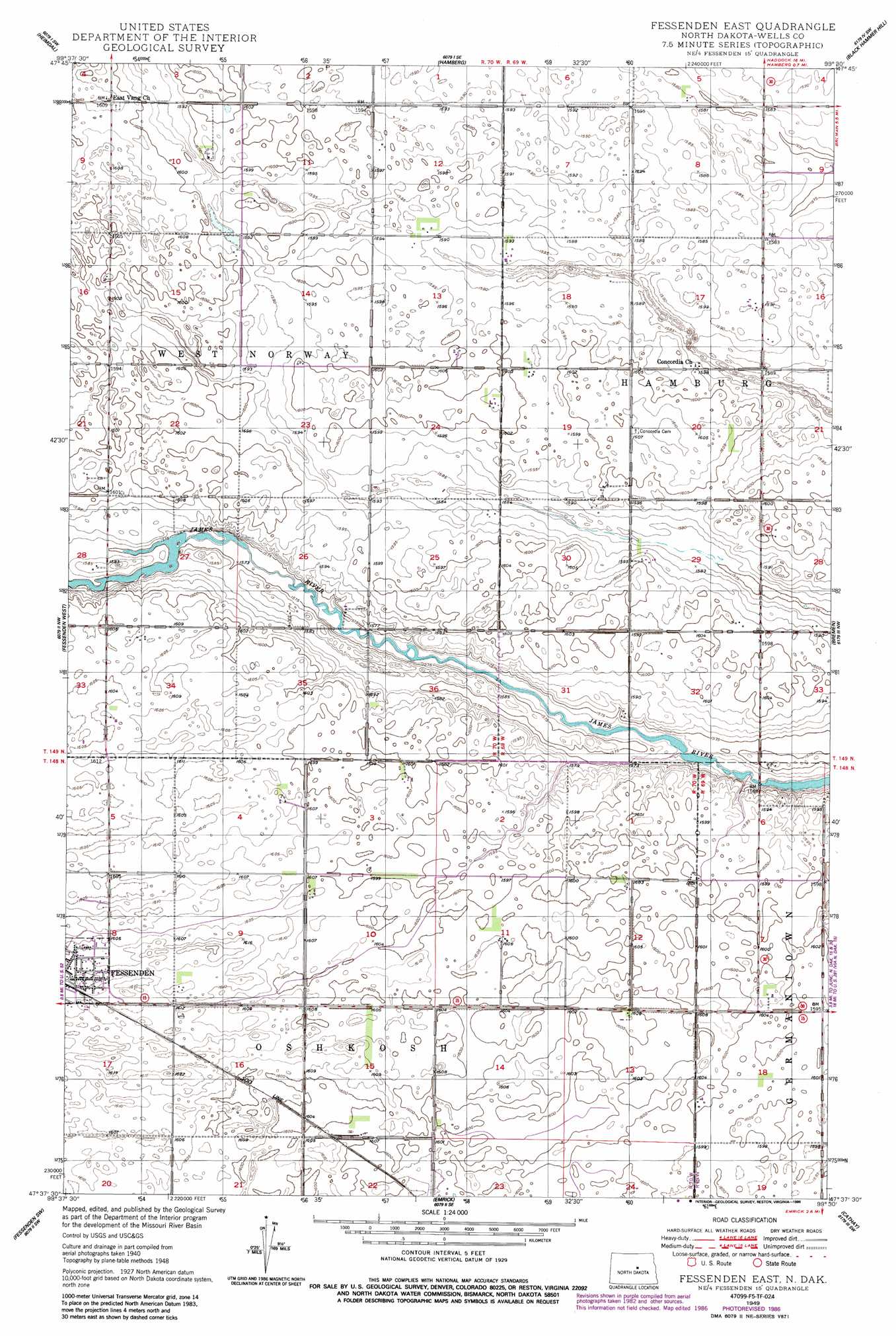
Fessenden East Topo Map North Dakota
To zoom in, hover over the map of Fessenden East
USGS Topo Quad 47099f5 - 1:24,000 scale
| Topo Map Name: | Fessenden East |
| USGS Topo Quad ID: | 47099f5 |
| Print Size: | ca. 21 1/4" wide x 27" high |
| Southeast Coordinates: | 47.625° N latitude / 99.5° W longitude |
| Map Center Coordinates: | 47.6875° N latitude / 99.5625° W longitude |
| U.S. State: | ND |
| Filename: | O47099F5.jpg |
| Download Map JPG Image: | Fessenden East topo map 1:24,000 scale |
| Map Type: | Topographic |
| Topo Series: | 7.5´ |
| Map Scale: | 1:24,000 |
| Source of Map Images: | United States Geological Survey (USGS) |
| Alternate Map Versions: |
Fessenden East ND 1949, updated 1949 Download PDF Buy paper map Fessenden East ND 1949, updated 1986 Download PDF Buy paper map Fessenden East ND 2011 Download PDF Buy paper map Fessenden East ND 2014 Download PDF Buy paper map |
1:24,000 Topo Quads surrounding Fessenden East
Selz Ne |
Hesper |
Maddock |
Flora |
Josephine |
Wellsburg |
Heimdal |
Hamberg |
Black Hammer Hill |
Flora Se |
Manfred |
Fessenden West |
Fessenden East |
Bremen |
Munster |
Manfred Se |
Fessenden Sw |
Emrick |
Cathay |
Cathay Se |
Chaseley |
Bowden |
Heaton |
Sykeston |
Dover |
> Back to 47099e1 at 1:100,000 scale
> Back to 47098a1 at 1:250,000 scale
> Back to U.S. Topo Maps home
Fessenden East digital topo map on disk
Buy this Fessenden East topo map showing relief, roads, GPS coordinates and other geographical features, as a high-resolution digital map file on DVD:
Eastern North Dakota & Eastern South Dakota
Buy digital topo maps: Eastern North Dakota & Eastern South Dakota