Lake Helen Topo Map North Dakota
To zoom in, hover over the map of Lake Helen
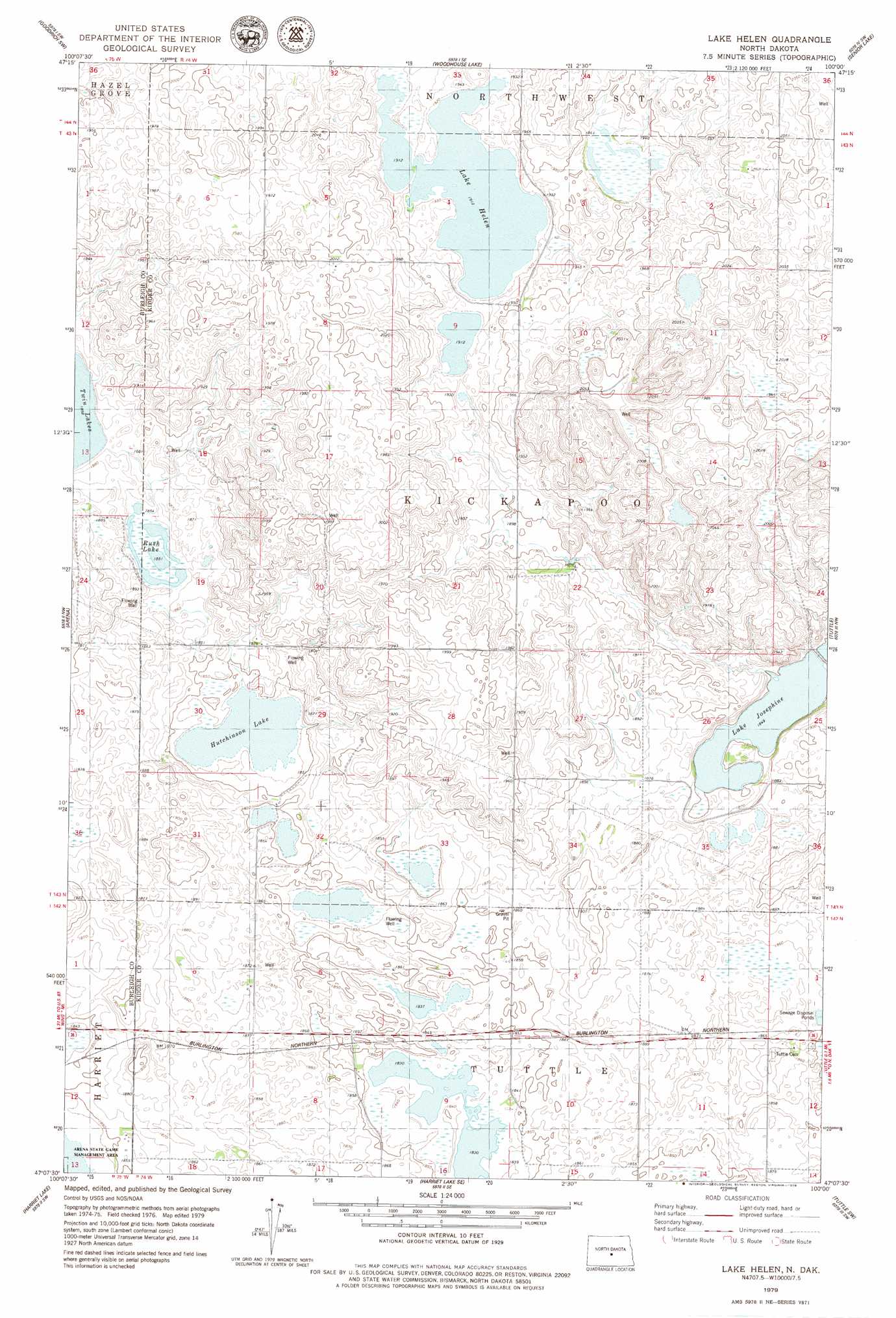
USGS Topo Quad 47100b1 - 1:24,000 scale
| Topo Map Name: | Lake Helen |
| USGS Topo Quad ID: | 47100b1 |
| Print Size: | ca. 21 1/4" wide x 27" high |
| Southeast Coordinates: | 47.125° N latitude / 100° W longitude |
| Map Center Coordinates: | 47.1875° N latitude / 100.0625° W longitude |
| U.S. State: | ND |
| Filename: | O47100B1.jpg |
| Download Map JPG Image: | Lake Helen topo map 1:24,000 scale |
| Map Type: | Topographic |
| Topo Series: | 7.5´ |
| Map Scale: | 1:24,000 |
| Source of Map Images: | United States Geological Survey (USGS) |
| Alternate Map Versions: |
Lake Helen ND 1979, updated 1979 Download PDF Buy paper map Lake Helen ND 2011 Download PDF Buy paper map Lake Helen ND 2014 Download PDF Buy paper map |
1:24,000 Topo Quads surrounding Lake Helen
Denhoff |
Goodrich West |
Goodrich East |
Hurdsfield |
Chaseley |
Florence Lake |
Goodrich Sw |
Woodhouse Lake |
Senior Lake |
Willow Lake |
Wing |
Arena |
Lake Helen |
Tuttle |
Robinson |
Wing Se |
Harriet Lake |
Harriet Lake Se |
Tuttle Sw |
Horsehead Lake |
Sibley Butte |
Clear Lake |
Stony Slough |
Steele Nw |
Steele Ne |
> Back to 47100a1 at 1:100,000 scale
> Back to 47100a1 at 1:250,000 scale
> Back to U.S. Topo Maps home
Lake Helen topo map: Gazetteer
Lake Helen: Lakes
Hutchinson Lake elevation 560m 1837′Lake Helen elevation 583m 1912′
Lake Josephine elevation 564m 1850′
Rush Lake elevation 565m 1853′
Lake Helen digital topo map on disk
Buy this Lake Helen topo map showing relief, roads, GPS coordinates and other geographical features, as a high-resolution digital map file on DVD:
Eastern North Dakota & Eastern South Dakota
Buy digital topo maps: Eastern North Dakota & Eastern South Dakota