Sanger Topo Map North Dakota
To zoom in, hover over the map of Sanger
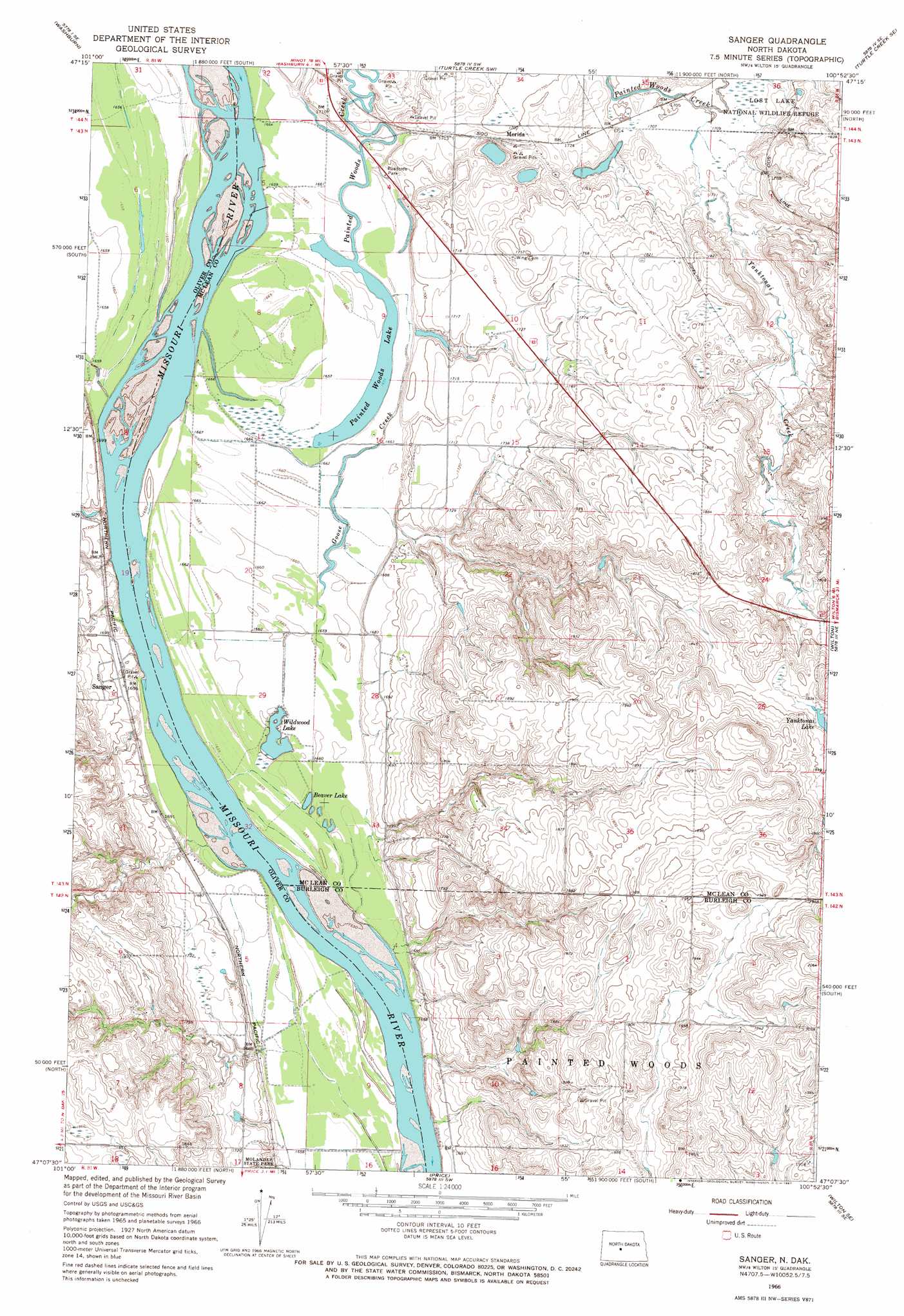
USGS Topo Quad 47100b8 - 1:24,000 scale
| Topo Map Name: | Sanger |
| USGS Topo Quad ID: | 47100b8 |
| Print Size: | ca. 21 1/4" wide x 27" high |
| Southeast Coordinates: | 47.125° N latitude / 100.875° W longitude |
| Map Center Coordinates: | 47.1875° N latitude / 100.9375° W longitude |
| U.S. State: | ND |
| Filename: | O47100B8.jpg |
| Download Map JPG Image: | Sanger topo map 1:24,000 scale |
| Map Type: | Topographic |
| Topo Series: | 7.5´ |
| Map Scale: | 1:24,000 |
| Source of Map Images: | United States Geological Survey (USGS) |
| Alternate Map Versions: |
Sanger ND 1966, updated 1967 Download PDF Buy paper map Sanger ND 2011 Download PDF Buy paper map Sanger ND 2014 Download PDF Buy paper map |
1:24,000 Topo Quads surrounding Sanger
Underwood |
Washburn Ne |
Turtle Creek Nw |
Turtle Creek Ne |
Mercer |
Washburn Sw |
Washburn |
Turtle Creek Sw |
Turtle Creek Se |
Mercer Sw |
Fort Clark |
Fort Clark Ne |
Sanger |
Wilton |
Grass Lake |
Nelson Lake |
Fort Clark Se |
Price |
Wilton Se |
Baldwin |
Crown Butte Nw |
Crown Butte |
Harmon |
Burnt Butte |
Keever Butte |
> Back to 47100a1 at 1:100,000 scale
> Back to 47100a1 at 1:250,000 scale
> Back to U.S. Topo Maps home
Sanger topo map: Gazetteer
Sanger: Capes
Pretty Point (historical) elevation 513m 1683′Sanger: Dams
Katz Dam elevation 506m 1660′Landgren Dam A elevation 534m 1751′
Landgren Dam B elevation 572m 1876′
Sanger: Lakes
Beaver Lake elevation 503m 1650′Painted Woods Lake elevation 505m 1656′
Wildwood Lake elevation 502m 1646′
Sanger: Parks
Molander State Park elevation 511m 1676′Sanger: Populated Places
Merida elevation 523m 1715′Sanger elevation 520m 1706′
Sanger: Streams
Goose Creek elevation 507m 1663′Painted Woods Creek elevation 506m 1660′
Turtle Creek (historical) elevation 506m 1660′
Yanktonai Creek elevation 519m 1702′
Sanger digital topo map on disk
Buy this Sanger topo map showing relief, roads, GPS coordinates and other geographical features, as a high-resolution digital map file on DVD:
Eastern North Dakota & Eastern South Dakota
Buy digital topo maps: Eastern North Dakota & Eastern South Dakota