Anamoose Sw Topo Map North Dakota
To zoom in, hover over the map of Anamoose Sw
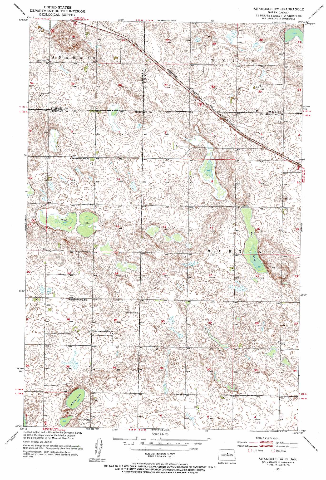
USGS Topo Quad 47100g2 - 1:24,000 scale
| Topo Map Name: | Anamoose Sw |
| USGS Topo Quad ID: | 47100g2 |
| Print Size: | ca. 21 1/4" wide x 27" high |
| Southeast Coordinates: | 47.75° N latitude / 100.125° W longitude |
| Map Center Coordinates: | 47.8125° N latitude / 100.1875° W longitude |
| U.S. State: | ND |
| Filename: | O47100G2.jpg |
| Download Map JPG Image: | Anamoose Sw topo map 1:24,000 scale |
| Map Type: | Topographic |
| Topo Series: | 7.5´ |
| Map Scale: | 1:24,000 |
| Source of Map Images: | United States Geological Survey (USGS) |
| Alternate Map Versions: |
Anamoose SW ND 1951, updated 1953 Download PDF Buy paper map Anamoose SW ND 2011 Download PDF Buy paper map Anamoose SW ND 2014 Download PDF Buy paper map |
1:24,000 Topo Quads surrounding Anamoose Sw
Rangeley |
Rangeley Se |
Orrin |
Balta Se |
Petrified Lake |
Drake Nw |
Drake |
Anamoose |
Clifton |
Selz Nw |
Drake Sw |
Drake Se |
Anamoose Sw |
Martin |
Harvey |
Lincoln Valley Nw |
Lincoln Valley |
Sheyenne Lake |
Sheyenne Lake Ne |
Manfred Nw |
Lincoln Valley Sw |
Lincoln Valley Se |
Mertz Slough |
Pony Gulch |
Manfred Sw |
> Back to 47100e1 at 1:100,000 scale
> Back to 47100a1 at 1:250,000 scale
> Back to U.S. Topo Maps home
Anamoose Sw topo map: Gazetteer
Anamoose Sw: Lakes
Alkali Lake elevation 503m 1650′Mud Lake elevation 488m 1601′
Steele Lake elevation 480m 1574′
Wolf Lake elevation 489m 1604′
Anamoose Sw digital topo map on disk
Buy this Anamoose Sw topo map showing relief, roads, GPS coordinates and other geographical features, as a high-resolution digital map file on DVD:
Eastern North Dakota & Eastern South Dakota
Buy digital topo maps: Eastern North Dakota & Eastern South Dakota