Kongsberg Ne Topo Map North Dakota
To zoom in, hover over the map of Kongsberg Ne
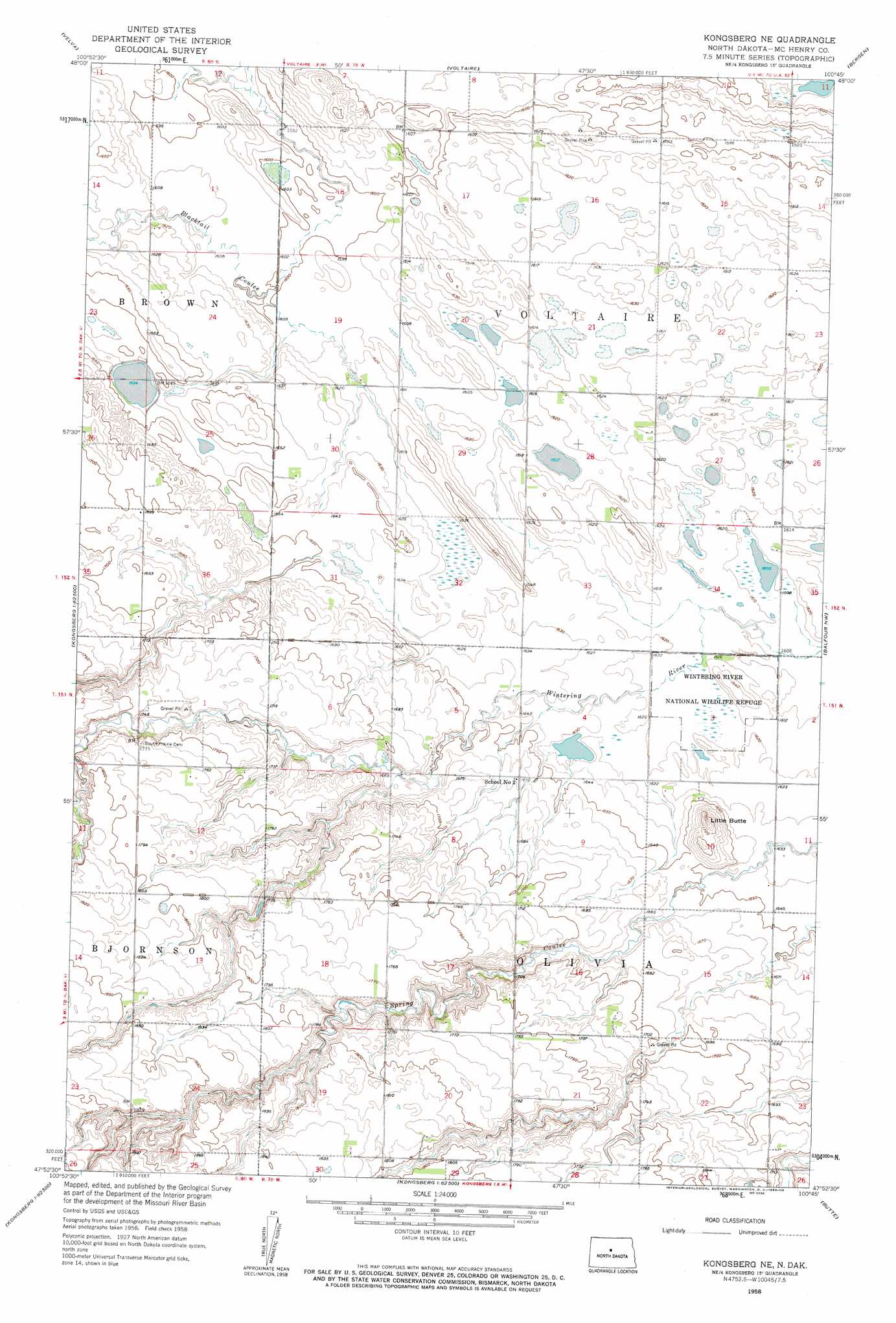
USGS Topo Quad 47100h7 - 1:24,000 scale
| Topo Map Name: | Kongsberg Ne |
| USGS Topo Quad ID: | 47100h7 |
| Print Size: | ca. 21 1/4" wide x 27" high |
| Southeast Coordinates: | 47.875° N latitude / 100.75° W longitude |
| Map Center Coordinates: | 47.9375° N latitude / 100.8125° W longitude |
| U.S. State: | ND |
| Filename: | O47100H7.jpg |
| Download Map JPG Image: | Kongsberg Ne topo map 1:24,000 scale |
| Map Type: | Topographic |
| Topo Series: | 7.5´ |
| Map Scale: | 1:24,000 |
| Source of Map Images: | United States Geological Survey (USGS) |
| Alternate Map Versions: |
Kongsberg NE ND 1958, updated 1959 Download PDF Buy paper map Kongsberg NE ND 2011 Download PDF Buy paper map Kongsberg NE ND 2014 Download PDF Buy paper map |
1:24,000 Topo Quads surrounding Kongsberg Ne
Sawyer Ne |
Norwich |
Simcoe |
Karlsruhe Nw |
Karlsruhe Ne |
Sawyer |
Velva |
Voltaire |
Bergen |
Karlsruhe |
Robinson Coulee |
Blacktail Coulee |
Kongsberg Ne |
Balfour Nw |
Balfour |
Benedict |
Ruso |
Kongsberg |
Butte |
Kief |
Coleharbor Ne |
Horseshoe Valley |
Long Lake |
Alkali Lake |
Siebold Lake |
> Back to 47100e1 at 1:100,000 scale
> Back to 47100a1 at 1:250,000 scale
> Back to U.S. Topo Maps home
Kongsberg Ne topo map: Gazetteer
Kongsberg Ne: Parks
Wintering River National Wildlife Refuge elevation 493m 1617′Kongsberg Ne: Streams
Blacktail Coulee elevation 488m 1601′Kongsberg Ne: Summits
Little Butte elevation 530m 1738′Kongsberg Ne digital topo map on disk
Buy this Kongsberg Ne topo map showing relief, roads, GPS coordinates and other geographical features, as a high-resolution digital map file on DVD:
Eastern North Dakota & Eastern South Dakota
Buy digital topo maps: Eastern North Dakota & Eastern South Dakota