Hannover Ne Topo Map North Dakota
To zoom in, hover over the map of Hannover Ne
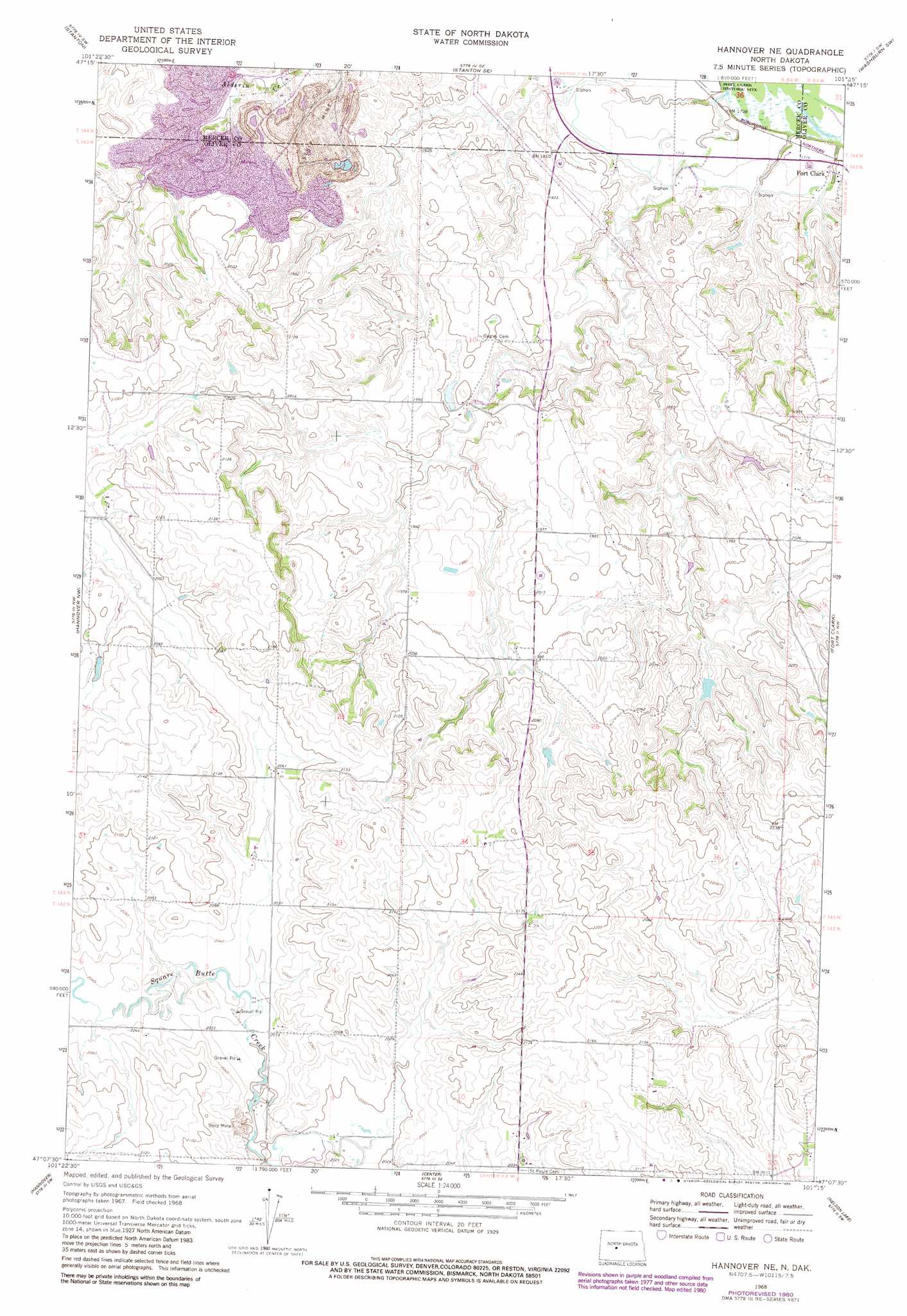
USGS Topo Quad 47101b3 - 1:24,000 scale
| Topo Map Name: | Hannover Ne |
| USGS Topo Quad ID: | 47101b3 |
| Print Size: | ca. 21 1/4" wide x 27" high |
| Southeast Coordinates: | 47.125° N latitude / 101.25° W longitude |
| Map Center Coordinates: | 47.1875° N latitude / 101.3125° W longitude |
| U.S. State: | ND |
| Filename: | O47101B3.jpg |
| Download Map JPG Image: | Hannover Ne topo map 1:24,000 scale |
| Map Type: | Topographic |
| Topo Series: | 7.5´ |
| Map Scale: | 1:24,000 |
| Source of Map Images: | United States Geological Survey (USGS) |
| Alternate Map Versions: |
Hannover NE ND 1968, updated 1969 Download PDF Buy paper map Hannover NE ND 1968, updated 1980 Download PDF Buy paper map Hannover NE ND 2011 Download PDF Buy paper map Hannover NE ND 2014 Download PDF Buy paper map |
1:24,000 Topo Quads surrounding Hannover Ne
Hazen Ne |
Garrison Dam South |
Riverdale South |
Underwood |
Washburn Ne |
Hazen East |
Stanton |
Stanton Se |
Washburn Sw |
Washburn |
Red Butte |
Hannover Nw |
Hannover Ne |
Fort Clark |
Fort Clark Ne |
Otter Creek |
Hannover |
Center |
Nelson Lake |
Fort Clark Se |
Bluegrass |
New Salem Nw |
New Salem Ne |
Crown Butte Nw |
Crown Butte |
> Back to 47101a1 at 1:100,000 scale
> Back to 47100a1 at 1:250,000 scale
> Back to U.S. Topo Maps home
Hannover Ne topo map: Gazetteer
Hannover Ne: Dams
Burns-Wretling Dam elevation 660m 2165′Vanosting Dam elevation 548m 1797′
Hannover Ne: Populated Places
Fort Clark elevation 518m 1699′Hannover Ne: Streams
Chardon Creek elevation 512m 1679′Clarks Creek elevation 512m 1679′
Hannover Ne digital topo map on disk
Buy this Hannover Ne topo map showing relief, roads, GPS coordinates and other geographical features, as a high-resolution digital map file on DVD:
Eastern North Dakota & Eastern South Dakota
Buy digital topo maps: Eastern North Dakota & Eastern South Dakota