Washburn Topo Map North Dakota
To zoom in, hover over the map of Washburn
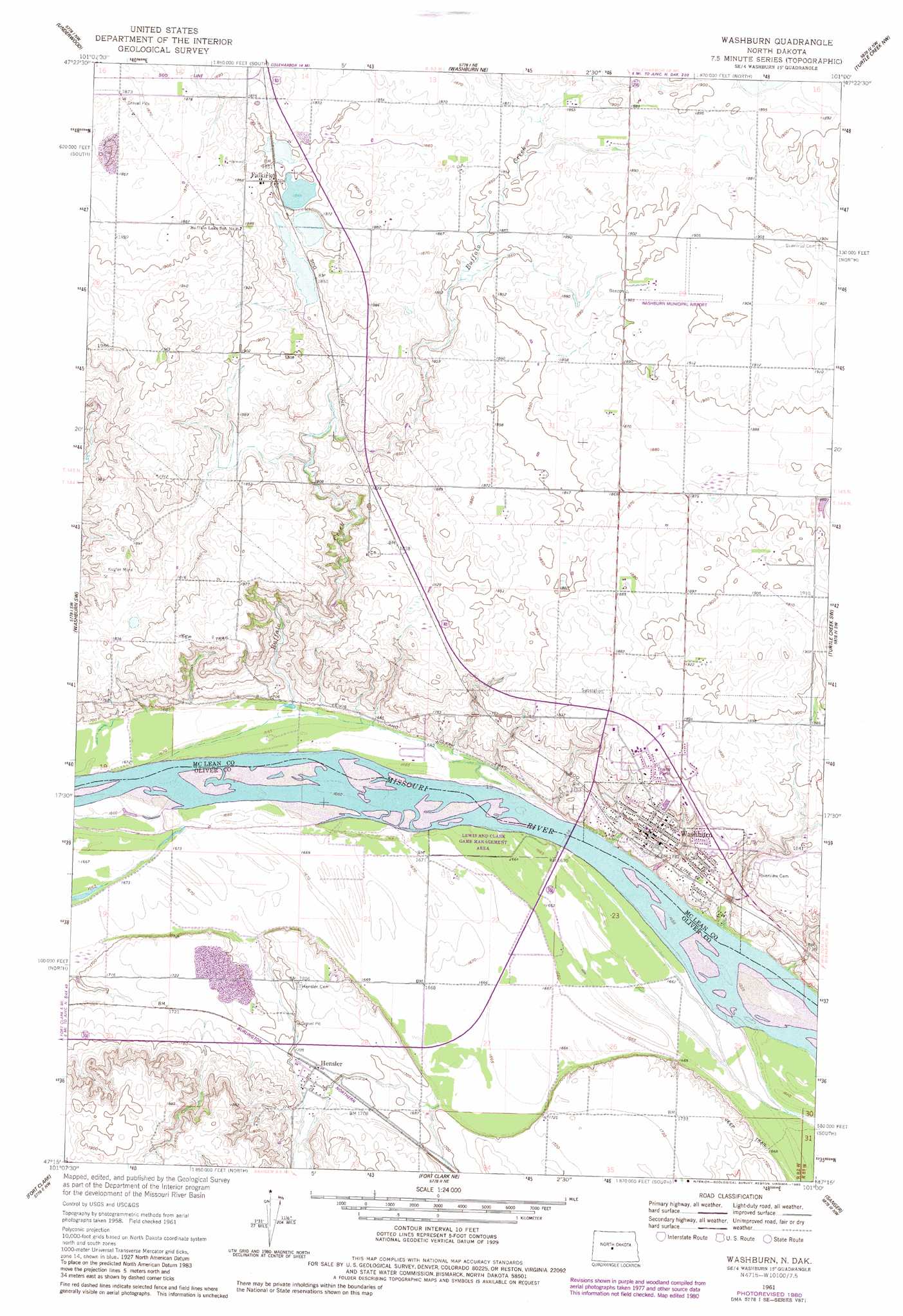
USGS Topo Quad 47101c1 - 1:24,000 scale
| Topo Map Name: | Washburn |
| USGS Topo Quad ID: | 47101c1 |
| Print Size: | ca. 21 1/4" wide x 27" high |
| Southeast Coordinates: | 47.25° N latitude / 101° W longitude |
| Map Center Coordinates: | 47.3125° N latitude / 101.0625° W longitude |
| U.S. State: | ND |
| Filename: | O47101C1.jpg |
| Download Map JPG Image: | Washburn topo map 1:24,000 scale |
| Map Type: | Topographic |
| Topo Series: | 7.5´ |
| Map Scale: | 1:24,000 |
| Source of Map Images: | United States Geological Survey (USGS) |
| Alternate Map Versions: |
Washburn ND 1961, updated 1963 Download PDF Buy paper map Washburn ND 1961, updated 1978 Download PDF Buy paper map Washburn ND 1961, updated 1980 Download PDF Buy paper map Washburn ND 2011 Download PDF Buy paper map Washburn ND 2014 Download PDF Buy paper map |
1:24,000 Topo Quads surrounding Washburn
Riverdale North |
Coleharbor |
Lake Nettie |
Turtle Lake |
Peterson Lake |
Riverdale South |
Underwood |
Washburn Ne |
Turtle Creek Nw |
Turtle Creek Ne |
Stanton Se |
Washburn Sw |
Washburn |
Turtle Creek Sw |
Turtle Creek Se |
Hannover Ne |
Fort Clark |
Fort Clark Ne |
Sanger |
Wilton |
Center |
Nelson Lake |
Fort Clark Se |
Price |
Wilton Se |
> Back to 47101a1 at 1:100,000 scale
> Back to 47100a1 at 1:250,000 scale
> Back to U.S. Topo Maps home
Washburn topo map: Gazetteer
Washburn: Airports
Washburn Municipal Airport elevation 580m 1902′Washburn: Mines
Kugler Mine elevation 570m 1870′Washburn: Populated Places
Falkirk elevation 564m 1850′Hensler elevation 522m 1712′
Washburn elevation 535m 1755′
Washburn: Streams
Buffalo Creek elevation 505m 1656′Washburn digital topo map on disk
Buy this Washburn topo map showing relief, roads, GPS coordinates and other geographical features, as a high-resolution digital map file on DVD:
Eastern North Dakota & Eastern South Dakota
Buy digital topo maps: Eastern North Dakota & Eastern South Dakota